MyTopo
Hardpan Coulee Montana US Topo Map
Couldn't load pickup availability
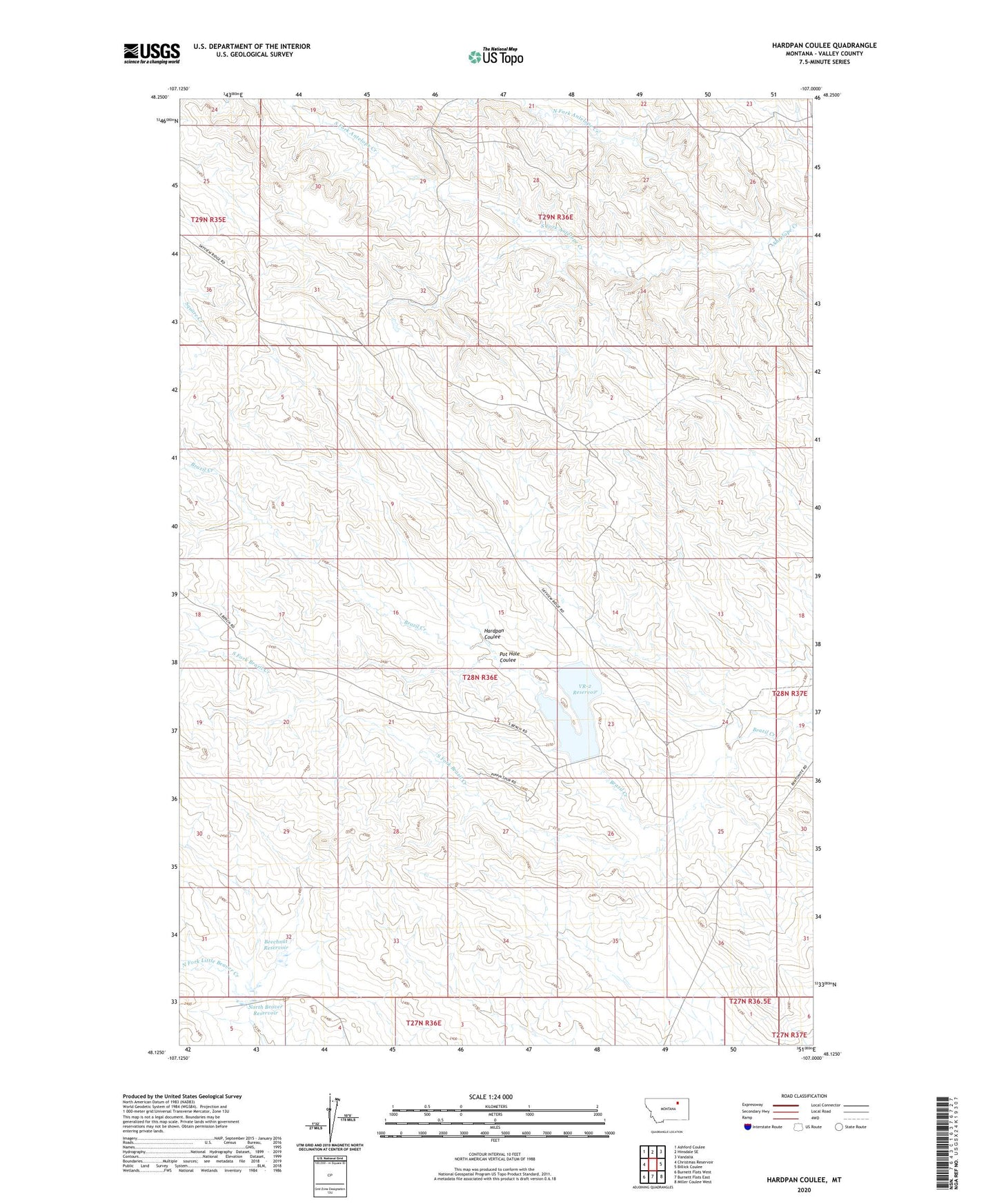
2024 topographic map quadrangle Hardpan Coulee in the state of Montana. Scale: 1:24000. Based on the newly updated USGS 7.5' US Topo map series, this map is in the following counties: Valley. The map contains contour data, water features, and other items you are used to seeing on USGS maps, but also has updated roads and other features. This is the next generation of topographic maps. Printed on high-quality waterproof paper with UV fade-resistant inks.
Quads adjacent to this one:
West: Christmas Reservoir
Northwest: Ashford Coulee
North: Hinsdale SE
Northeast: Vandalia
East: Billick Coulee
Southeast: Miller Coulee West
South: Burnett Flats East
Southwest: Burnett Flats West
This map covers the same area as the classic USGS quad with code o48107b1.
Contains the following named places: Beechnut Dam, Beechnut Reservoir, Brazil Creek, Brazil Divide Dam, Hardpan Coulee, North Beaver Dam, North Beaver Reservoir, North Fork Antelope Creek, Number 2 Reservoir Dam, Pot Hole Coulee, Ralph School, Sculpin Dam, South Fork Antelope Creek, South Fork Brazil Creek, VR-2 Dam, VR-2 Reservoir