MyTopo
Mills Creek East Montana US Topo Map
Couldn't load pickup availability
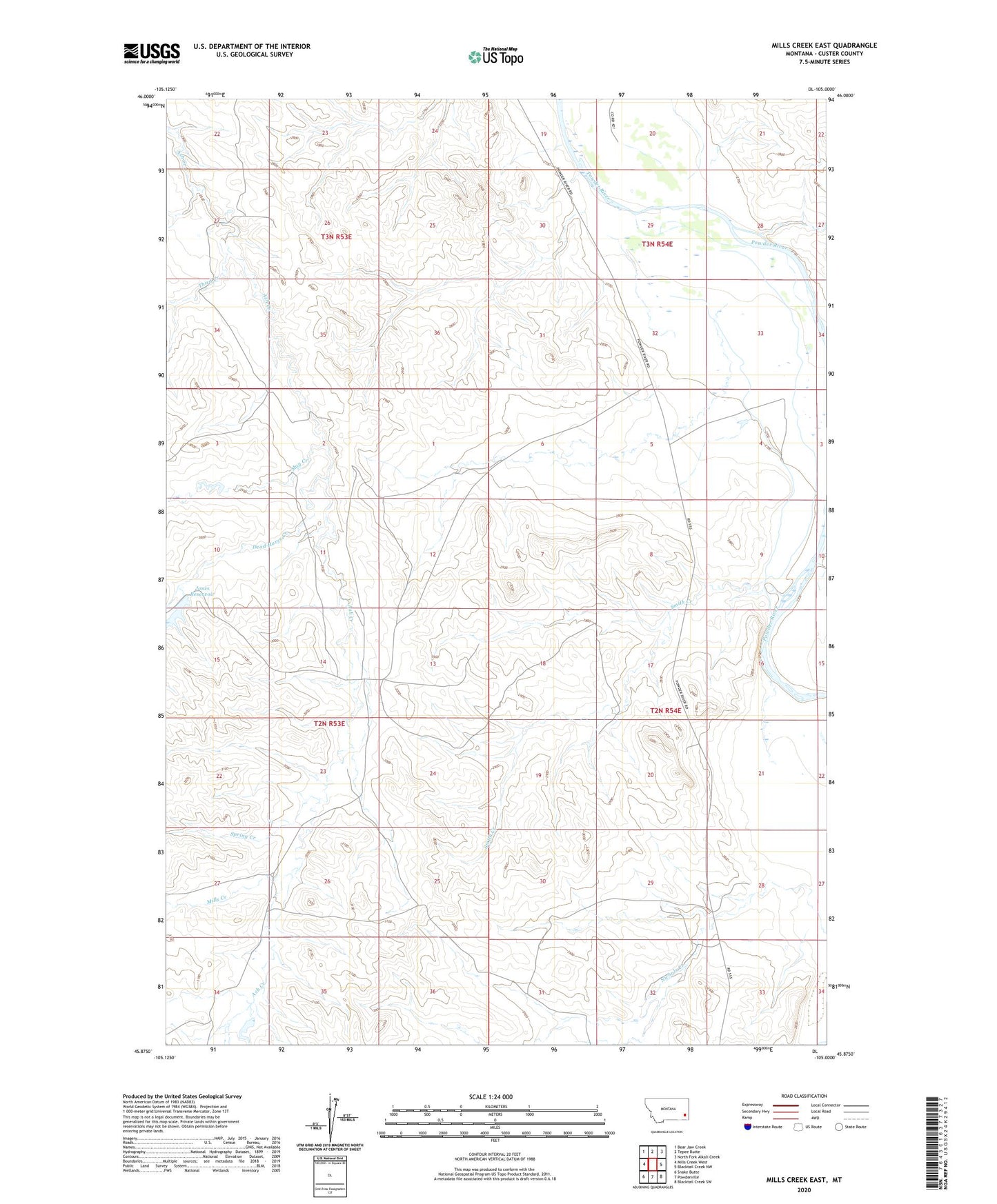
2024 topographic map quadrangle Mills Creek East in the state of Montana. Scale: 1:24000. Based on the newly updated USGS 7.5' US Topo map series, this map is in the following counties: Custer. The map contains contour data, water features, and other items you are used to seeing on USGS maps, but also has updated roads and other features. This is the next generation of topographic maps. Printed on high-quality waterproof paper with UV fade-resistant inks.
Quads adjacent to this one:
West: Mills Creek West
Northwest: Bear Jaw Creek
North: Tepee Butte
Northeast: North Fork Alkali Creek
East: Blacktail Creek NW
Southeast: Blacktail Creek SW
South: Powderville
Southwest: Snake Butte
This map covers the same area as the classic USGS quad with code o45105h1.
Contains the following named places: 02N53E01DACC01 Well, 02N53E36ADBD01 Well, 02N54E09DC__01 Well, 02N54E28CAAC01 Well, 02N54E34BBB_02 Well, 02N54E34BBCA01 Well, 03N53E27ACBD01 Well, 03N54E29DDA_01 Well, 04N53E25CCDC01 Well, Dead Horse Creek, Jones Dam, Jones Reservoir, May Creek, Mills Creek, Smith Creek, Spring Creek, Third Creek