MyTopo
Monday Creek Montana US Topo Map
Couldn't load pickup availability
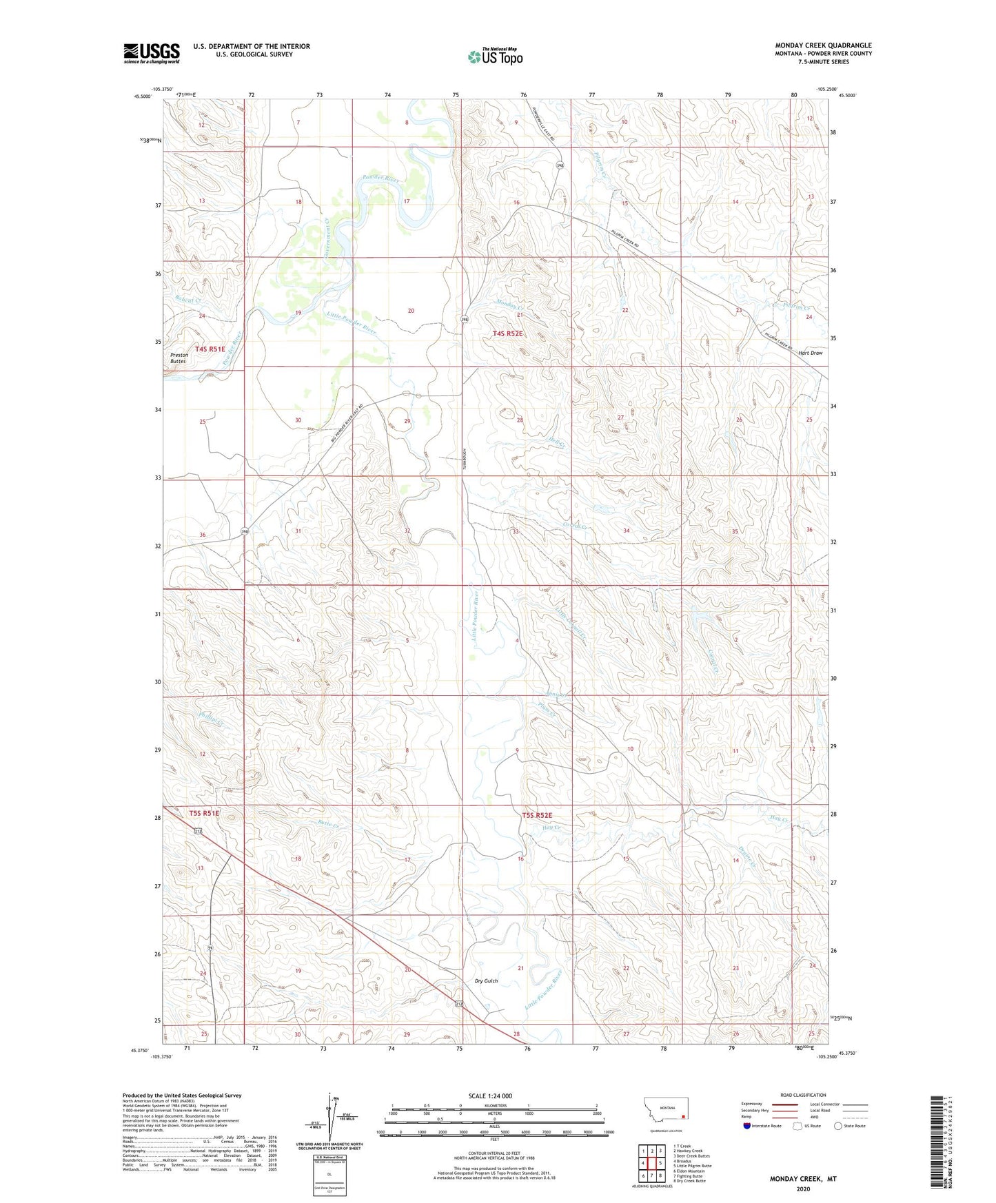
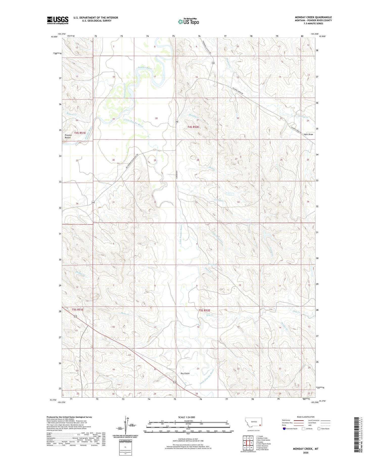
2020 topographic map quadrangle Monday Creek in the state of Montana. Scale: 1:24000. Based on the newly updated USGS 7.5' US Topo map series, this map is in the following counties: Powder River. The map contains contour data, water features, and other items you are used to seeing on USGS maps, but also has updated roads and other features. This is the next generation of topographic maps. Printed on high-quality waterproof paper with UV fade-resistant inks.
Quads adjacent to this one:
West: Broadus
Northwest: T Creek
North: Hawkey Creek
Northeast: Deer Creek Buttes
East: Little Pilgrim Butte
Southeast: Dry Creek Butte
South: Fighting Butte
Southwest: Eldon Mountain
Contains the following named places: 03S52E18DACB01 Well, 04S51E13BDBB01 Well, 04S51E25ACAD01 Well, 04S51E36AC__01 Well, 04S52E15BDCA01 Well, 04S52E17DAAA01 Well, 04S52E18ACD_01 Well, 04S52E18BCDC01 Well, 04S52E20DAAA01 Well, 04S52E21CB__01 Well, 04S52E23ADDB01 Well, 04S52E29BBDD01 Well, 05S52E04DBBC01 Well, 05S52E05ADDA01 Well, 05S52E08AB__01 Well, 05S54E20BB__01 Well, Annis Creek, Bobcat Creek, Butte Creek, Corral Creek, Draine Creek, Dry Gulch, East Fork Little Powder River, Government Creek, Hart Draw, Hay Creek, Hell Creek, Little Corrall Creek, Little Powder River, Little Powder River Fishing Access Site, Monday Creek, Plum Creek, Turnbull Number 1 Dam