MyTopo
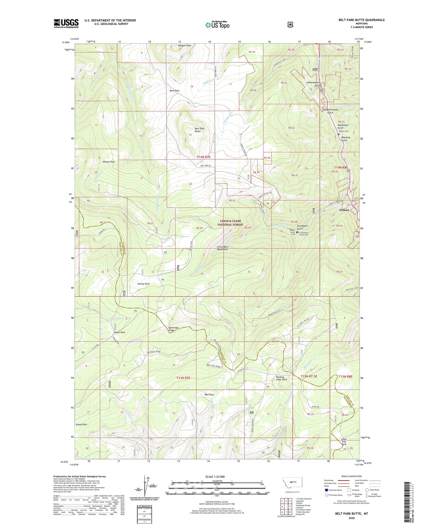
Belt Park Butte Montana US Topo Map
Couldn't load pickup availability
Also explore the Belt Park Butte Forest Service Topo of this same quad for updated USFS data
2024 topographic map quadrangle Belt Park Butte in the state of Montana. Scale: 1:24000. Based on the newly updated USGS 7.5' US Topo map series, this map is in the following counties: Cascade, Meagher. The map contains contour data, water features, and other items you are used to seeing on USGS maps, but also has updated roads and other features. This is the next generation of topographic maps. Printed on high-quality waterproof paper with UV fade-resistant inks.
Quads adjacent to this one:
West: Bubbling Springs
Northwest: Thunder Mountain
North: Monarch
Northeast: Barker
East: Neihart
Southeast: Kings Hill
South: Moose Mountain
Southwest: Strawberry Butte
This map covers the same area as the classic USGS quad with code o46110h7.
Contains the following named places: 89 Millsite, Aspen Campground, Belt Park Butte, Blanding Gulch, Carpenter Creek, Galt Mine, Graveyard Gulch, Graveyard Gulch Cemetery, Harley Creek, Harley Park, Headstone Gulch, Horn Creek, Important Mill Mine, Jericho, Johannesburg, Johannesburg Gulch, Keegan Peak, Little Water Creek, Lone Tree Park, Miners Union Cemetery, Neihart Cemetery, NW SW Section 7 Mine, O'Brian Mine, Onion Park, Pine Grove School, Prospect Creek, Quartzite Ridge, Rock Pit, Rocking Chair Creek, Rocking Chair Park, Silver Dyke School, Slaughterhouse Gulch, SW NW Section 25 Mine, Wet Park, Wilson Creek, Wilson Park