MyTopo
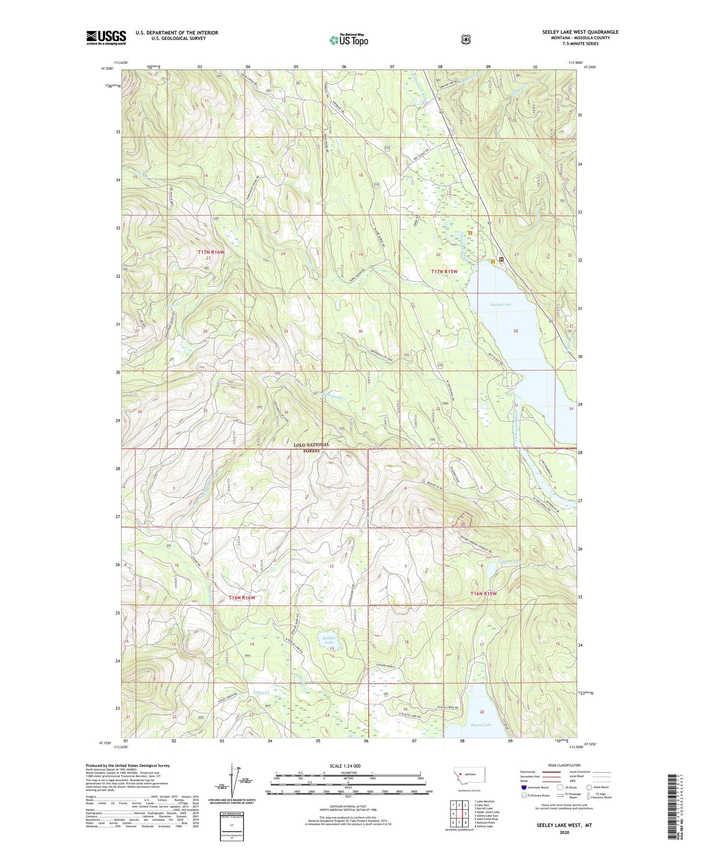
Seeley Lake West Montana US Topo Map
Couldn't load pickup availability
Also explore the Seeley Lake West Forest Service Topo of this same quad for updated USFS data
2024 topographic map quadrangle Seeley Lake West in the state of Montana. Scale: 1:24000. Based on the newly updated USGS 7.5' US Topo map series, this map is in the following counties: Missoula. The map contains contour data, water features, and other items you are used to seeing on USGS maps, but also has updated roads and other features. This is the next generation of topographic maps. Printed on high-quality waterproof paper with UV fade-resistant inks.
Quads adjacent to this one:
West: Upper Jocko Lake
Northwest: Lake Marshall
North: Lake Inez
Northeast: Morrell Lake
East: Seeley Lake East
Southeast: Salmon Lake
South: Belmont Point
Southwest: Gold Creek Peak
This map covers the same area as the classic USGS quad with code o47113b5.
Contains the following named places: 16N16W14DDCC01 Well, 16N16W24AABA01 Well, 16N19W11BACB01 Well, 17N15W08DBDB01 Well, 17N15W16CCBB01 Well, 17N15W17ABBC01 Well, 17N15W17ADCC01 Well, 17N15W17BBCD01 Well, 17N15W17BCAC01 Well, 17N15W17BDBA01 Well, 17N15W20BBAD01 Well, 17N15W28BACA01 Well, 17N15W33BABA01 Well, 17N15W34CCCC01 Well, 59868, Archibald Creek, Auggie Creek, Beaver Creek, Benedict Creek, Buck Creek, Camp Paxson, Deer Creek, Double Arrow Lookout, Fawn Creek, Finley Creek, Hidden Lake, Placid Lake Campground, Placid Lake Recreation Site, Placid Lake School, Placid Lake State Park, Rice Creek, River Point Campground, Sawyer Creek, Seeley Lake, Seeley Lake Campground, Seeley Lake Game Preserve, Seeley Lake Ranger Station, Seeley Lake-Blackfoot Valley Division, Sheep Creek, Slippery John Creek, Tamaracks Resort, Tuppers Lake