MyTopo
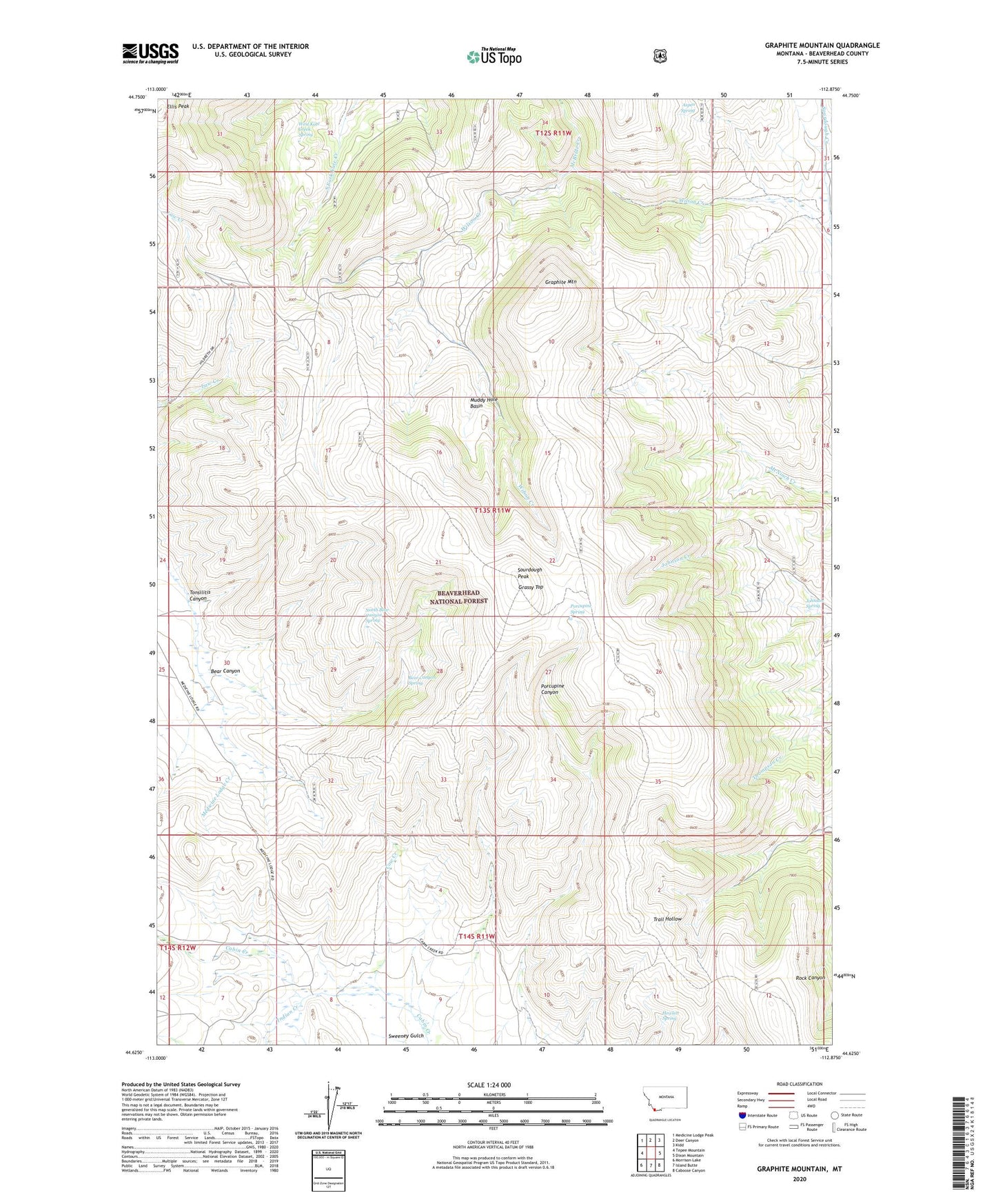
Graphite Mountain Montana US Topo Map
Couldn't load pickup availability
Also explore the Graphite Mountain Forest Service Topo of this same quad for updated USFS data
2024 topographic map quadrangle Graphite Mountain in the state of Montana. Scale: 1:24000. Based on the newly updated USGS 7.5' US Topo map series, this map is in the following counties: Beaverhead. The map contains contour data, water features, and other items you are used to seeing on USGS maps, but also has updated roads and other features. This is the next generation of topographic maps. Printed on high-quality waterproof paper with UV fade-resistant inks.
Quads adjacent to this one:
West: Tepee Mountain
Northwest: Medicine Lodge Peak
North: Deer Canyon
Northeast: Kidd
East: Dixon Mountain
Southeast: Caboose Canyon
South: Island Butte
Southwest: Morrison Lake
This map covers the same area as the classic USGS quad with code o44112f8.
Contains the following named places: Bear Canyon, Bear Canyon Spring, Cow Creek, Ellis Peak, Graphite Mountain, Grassy Top, Hanson Sheep Headquarters, Hewlett Spring, Indian Creek, Johnson Spring, McBride Creek, Muddy Hole Basin, North Bear Canyon Spring, Porcupine Canyon Mine, Porcupine Spring, Sheep Creek, Sourdough Peak, Sweeney Gulch, Tonsilitis Canyon, Trail Hollow Creek Mine, West Kate Creek Spring