MyTopo
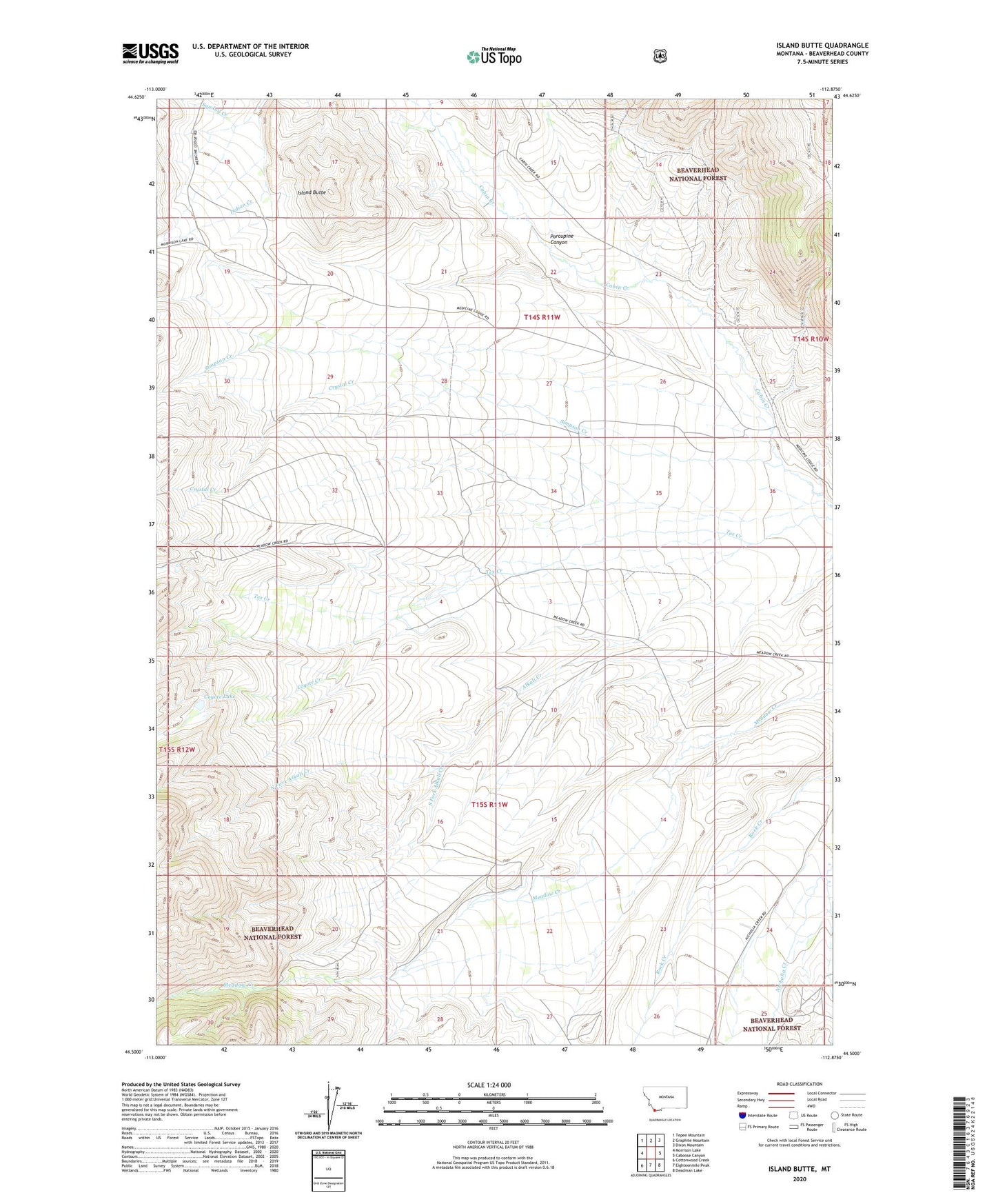
Island Butte Montana US Topo Map
Couldn't load pickup availability
Also explore the Island Butte Forest Service Topo of this same quad for updated USFS data
2024 topographic map quadrangle Island Butte in the state of Montana. Scale: 1:24000. Based on the newly updated USGS 7.5' US Topo map series, this map is in the following counties: Beaverhead. The map contains contour data, water features, and other items you are used to seeing on USGS maps, but also has updated roads and other features. This is the next generation of topographic maps. Printed on high-quality waterproof paper with UV fade-resistant inks.
Quads adjacent to this one:
West: Morrison Lake
Northwest: Tepee Mountain
North: Graphite Mountain
Northeast: Dixon Mountain
East: Caboose Canyon
Southeast: Deadman Lake
South: Eighteenmile Peak
Southwest: Cottonwood Creek
This map covers the same area as the classic USGS quad with code o44112e8.
Contains the following named places: Coyote Creek, Coyote Lake, Crystal Creek, Island Butte, Morrison Canyon, Nicholia, Nicholia Post Office, Nicholia School, North Fork Alkali Creek, Porcupine Canyon, Sawlog Creek, Simpson Creek, South Fork Alkali Creek, Whitworth Ranch