MyTopo
Edgar Montana US Topo Map
Couldn't load pickup availability
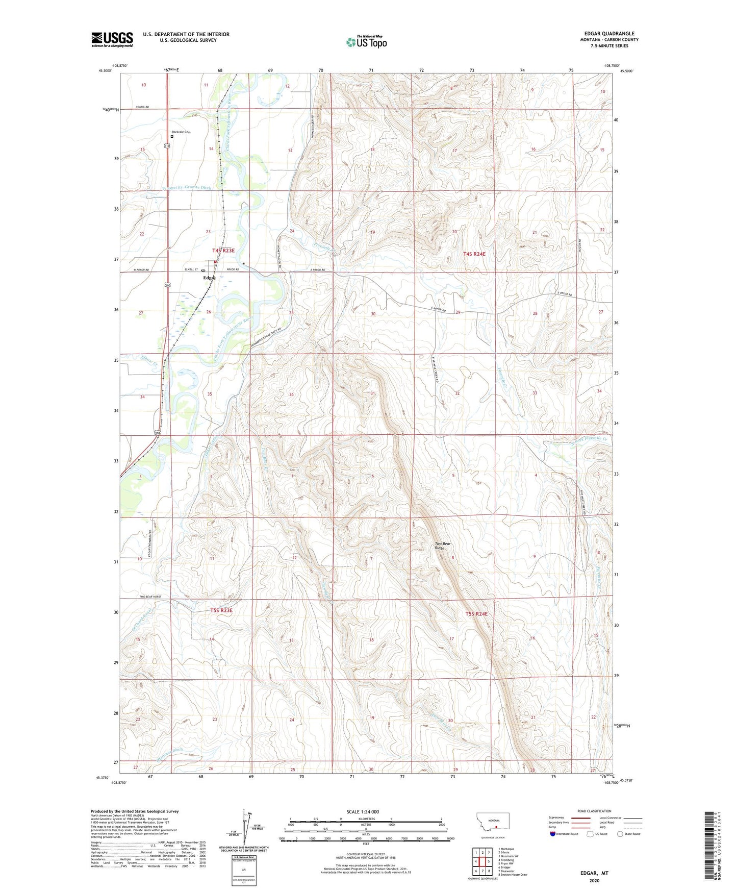
2024 topographic map quadrangle Edgar in the state of Montana. Scale: 1:24000. Based on the newly updated USGS 7.5' US Topo map series, this map is in the following counties: Carbon. The map contains contour data, water features, and other items you are used to seeing on USGS maps, but also has updated roads and other features. This is the next generation of topographic maps. Printed on high-quality waterproof paper with UV fade-resistant inks.
Quads adjacent to this one:
West: Fromberg
Northwest: Montaqua
North: Silesia
Northeast: Mossmain SW
East: Pryor NW
Southeast: Section House Draw
South: Bluewater
Southwest: Bridger
This map covers the same area as the classic USGS quad with code o45108d7.
Contains the following named places: 04S16E20CCCB01 Well, 04S23E11CBBC01 Well, 04S23E13CCAA01 Well, 04S23E13CDAD01 Well, 04S23E13DBCA01 Well, 04S23E22DCBB01 Well, 04S23E23CBBB01 Well, 04S23E23CDDD01 Well, 04S23E25BCDC01 Well, 04S23E27DADA01 Well, 04S23E35CACD01 Well, 05S23E03AABA01 Well, 05S23E10AABB01 Well, 59026, 59029, Edgar, Edgar Canal, Edgar Census Designated Place, Edgar Elementary School, Edgar Elevator, Edgar Post Office, Edgar Rural Fire District 4, Elbow Creek, Five Mile Creek, Fivemile Creek, Heiser, Middle Fork Fivemile Creek, North Fork Fivemile Creek, Rockvale Cemetery, Two Bear Creek, Two Bear Ridge