MyTopo
Mount Ellis Montana US Topo Map
Couldn't load pickup availability
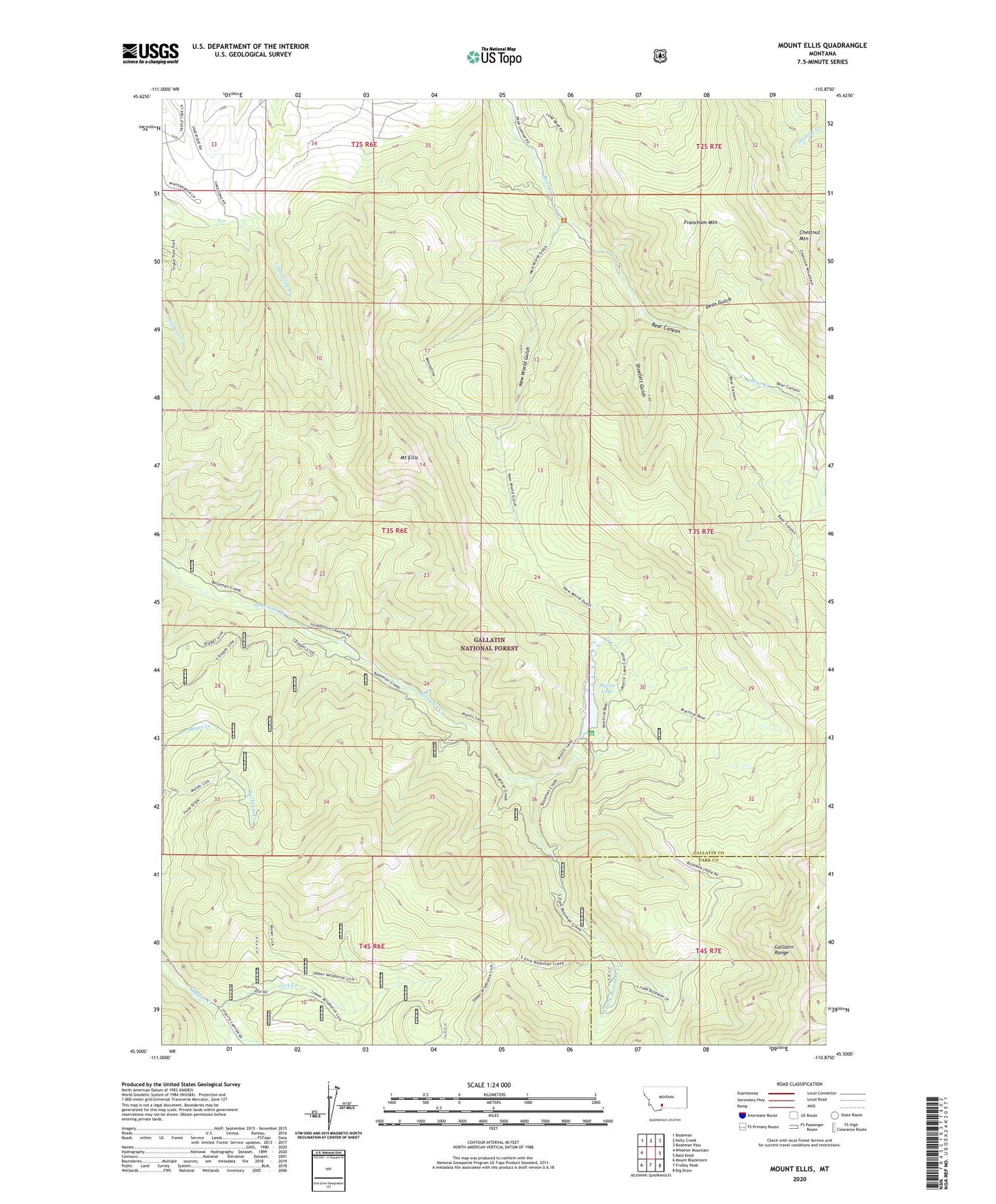
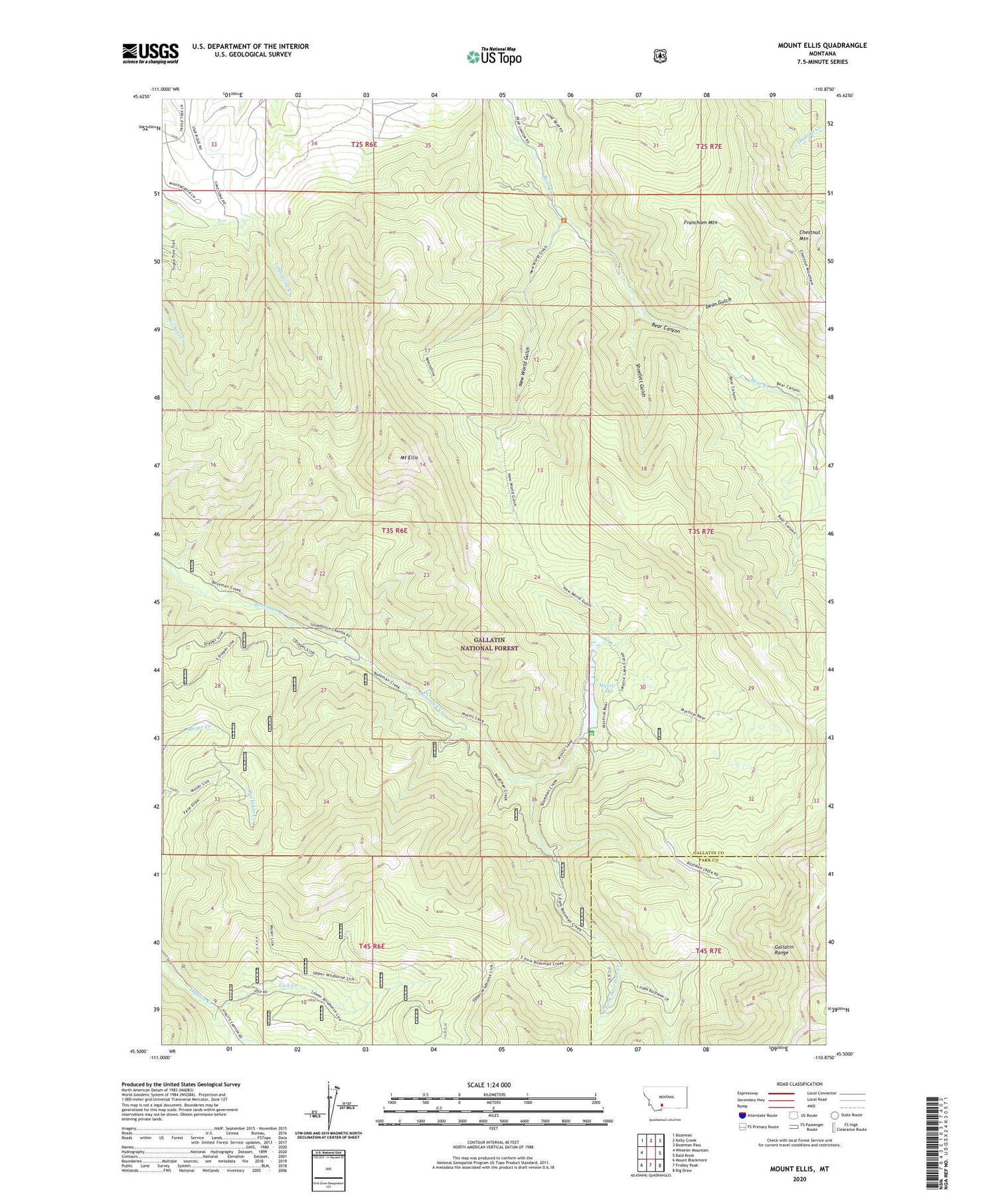
2020 topographic map quadrangle Mount Ellis in the state of Montana. Scale: 1:24000. Based on the newly updated USGS 7.5' US Topo map series, this map is in the following counties: Gallatin, Park. The map contains contour data, water features, and other items you are used to seeing on USGS maps, but also has updated roads and other features. This is the next generation of topographic maps. Printed on high-quality waterproof paper with UV fade-resistant inks.
Quads adjacent to this one:
West: Wheeler Mountain
Northwest: Bozeman
North: Kelly Creek
Northeast: Bozeman Pass
East: Bald Knob
Southeast: Big Draw
South: Fridley Peak
Southwest: Mount Blackmore
Contains the following named places: 02S06E33ADAC01 Well, 02S06E33BDDC01 Well, 02S06E36CB__01 Well, Bear Canyon Ski Lodge, Chestnut Mountain, Dean Gulch, Francham Mountain, Lick Creek, Mount Ellis, Mystic Lake, Mystic Lake Dam, Mystic Lake Ranger Station, New World Gulch, Shoefelt Gulch, South Fork Bozeman Creek