MyTopo
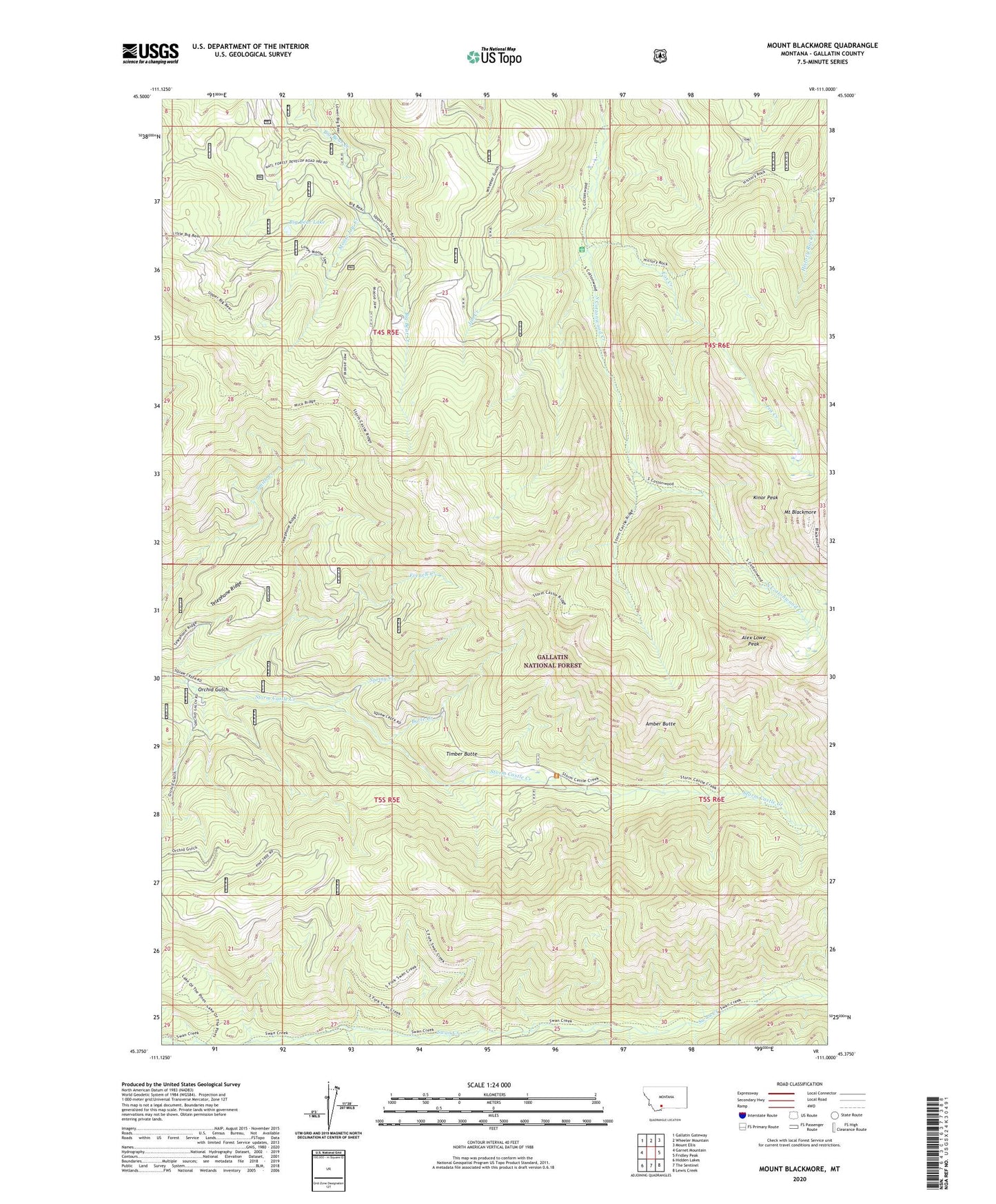
Mount Blackmore Montana US Topo Map
Couldn't load pickup availability
Also explore the Mount Blackmore Forest Service Topo of this same quad for updated USFS data
2024 topographic map quadrangle Mount Blackmore in the state of Montana. Scale: 1:24000. Based on the newly updated USGS 7.5' US Topo map series, this map is in the following counties: Gallatin. The map contains contour data, water features, and other items you are used to seeing on USGS maps, but also has updated roads and other features. This is the next generation of topographic maps. Printed on high-quality waterproof paper with UV fade-resistant inks.
Quads adjacent to this one:
West: Garnet Mountain
Northwest: Gallatin Gateway
North: Wheeler Mountain
Northeast: Mount Ellis
East: Fridley Peak
Southeast: Lewis Creek
South: The Sentinel
Southwest: Hidden Lakes
This map covers the same area as the classic USGS quad with code o45111d1.
Contains the following named places: Alex Lowe Peak, Amber Butte, Big Bear Lake, Blanchard Sawmill, Butte Creek, Butte Meadows Camp, Butte Meadows Ranger Station, Fox Creek, French Creek, Jim Creek, Kinor Peak, Moose Jaw Creek, Mount Blackmore, Orchid Gulch, South Fork Swan Creek, Spring Creek, Telephone Ridge, Timber Butte