MyTopo
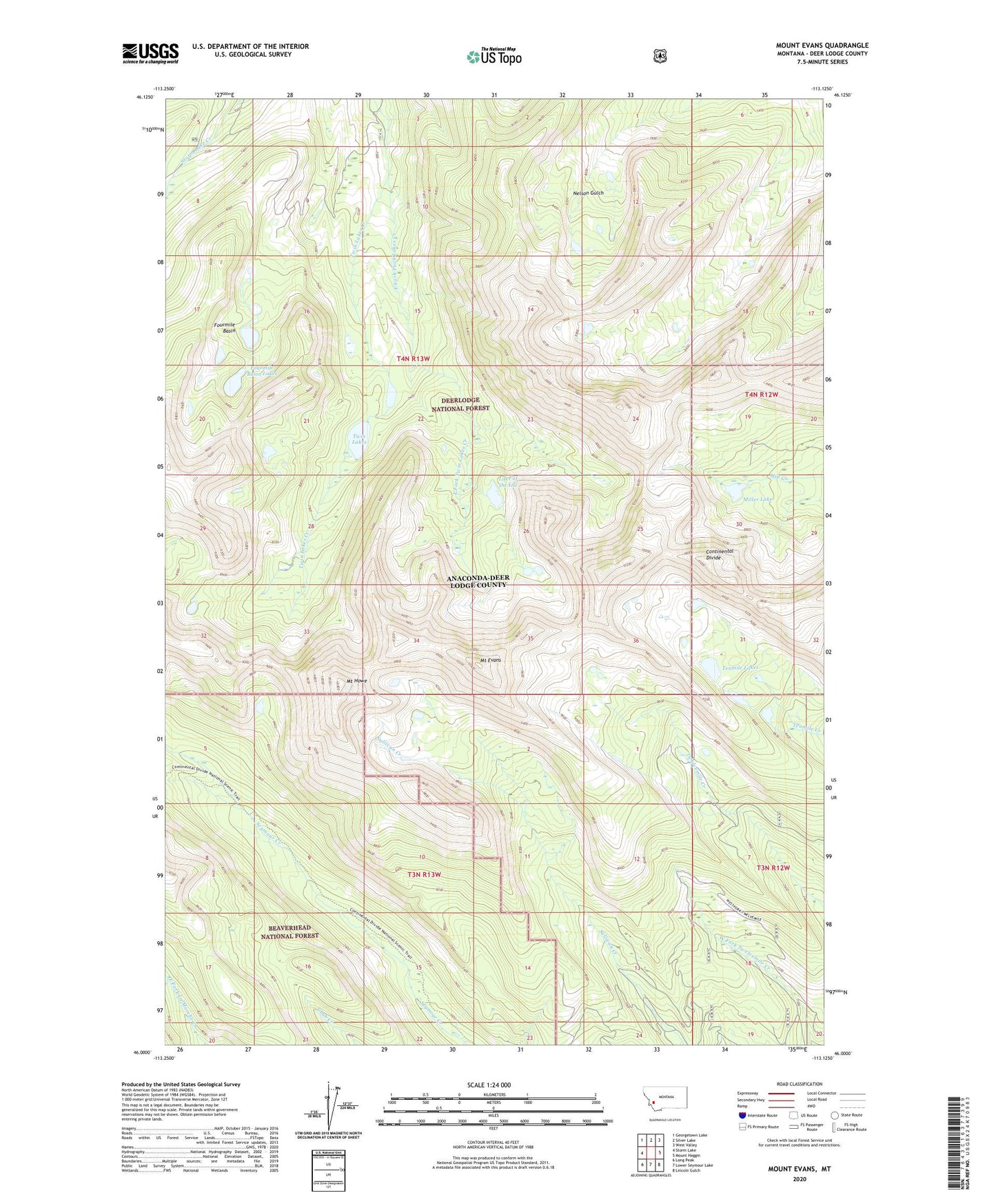
Mount Evans Montana US Topo Map
Couldn't load pickup availability
Also explore the Mount Evans Forest Service Topo of this same quad for updated USFS data
2024 topographic map quadrangle Mount Evans in the state of Montana. Scale: 1:24000. Based on the newly updated USGS 7.5' US Topo map series, this map is in the following counties: Deer Lodge. The map contains contour data, water features, and other items you are used to seeing on USGS maps, but also has updated roads and other features. This is the next generation of topographic maps. Printed on high-quality waterproof paper with UV fade-resistant inks.
Quads adjacent to this one:
West: Storm Lake
Northwest: Georgetown Lake
North: Silver Lake
Northeast: West Valley
East: Mount Haggin
Southeast: Lincoln Gulch
South: Lower Seymour Lake
Southwest: Long Peak
This map covers the same area as the classic USGS quad with code o46113a2.
Contains the following named places: Anaconda Division, Anaconda Range, East Fork Twin Lakes Creek, Fourmile Basin, Fourmile Basin Lakes, Lake of the Isle, Miller Lake, Mount Evans, Mount Howe, Tenmile Lakes, Twin Lakes, ZIP Code: 59711