MyTopo
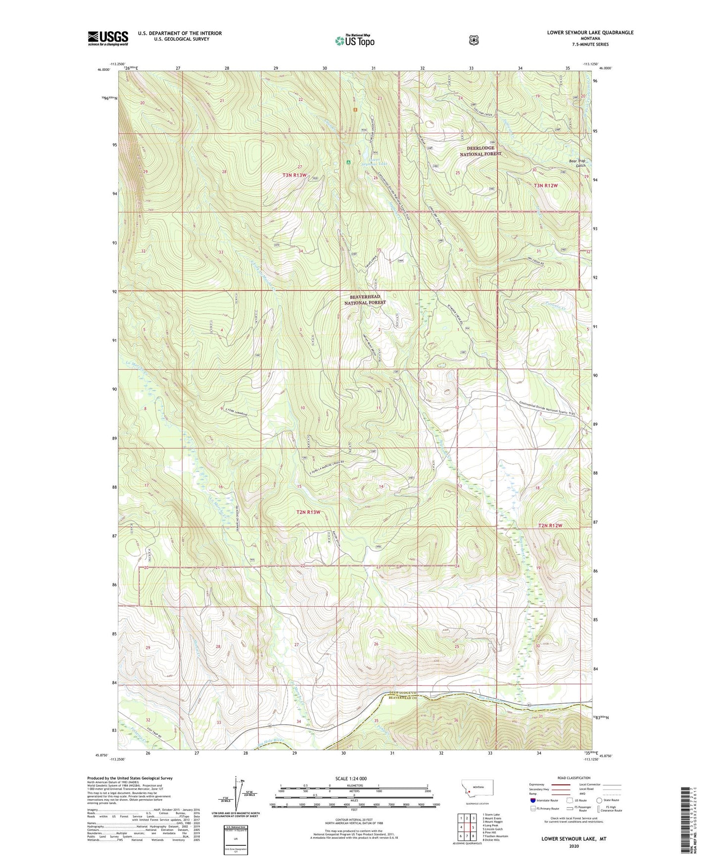
Lower Seymour Lake Montana US Topo Map
Couldn't load pickup availability
Also explore the Lower Seymour Lake Forest Service Topo of this same quad for updated USFS data
2024 topographic map quadrangle Lower Seymour Lake in the state of Montana. Scale: 1:24000. Based on the newly updated USGS 7.5' US Topo map series, this map is in the following counties: Deer Lodge, Beaverhead. The map contains contour data, water features, and other items you are used to seeing on USGS maps, but also has updated roads and other features. This is the next generation of topographic maps. Printed on high-quality waterproof paper with UV fade-resistant inks.
Quads adjacent to this one:
West: Long Peak
Northwest: Storm Lake
North: Mount Evans
Northeast: Mount Haggin
East: Lincoln Gulch
Southeast: Dickie Hills
South: Foolhen Mountain
Southwest: Pine Hill
This map covers the same area as the classic USGS quad with code o45113h2.
Contains the following named places: 02N13W16DDC_01 Well, Anderson Ditch, Arcola Scout Camp, Bacon Ditch, Bear Trap Gulch, Chub Creek, East Fork La Marche Creek, La Marche Creek Ranch, Lake Gulch, Lower Seymour Lake, Lower Seymour Laske Campground, Pony Creek, Seymour Campground, Seymour Creek, Sportmans Campground, Sundance Lodge