MyTopo
Silver Lake Montana US Topo Map
Couldn't load pickup availability
Also explore the Silver Lake Forest Service Topo of this same quad for updated USFS data
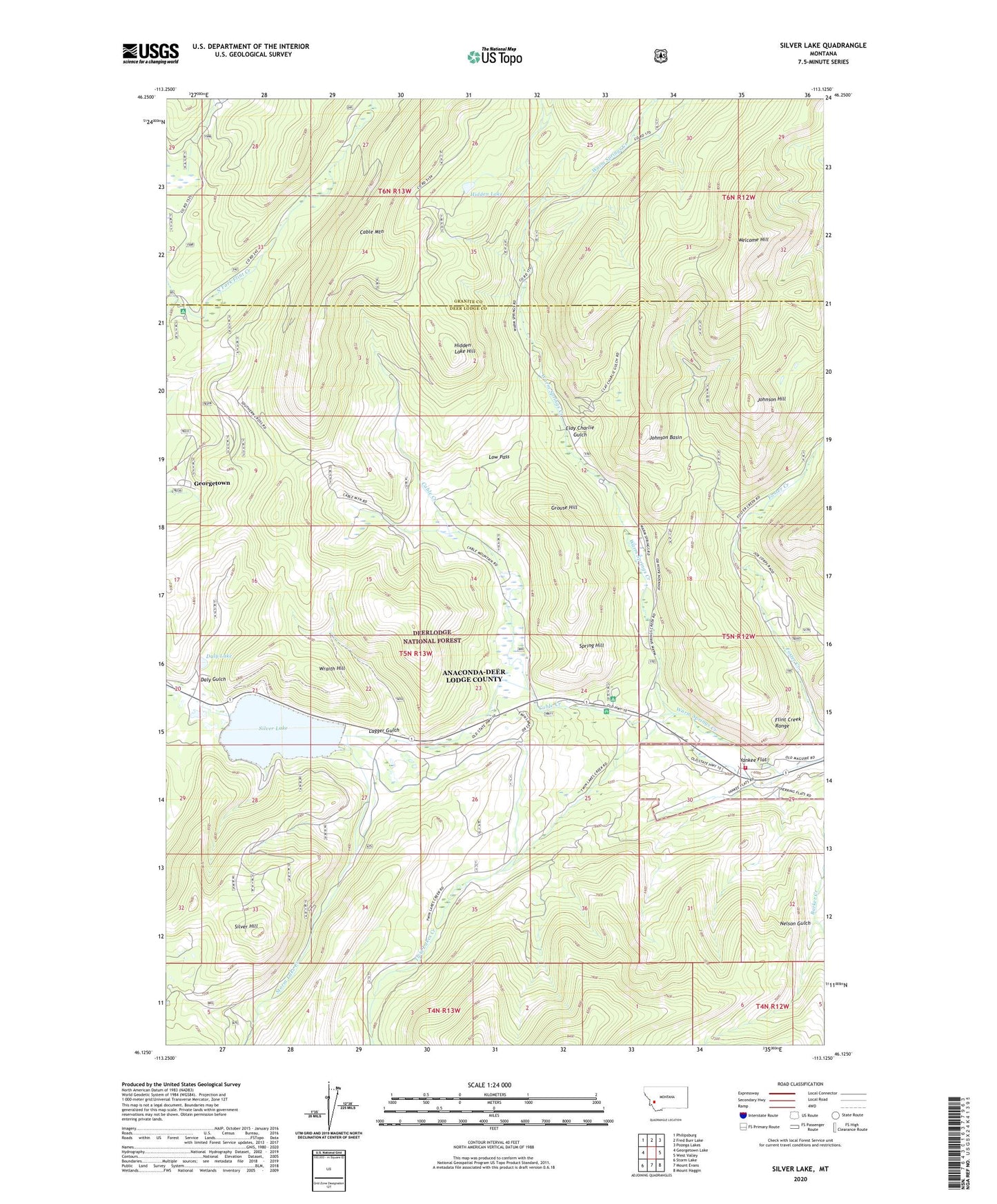
2024 topographic map quadrangle Silver Lake in the state of Montana. Scale: 1:24000. Based on the newly updated USGS 7.5' US Topo map series, this map is in the following counties: Deer Lodge, Granite. The map contains contour data, water features, and other items you are used to seeing on USGS maps, but also has updated roads and other features. This is the next generation of topographic maps. Printed on high-quality waterproof paper with UV fade-resistant inks.
Quads adjacent to this one:
West: Georgetown Lake
Northwest: Philipsburg
North: Fred Burr Lake
Northeast: Pozega Lakes
East: West Valley
Southeast: Mount Haggin
South: Mount Evans
Southwest: Storm Lake
This map covers the same area as the classic USGS quad with code o46113b2.
Contains the following named places: Anaconda Civilan Conservation Center, Atlantic Cable Quartz Lode Historical Marker, Bob Evans Mine, Cable City, Cable Creek, Cable Lookout Tower, Cable Mine, Cable Mountain, Cable Mountain Campground, Cable Post Office, Cable School, Camp Silvercloud, Clay Charlie Gulch, Clay Charlie Gulch Mine, Daly Gulch, Daly Gulch Placer Mine, Daly Lake, Foster Creek Mine, Georgetown, Georgetown Lake Volunteer Fire Company Station 3, Gold Coin, Gold Coin 8 Mine, Gold Coin Mine, Goldcoin Post Office, Grouse Hill, Hidden Lake, Hidden Lake Hill, Hidden Lake Mine, Horseshoe Bend Mine, Johnson Basin, Johnson Hill, Lagger Gulch, Lindburg, Low Pass, Lower Warm Springs Campground, Lucky Blue Mine, Maguire, Nelson Gulch, New Year Mine, NW NE Section 12 Mine, NW NE Section 8 Mine, NW SW Section 27 Mine, NW SW Section 9 Mine, Old Bonanza Mine, Orofino Mine, Pleideus Mine, Pyrenees Post Office, Red Rose Mine, Saint Timothys Chapel, SE NW Section 9 Mine, SE SW Section 33 Mine, Seba, Silver Hill, Silver Lake, Silver Lake East Dam, Silver Lake Millsite, Silver Lake West Dam, Silver Moss Mine, Southern Cross, Southern Cross Post Office, Southern Cross School, Spring Hill, Spring Hill Campground, Spring Hill Mine, Spring Hill Picnic Area, Storm Lake Creek, SW NW Section 21 Mine, SW SW Section 23 Mine, Ten Mile, Trigger Mine, Trilby Mine, Twin Lakes Creek, Upper Warm Springs Picnic Area, Welcome Hill, West Fork Warm Springs Creek, Wraith Hill, Wraith Hill Ski Area, Yankee Flat