
MyTopo
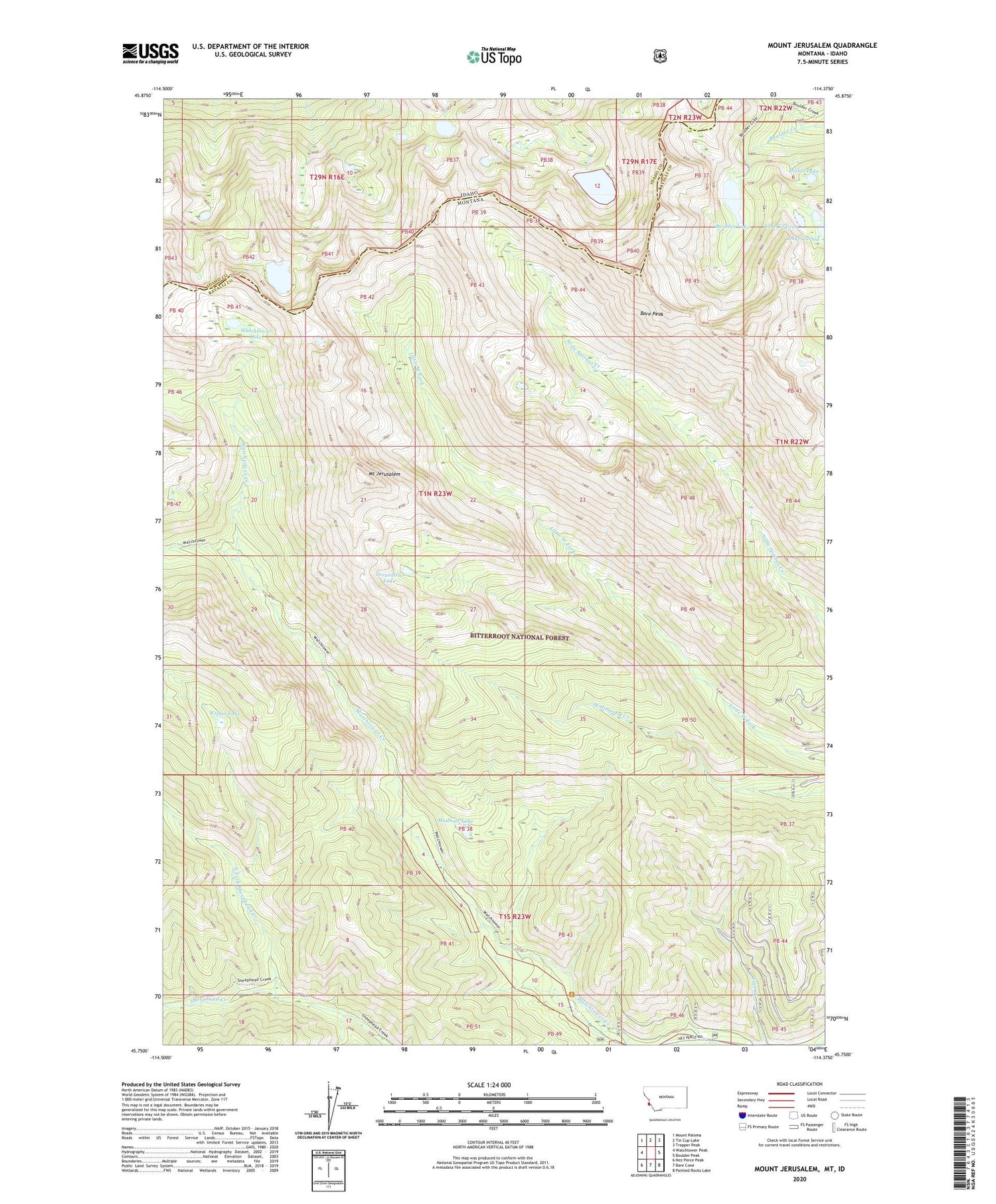
Mount Jerusalem Montana US Topo Map
Couldn't load pickup availability
2020 topographic map quadrangle Mount Jerusalem in the states of Montana, Idaho. Scale: 1:24000. Based on the newly updated USGS 7.5' US Topo map series, this map is in the following counties: Ravalli, Idaho. The map contains contour data, water features, and other items you are used to seeing on USGS maps, but also has updated roads and other features. This is the next generation of topographic maps. Printed on high-quality waterproof paper with UV fade-resistant inks.
Quads adjacent to this one:
West: Watchtower Peak
Northwest: Mount Paloma
North: Tin Cup Lake
Northeast: Trapper Peak
East: Boulder Peak
Southeast: Painted Rocks Lake
South: Bare Cone
Southwest: Nez Perce Peak
Contains the following named places: Bare Peak, Boulder Lake, Canyon Lake, Dollar Lake, Esplin Lake, Jerusalem Lake, Lake Crystal, Lake Turbid, Mount Jerusalem, Mudhole Lake, North Fork Sheephead Creek, Tough Creek, Watchtower Lake


