MyTopo
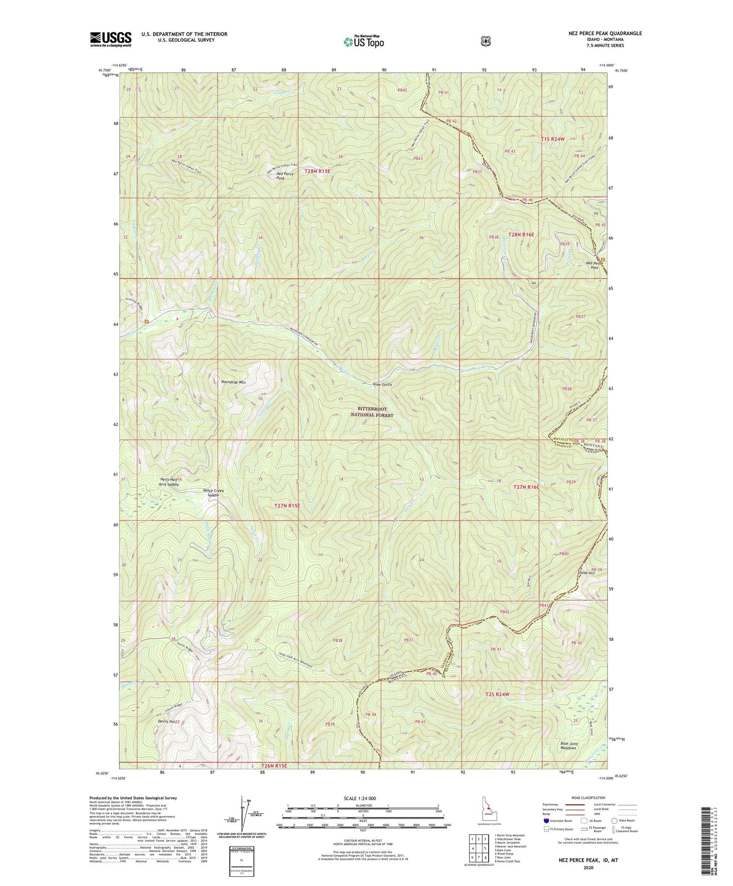
Nez Perce Peak Idaho US Topo Map
Couldn't load pickup availability
Also explore the Nez Perce Peak Forest Service Topo of this same quad for updated USFS data
2024 topographic map quadrangle Nez Perce Peak in the states of Idaho, Montana. Scale: 1:24000. Based on the newly updated USGS 7.5' US Topo map series, this map is in the following counties: Idaho, Ravalli. The map contains contour data, water features, and other items you are used to seeing on USGS maps, but also has updated roads and other features. This is the next generation of topographic maps. Printed on high-quality waterproof paper with UV fade-resistant inks.
Quads adjacent to this one:
West: Beaver Jack Mountain
Northwest: Burnt Strip Mountain
North: Watchtower Peak
Northeast: Mount Jerusalem
East: Bare Cone
Southeast: Horse Creek Pass
South: Blue Joint
Southwest: Wood Hump
Contains the following named places: Blue Joint Meadows, Cayuse Creek, Devils Point, Halfway Creek, Hells Half Acre Saddle, Kerlee Creek, Lazy Creek, MacGregor Creek, Magruder Creek, Nez Perce Pass, Nez Perce Peak, Old Nez Perce Trail, Pete Creek, Roundtop Mountain, Shumaker Creek, Slow Gulch, South Route Old Nez Perce Trail, Steep Hill, Storm Ridge, Vance Creek, Vance Creek Saddle