MyTopo
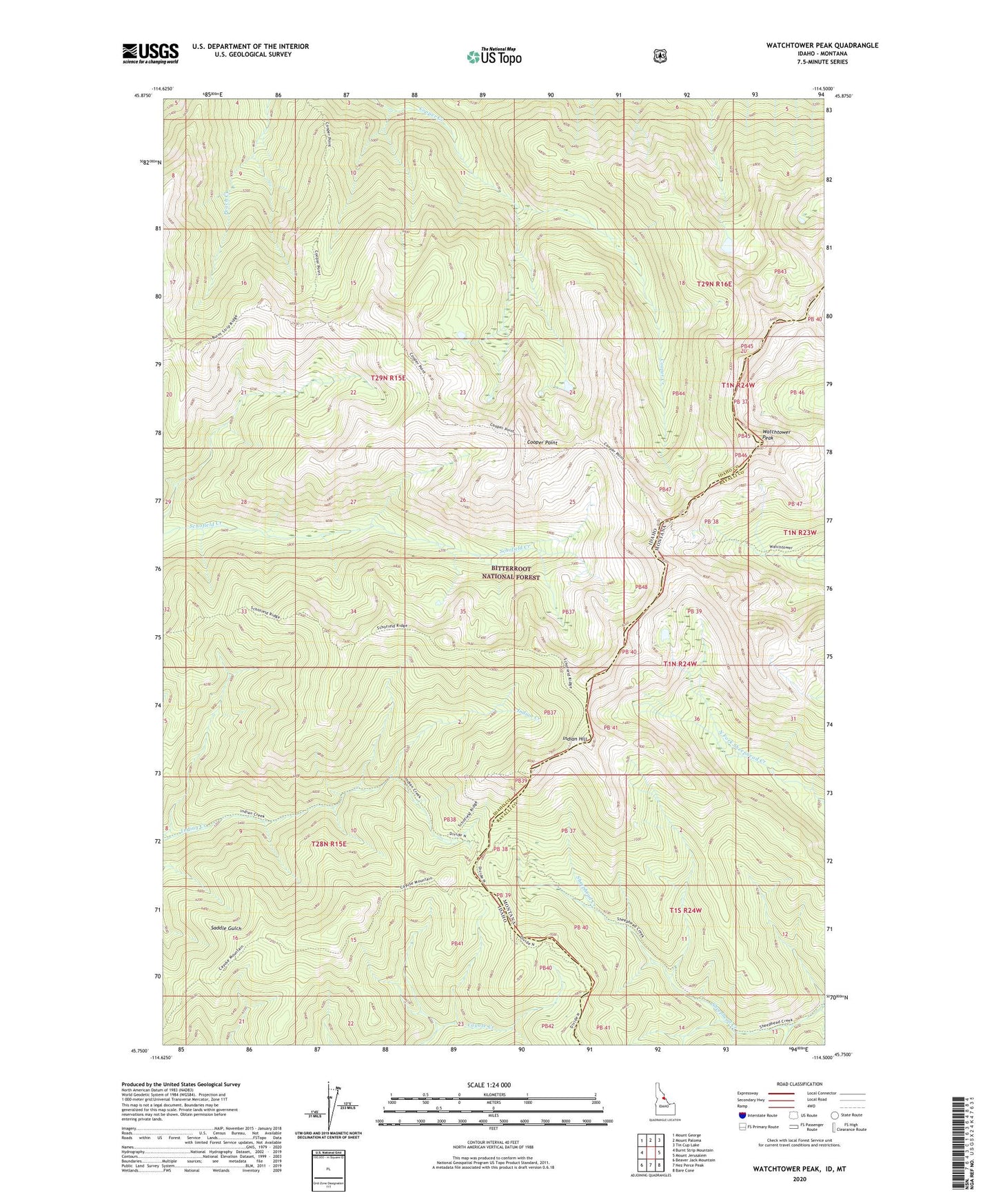
Watchtower Peak Idaho US Topo Map
Couldn't load pickup availability
Also explore the Watchtower Peak Forest Service Topo of this same quad for updated USFS data
2024 topographic map quadrangle Watchtower Peak in the states of Idaho, Montana. Scale: 1:24000. Based on the newly updated USGS 7.5' US Topo map series, this map is in the following counties: Idaho, Ravalli. The map contains contour data, water features, and other items you are used to seeing on USGS maps, but also has updated roads and other features. This is the next generation of topographic maps. Printed on high-quality waterproof paper with UV fade-resistant inks.
Quads adjacent to this one:
West: Burnt Strip Mountain
Northwest: Mount George
North: Mount Paloma
Northeast: Tin Cup Lake
East: Mount Jerusalem
Southeast: Bare Cone
South: Nez Perce Peak
Southwest: Beaver Jack Mountain
Contains the following named places: Cooper Point, Indian Hill, Watchtower Peak