MyTopo
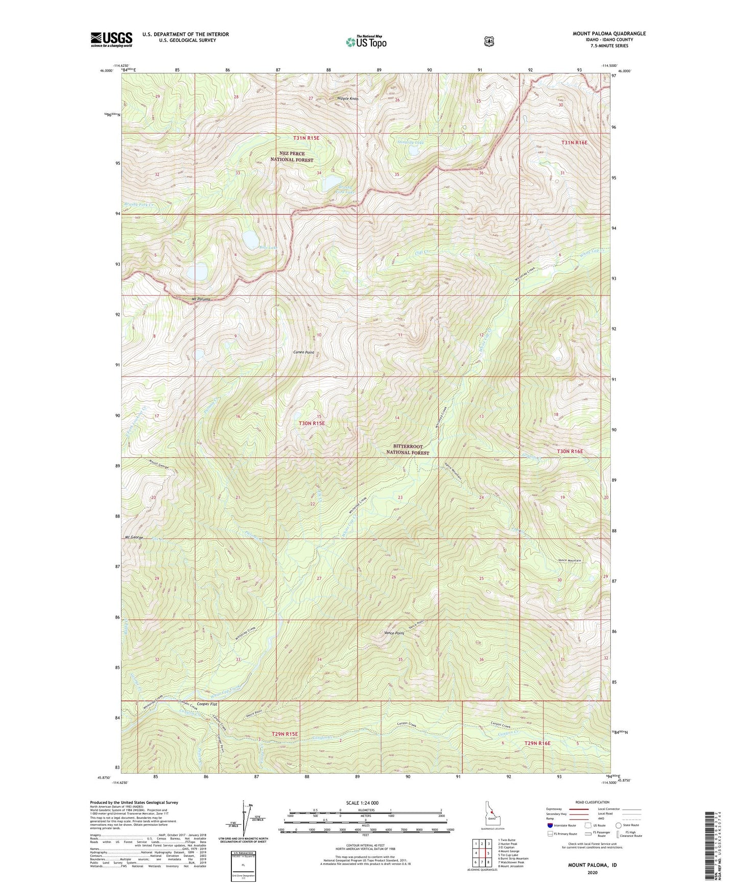
Mount Paloma Idaho US Topo Map
Couldn't load pickup availability
Also explore the Mount Paloma Forest Service Topo of this same quad for updated USFS data
2024 topographic map quadrangle Mount Paloma in the state of Idaho. Scale: 1:24000. Based on the newly updated USGS 7.5' US Topo map series, this map is in the following counties: Idaho. The map contains contour data, water features, and other items you are used to seeing on USGS maps, but also has updated roads and other features. This is the next generation of topographic maps. Printed on high-quality waterproof paper with UV fade-resistant inks.
Quads adjacent to this one:
West: Mount George
Northwest: Twin Butte
North: Hunter Peak
Northeast: El Capitan
East: Tin Cup Lake
Southeast: Mount Jerusalem
South: Watchtower Peak
Southwest: Burnt Strip Mountain
This map covers the same area as the classic USGS quad with code o45114h5.
Contains the following named places: Baldy Creek, Bills Lake, Brushy Fork Lake, Canyon Creek, Clift Creek, Cooper Creek, Cooper Flat, Cooper Flat Guard Station, Cuneo Point, Elk Creek, Emerald Lake, Fall Creek, Fox Creek, George Creek, Granite Creek, Mount Paloma, Nipple Knob, Paloma Creek, Peach Creek, Stingray Lake, Vance Point