MyTopo
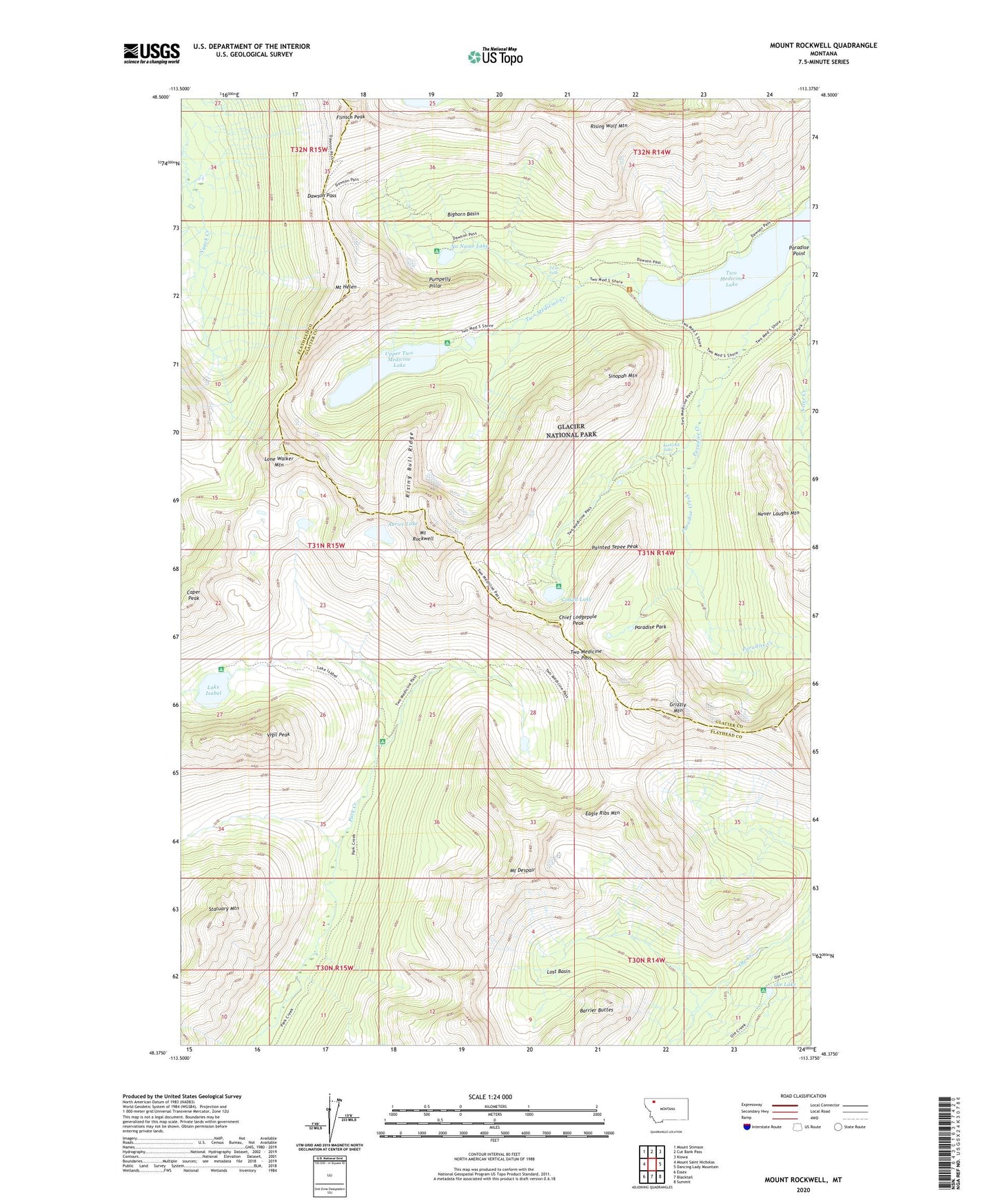
Mount Rockwell Montana US Topo Map
Couldn't load pickup availability
2024 topographic map quadrangle Mount Rockwell in the state of Montana. Scale: 1:24000. Based on the newly updated USGS 7.5' US Topo map series, this map is in the following counties: Glacier, Flathead. The map contains contour data, water features, and other items you are used to seeing on USGS maps, but also has updated roads and other features. This is the next generation of topographic maps. Printed on high-quality waterproof paper with UV fade-resistant inks.
Quads adjacent to this one:
West: Mount Saint Nicholas
Northwest: Mount Stimson
North: Cut Bank Pass
Northeast: Kiowa
East: Dancing Lady Mountain
Southeast: Summit
South: Blacktail
Southwest: Essex
This map covers the same area as the classic USGS quad with code o48113d4.
Contains the following named places: Aster Creek, Aurice Lake, Bighorn Basin, Buttercup Park Trail, Caper Peak, Chief Lodgepole Peak, Cobalt Lake, Dawson Pass, Dawson Pass Trail, Eagle Ribs Mountain, Flinsch Peak, Grizzly Mountain, Lake Isabel, Lone Walker Mountain, Lost Basin, Mount Despair, Mount Helen, Mount Rockwell, Never Laughs Mountain, No Name Lake, Ole Lake, Painted Tepee Peak, Paradise Creek, Paradise Park, Paradise Point, Pumpelly Pillar, Rising Bull Ridge, Rising Wolf Mountain, Rockwell Falls, Sinopah Mountain, South Shore Trail, Statuary Mountain, Twin Falls, Two Medicine Lake, Two Medicine Pass, Two Medicine Pass Trail, Upper Two Medicine Lake, Upper Two Medicine Trail, Vigil Peak