MyTopo
Cut Bank Pass Montana US Topo Map
Couldn't load pickup availability
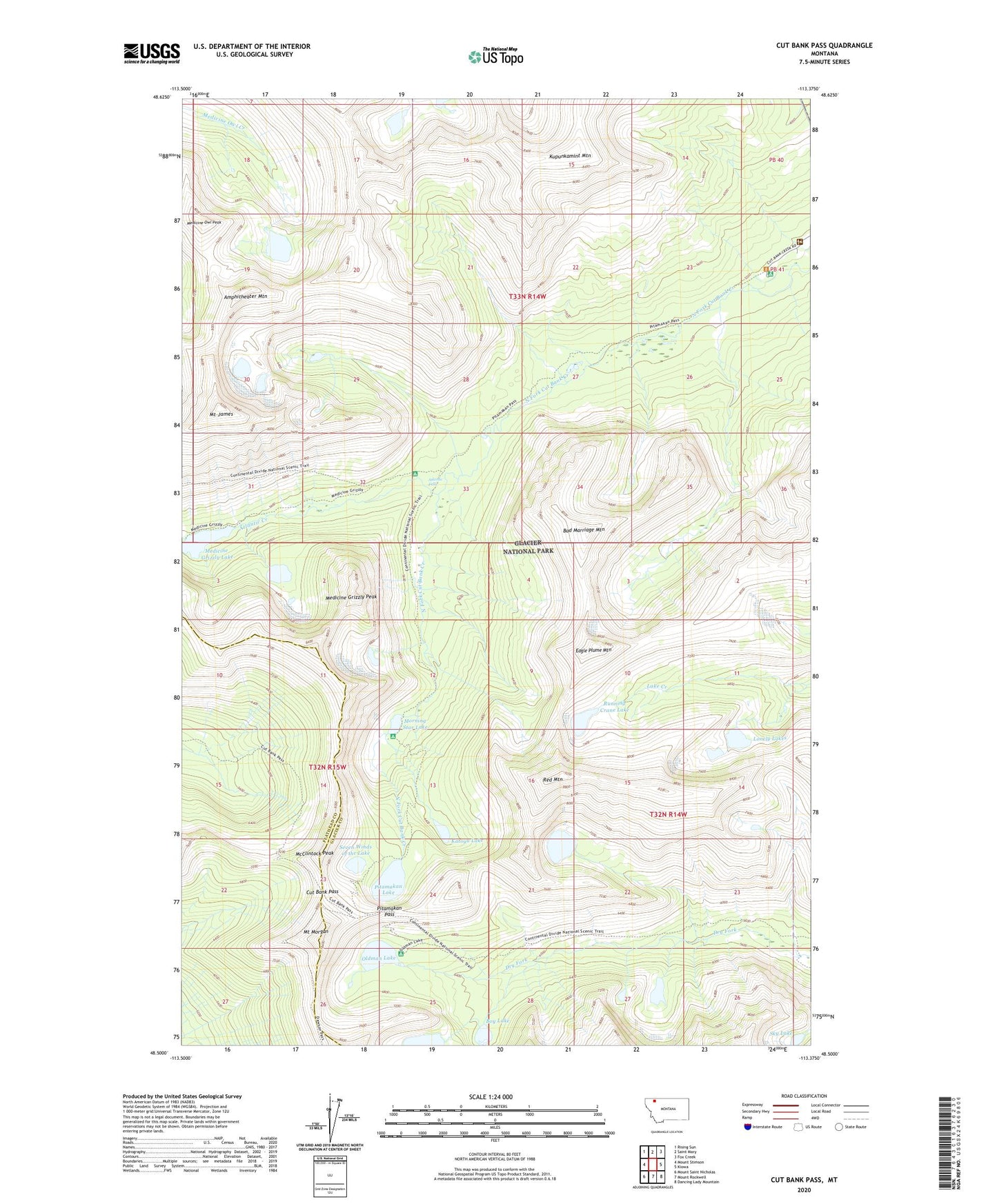
2024 topographic map quadrangle Cut Bank Pass in the state of Montana. Scale: 1:24000. Based on the newly updated USGS 7.5' US Topo map series, this map is in the following counties: Glacier, Flathead. The map contains contour data, water features, and other items you are used to seeing on USGS maps, but also has updated roads and other features. This is the next generation of topographic maps. Printed on high-quality waterproof paper with UV fade-resistant inks.
Quads adjacent to this one:
West: Mount Stimson
Northwest: Rising Sun
North: Saint Mary
Northeast: Fox Creek
East: Kiowa
Southeast: Dancing Lady Mountain
South: Mount Rockwell
Southwest: Mount Saint Nicholas
This map covers the same area as the classic USGS quad with code o48113e4.
Contains the following named places: Amphitheater Mountain, Atlantic Creek, Atlantic Falls, Bad Marriage Mountain, Boy Lake, Cut Bank Campground, Cut Bank Pass, Cut Bank Pass Trail, Cut Bank Ranger Station, Eagle Plume Mountain, Katoya Lake, Kupunkamint Mountain, Lonely Lakes, McClintock Peak, Medicine Grizzly Lake, Medicine Grizzly Peak, Medicine Grizzly Trail, Medicine Owl Lake, Medicine Owl Peak, Morning Star Lake, Mount James, Mount Morgan, Oldman Lake, Pitamakan Lake, Pitamakan Pass, Pitamakan Pass Trail, Red Mountain, Running Crane Lake, Seven Winds of the Lake, Sky Lake, Young Man Lake