MyTopo
Mount Wallace Montana US Topo Map
Couldn't load pickup availability
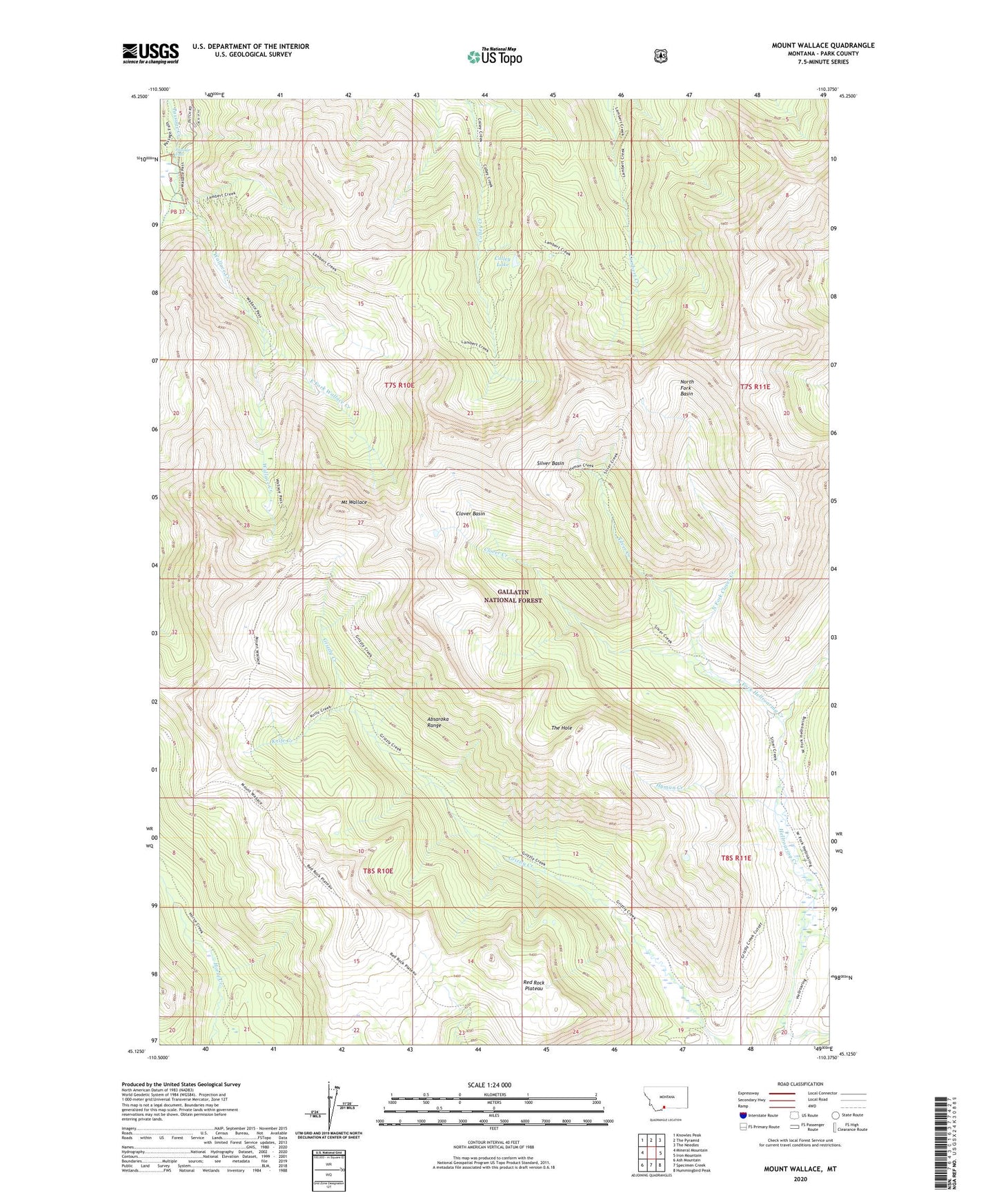
2020 topographic map quadrangle Mount Wallace in the state of Montana. Scale: 1:24000. Based on the newly updated USGS 7.5' US Topo map series, this map is in the following counties: Park. The map contains contour data, water features, and other items you are used to seeing on USGS maps, but also has updated roads and other features. This is the next generation of topographic maps. Printed on high-quality waterproof paper with UV fade-resistant inks.
Quads adjacent to this one:
West: Mineral Mountain
Northwest: Knowles Peak
North: The Pyramid
Northeast: The Needles
East: Iron Mountain
Southeast: Hummingbird Peak
South: Specimen Creek
Southwest: Ash Mountain
Contains the following named places: Bull Moose Cabin, Clover Basin, Clover Creek, Colley Lake, East Fork Hellroaring Creek, East Fork Wallace Creek, Gardiner-Cooke City Division, Hyman Creek, Knife Creek, Middle Fork Hellroaring Creek, Mount Wallace, North Fork Basin, North Fork Clover Creek, North Fork Hellroaring Creek, Passage Falls, Red Rock Plateau, Silver Basin, Silver Creek, The Hole, Wallace Creek