MyTopo
Nelson Coulee Montana US Topo Map
Couldn't load pickup availability
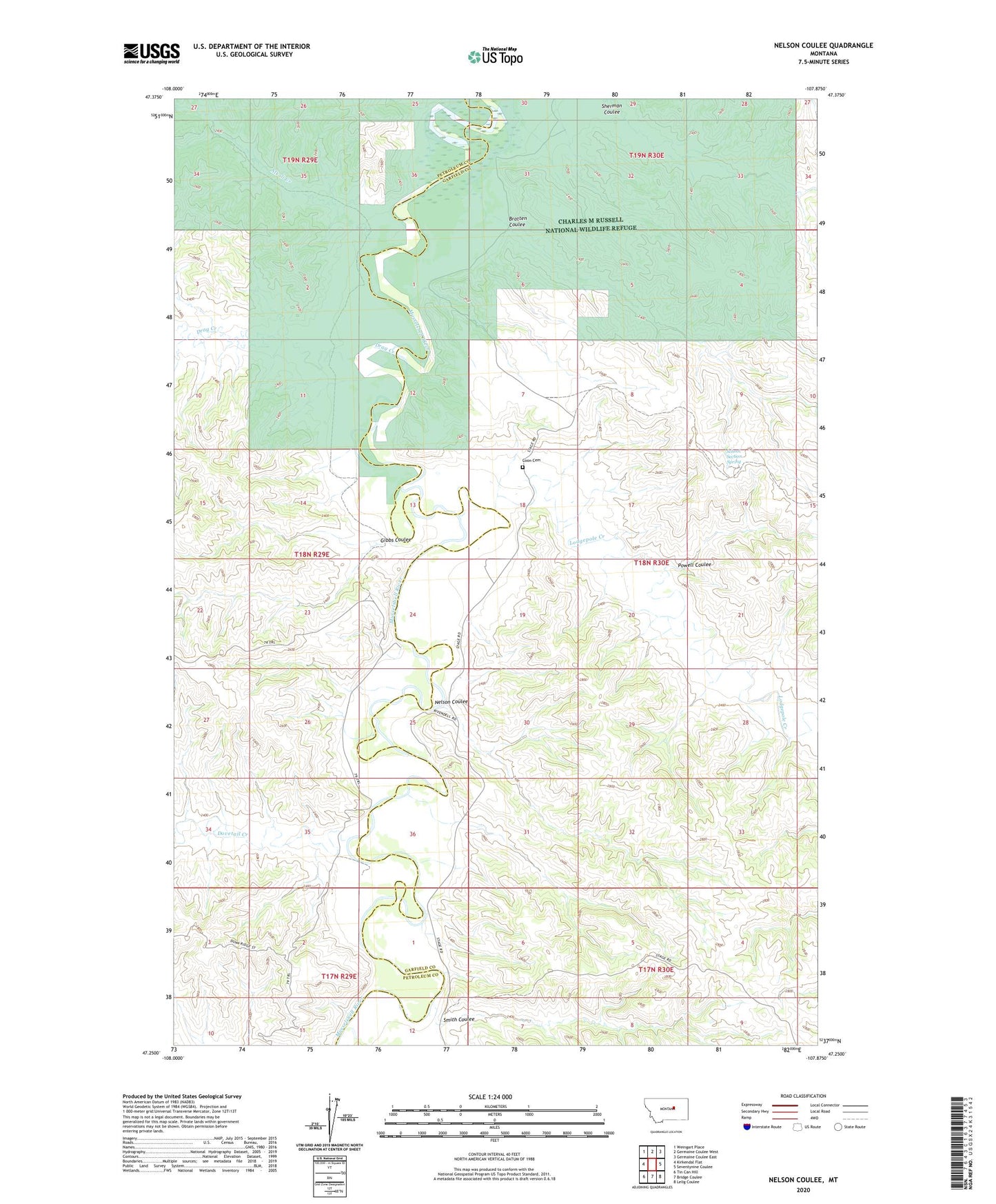
2024 topographic map quadrangle Nelson Coulee in the state of Montana. Scale: 1:24000. Based on the newly updated USGS 7.5' US Topo map series, this map is in the following counties: Garfield, Petroleum. The map contains contour data, water features, and other items you are used to seeing on USGS maps, but also has updated roads and other features. This is the next generation of topographic maps. Printed on high-quality waterproof paper with UV fade-resistant inks.
Quads adjacent to this one:
West: Kirkendal Flat
Northwest: Weingart Place
North: Germaine Coulee West
Northeast: Germaine Coulee East
East: Seventynine Coulee
Southeast: Lelig Coulee
South: Bridge Coulee
Southwest: Tin Can Hill
This map covers the same area as the classic USGS quad with code o47107c8.
Contains the following named places: 18N29E13BD__01 Well, 18N30E18DB__01 Well, 18N30E19BBBA01 Well, Alkali Creek, Bratten Coulee, Coon Cemetery, Davis Well, Dovetail Creek, Drag Creek, Gibbs Coulee, Horseshoe Bend School, Lodgepole Creek, Lone Star School, Matovich Ranch, Mecaha, Mecaha Post Office, Mecaha School, Mock Well, Musselshell River, Nelson Coulee, Powell Coulee, School Section Spring, Smith Coulee