MyTopo
Triple Crossing Reservoir West Montana US Topo Map
Couldn't load pickup availability
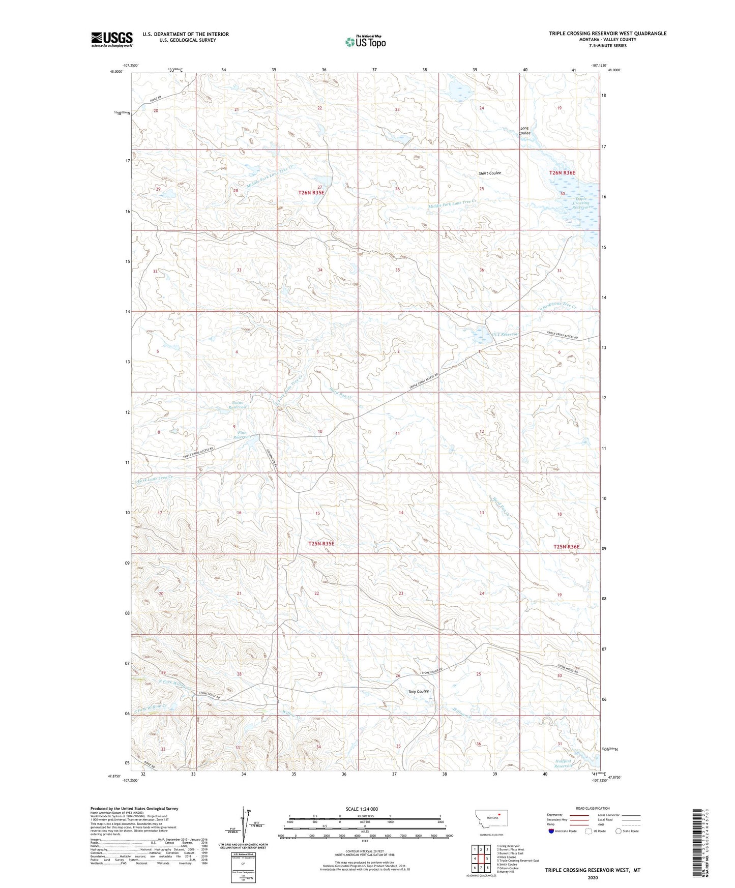
2024 topographic map quadrangle Triple Crossing Reservoir West in the state of Montana. Scale: 1:24000. Based on the newly updated USGS 7.5' US Topo map series, this map is in the following counties: Valley. The map contains contour data, water features, and other items you are used to seeing on USGS maps, but also has updated roads and other features. This is the next generation of topographic maps. Printed on high-quality waterproof paper with UV fade-resistant inks.
Quads adjacent to this one:
West: Niles Coulee
Northwest: Craig Reservoir
North: Burnett Flats West
Northeast: Burnett Flats East
East: Triple Crossing Reservoir East
Southeast: Murray Hill
South: Gibson Coulee
Southwest: Smith Coulee
Contains the following named places: Etchart Stone House, Finn Reservoir, Finn Reservoir Dam, Foulweather Dam, Hard Rock Dam, Horny Dam, Long Coulee, Long Horn Number 1 Dam, Nod Dam, North Fork Willow Creek, One Fork Dam, Ruins Dam, Ruins Reservoir, Shag Dam, Sheep Shed Dam, Short Coulee, Sob Dam, South Fork Willow Creek, Tin Roof Dam, Tony Coulee, Toprail Dam, Triple Crossing Reservoir, Ult Dam, ULT Reservoir, Winkum Dam