
MyTopo
Olney Montana US Topo Map
Couldn't load pickup availability
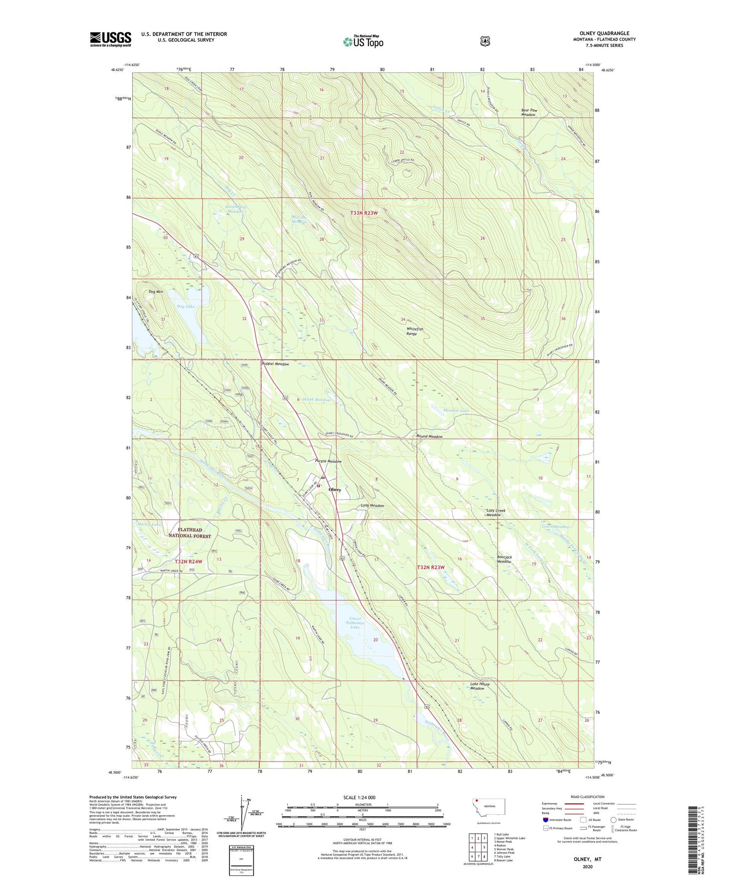
2020 topographic map quadrangle Olney in the state of Montana. Scale: 1:24000. Based on the newly updated USGS 7.5' US Topo map series, this map is in the following counties: Flathead. The map contains contour data, water features, and other items you are used to seeing on USGS maps, but also has updated roads and other features. This is the next generation of topographic maps. Printed on high-quality waterproof paper with UV fade-resistant inks.
Quads adjacent to this one:
West: Radnor
Northwest: Bull Lake
North: Upper Whitefish Lake
Northeast: Moose Peak
East: Werner Peak
Southeast: Beaver Lake
South: Tally Lake
Southwest: Johnson Peak
Contains the following named places: 32N23W07AC__01 Well, 32N23W07BABB01 Well, 32N23W08CAD_01 Well, 32N23W17BB__01 Well, 32N23W17BBBC01 Well, 33N23W30BDBD01 Well, 33N23W32DD__01 Well, Antice Creek, Bear Paw Meadow, Bootjack Meadow, Dog Creek, Dog Creek Campground, Dog Lake, Dog Mountain, Lake House Meadow, Lazy Creek Meadow, Lewis Meadow, Long Meadow, Lower Stillwater Lake, Martin Creek, McCabe Meadow, Meadow Lake, Mock Post Office, Mock School, Olney, Olney Ambulance, Olney Census Designated Place, Olney Community Church, Olney Elementary School, Olney Fire Department, Olney Post Office, Potter Creek, Purple Meadow, Ritsenburg Meadow, Round Meadow, Ruppel Meadow, Skunk Meadow, Stillwater Ranger Station, Whitefish Division


