MyTopo
Upper Whitefish Lake Montana US Topo Map
Couldn't load pickup availability
Also explore the Upper Whitefish Lake Forest Service Topo of this same quad for updated USFS data
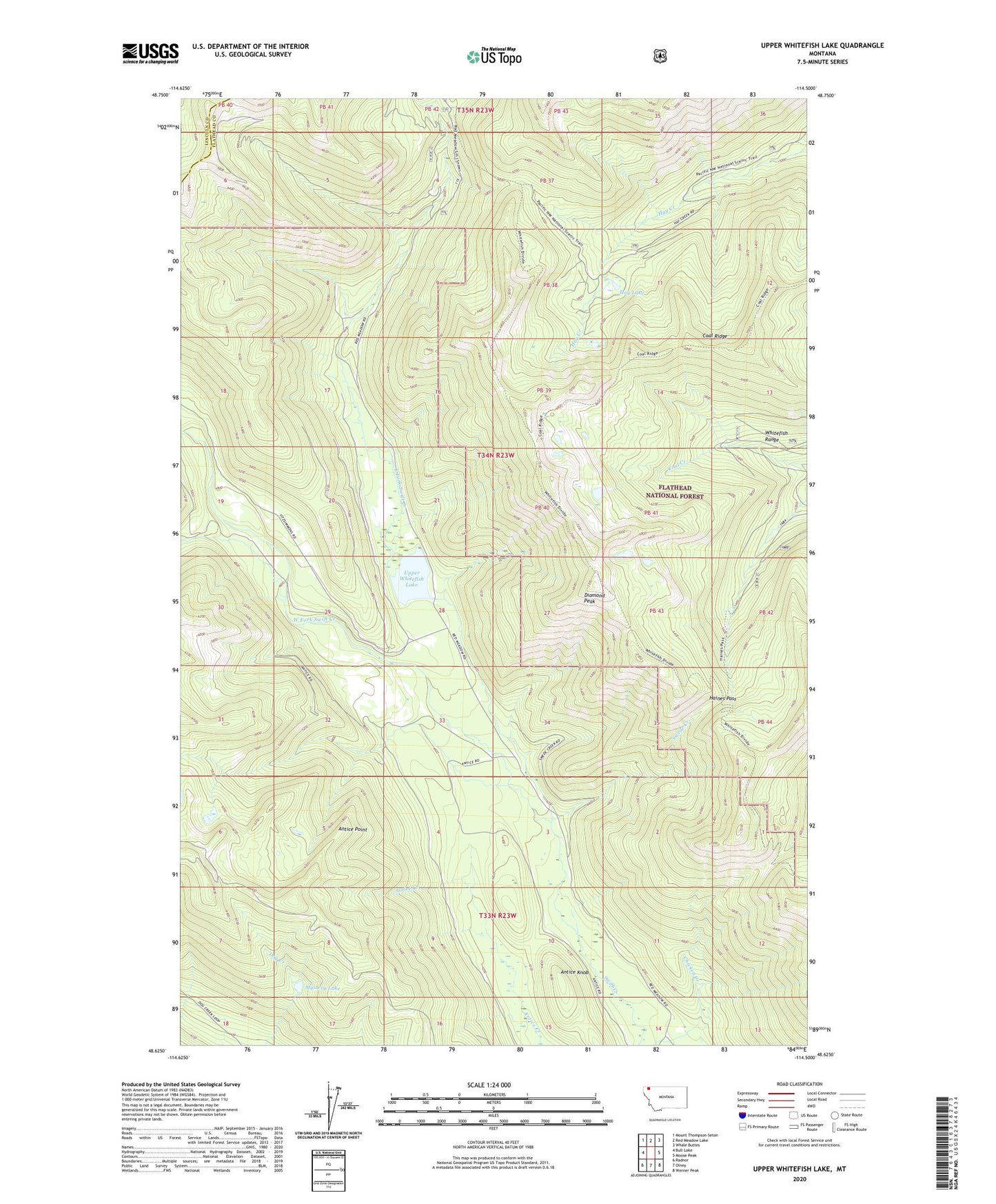
2024 topographic map quadrangle Upper Whitefish Lake in the state of Montana. Scale: 1:24000. Based on the newly updated USGS 7.5' US Topo map series, this map is in the following counties: Flathead, Lincoln. The map contains contour data, water features, and other items you are used to seeing on USGS maps, but also has updated roads and other features. This is the next generation of topographic maps. Printed on high-quality waterproof paper with UV fade-resistant inks.
Quads adjacent to this one:
West: Bull Lake
Northwest: Mount Thompson-Seton
North: Red Meadow Lake
Northeast: Whale Buttes
East: Moose Peak
Southeast: Werner Peak
South: Olney
Southwest: Radnor
This map covers the same area as the classic USGS quad with code o48114f5.
Contains the following named places: Antice Knob, Antice Point, Chicken Creek, Diamond Peak, East Fork Swift Creek, Haines Pass, Hay Lake, Mystery Lake, Ralph Thayer Memorial Trail, Stillwater State Forest, Swede Creek, Upper Whitefish Campground, Upper Whitefish Lake, West Fork Swift Creek