MyTopo
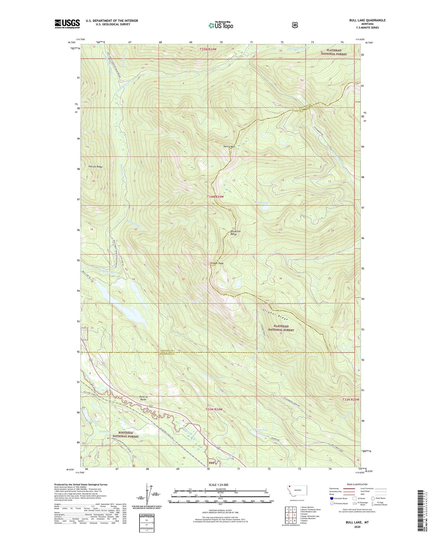
Bull Lake Montana US Topo Map
Couldn't load pickup availability
Also explore the Bull Lake Forest Service Topo of this same quad for updated USFS data
2024 topographic map quadrangle Bull Lake in the state of Montana. Scale: 1:24000. Based on the newly updated USGS 7.5' US Topo map series, this map is in the following counties: Lincoln, Flathead. The map contains contour data, water features, and other items you are used to seeing on USGS maps, but also has updated roads and other features. This is the next generation of topographic maps. Printed on high-quality waterproof paper with UV fade-resistant inks.
Quads adjacent to this one:
West: Stryker
Northwest: Mount Marston
North: Mount Thompson-Seton
Northeast: Red Meadow Lake
East: Upper Whitefish Lake
Southeast: Olney
South: Radnor
Southwest: Sunday Mountain
This map covers the same area as the classic USGS quad with code o48114f6.
Contains the following named places: 34N24W08BADA01 Well, 34N24W20CCBD01 Well, Bull Lake, Chepat Creek, Fish Lake, Fitzsimmons Creek, Hellroaring Creek, Herrig Lake, Herrig Mountain, Louis Creek, North Fork Fitzsimmons Creek, Point of Rocks, Spring Creek, Spring Creek Campground, Spring Lakes, Stryker Peak, Stryker Ridge, Sunday Creek, Sunday Lakes, Woods Lake