MyTopo
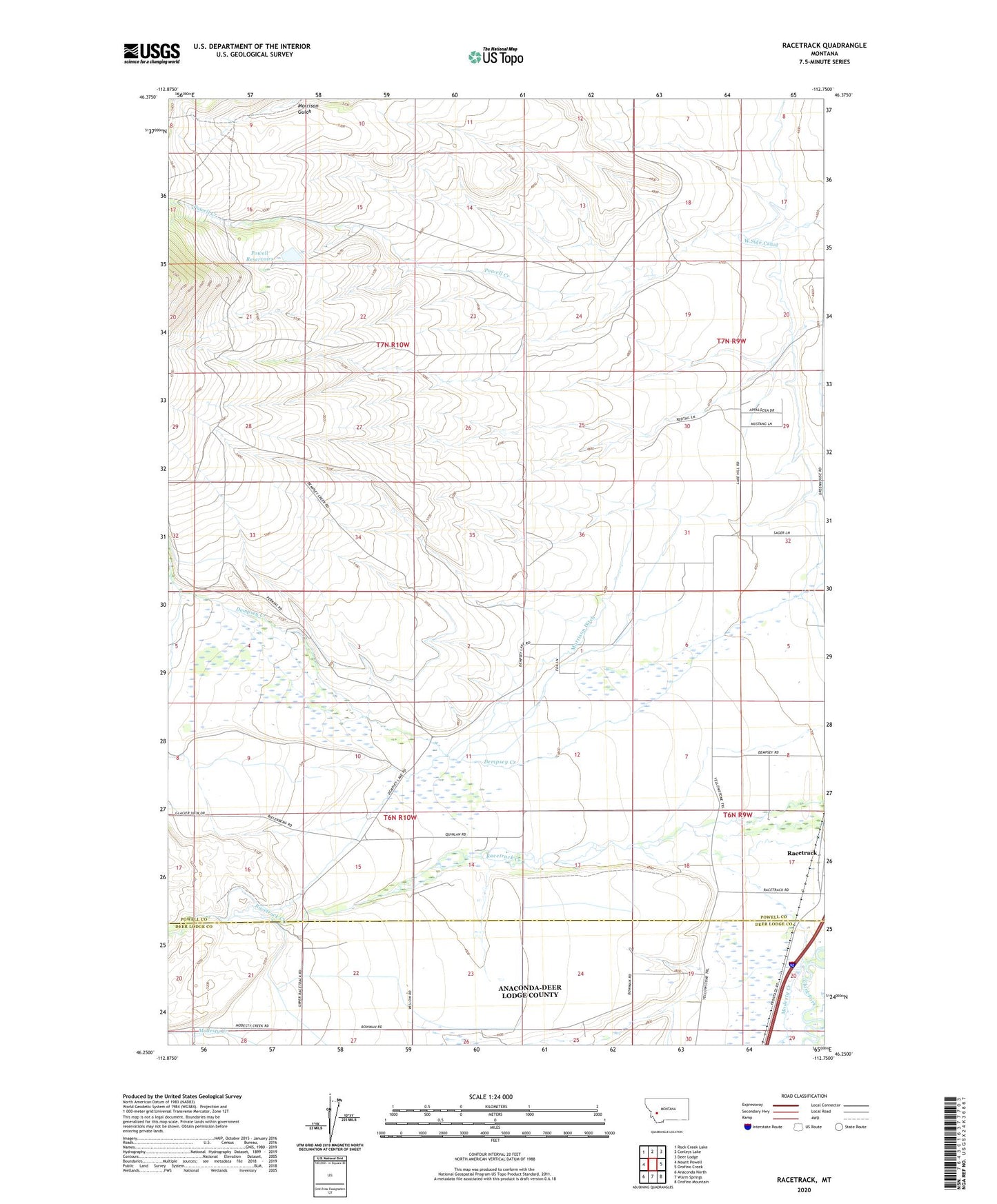
Racetrack Montana US Topo Map
Couldn't load pickup availability
Also explore the Racetrack Forest Service Topo of this same quad for updated USFS data
2024 topographic map quadrangle Racetrack in the state of Montana. Scale: 1:24000. Based on the newly updated USGS 7.5' US Topo map series, this map is in the following counties: Powell, Deer Lodge. The map contains contour data, water features, and other items you are used to seeing on USGS maps, but also has updated roads and other features. This is the next generation of topographic maps. Printed on high-quality waterproof paper with UV fade-resistant inks.
Quads adjacent to this one:
West: Mount Powell
Northwest: Rock Creek Lake
North: Conleys Lake
Northeast: Deer Lodge
East: Orofino Creek
Southeast: Orofino Mountain
South: Warm Springs
Southwest: Anaconda North
This map covers the same area as the classic USGS quad with code o46112c7.
Contains the following named places: 06N09W05ACAA01 Well, 06N09W06AC__01 Well, 06N09W06ADBB01 Well, 06N09W07AD__01 Well, 06N09W07AD__02 Well, 06N09W07BCCC01 Well, 06N09W07BCCC02 Well, 06N09W07CD__01 Well, 06N09W07DC__01 Well, 06N09W07DDDA01 Well, 06N09W17BCDD01 Well, 06N09W17BDCC01 Well, 06N09W17CDAA01 Well, 06N09W18AB__01 Well, 06N09W18BCAC01 Well, 06N09W18DD__01 Well, 06N09W19AC__02 Well, 06N09W19DB__01 Well, 06N09W20BD__01 Well, 06N10W01AD__01 Well, 06N10W04BBBA01 Well, 06N10W05AA__01 Well, 06N10W05AABA01 Well, 06N10W12DA__01 Well, 06N10W13BCBB01 Well, 06N10W14AC__01 Well, 06N10W14BCDB01 Well, 06N10W14CA__01 Well, 06N10W14CBBB01 Well, 06N10W15AAD_01 Well, 06N10W22DD__01 Well, 06N10W23BB__01 Well, 06N10W23BC__01 Well, 06N10W23DA__01 Well, 06N10W23DCDD01 Well, 06N10W26AB__01 Well, 06N10W27AA__01 Well, 06N10W28BB__01 Well, 06N10W28BBBB01 Well, 07N09W20ABDB01 Well, 07N09W20CADD01 Well, 07N09W29AB__01 Well, 07N09W29ABAA01 Well, 07N09W29ABCA01 Well, 07N09W29DB__01 Well, 07N09W30DD__01 Well, 07N09W31CCAD01 Well, 07N09W31CCBB01 Well, 07N09W31CD__01 Well, 07N09W31CDD_01 Well, 07N09W31DB__01 Well, 07N09W32ADAB01 Well, 07N09W32ADAB02 Well, 07N10W15DBCB01 Well, 59722, Champion, Deer Lodge Division, Dempsey Station, Elide, Modesty Creek, Montana State Prison Ranch Number 2, Morrison Ditch, Morrison Gulch, North Fork Dempsey Creek, Perkins Ranch, Powell Reservoirs, West Side Canal