
MyTopo
Packsaddle Butte Montana US Topo Map
Couldn't load pickup availability
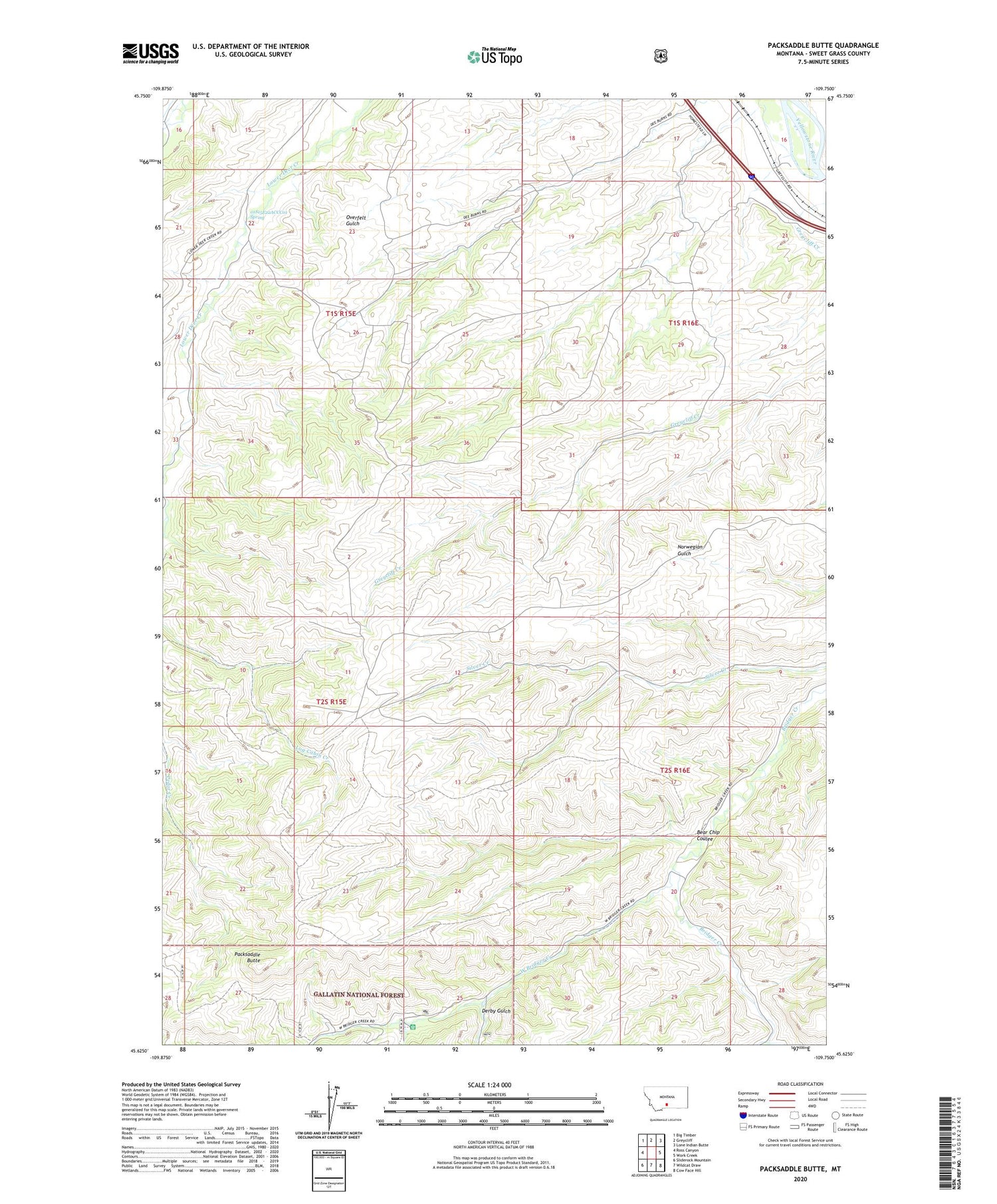
2020 topographic map quadrangle Packsaddle Butte in the state of Montana. Scale: 1:24000. Based on the newly updated USGS 7.5' US Topo map series, this map is in the following counties: Sweet Grass. The map contains contour data, water features, and other items you are used to seeing on USGS maps, but also has updated roads and other features. This is the next generation of topographic maps. Printed on high-quality waterproof paper with UV fade-resistant inks.
Quads adjacent to this one:
West: Ross Canyon
Northwest: Big Timber
North: Greycliff
Northeast: Lone Indian Butte
East: Work Creek
Southeast: Cow Face Hill
South: Wildcat Draw
Southwest: Sliderock Mountain
Contains the following named places: 01S15E22ABCC01 Well, 01S15E22ACCC01 Spring, 01S16E17DCBA01 Well, 02S15E03ABBA01 Spring, 02S16E20ACCA01 Spring, Bear Chip Coulee, Black Butte Trail, Captain William Clark Historical Marker, Crazy Mountains Historical Marker, Derby Gulch, East Bridger Creek, Fahlgren Gulch, Greycliff Rest Area, Packsaddle Butte, Thomas Party Historical Marker, West Bridger Creek, West Bridger Station


