
MyTopo
Paradise Montana US Topo Map
Couldn't load pickup availability
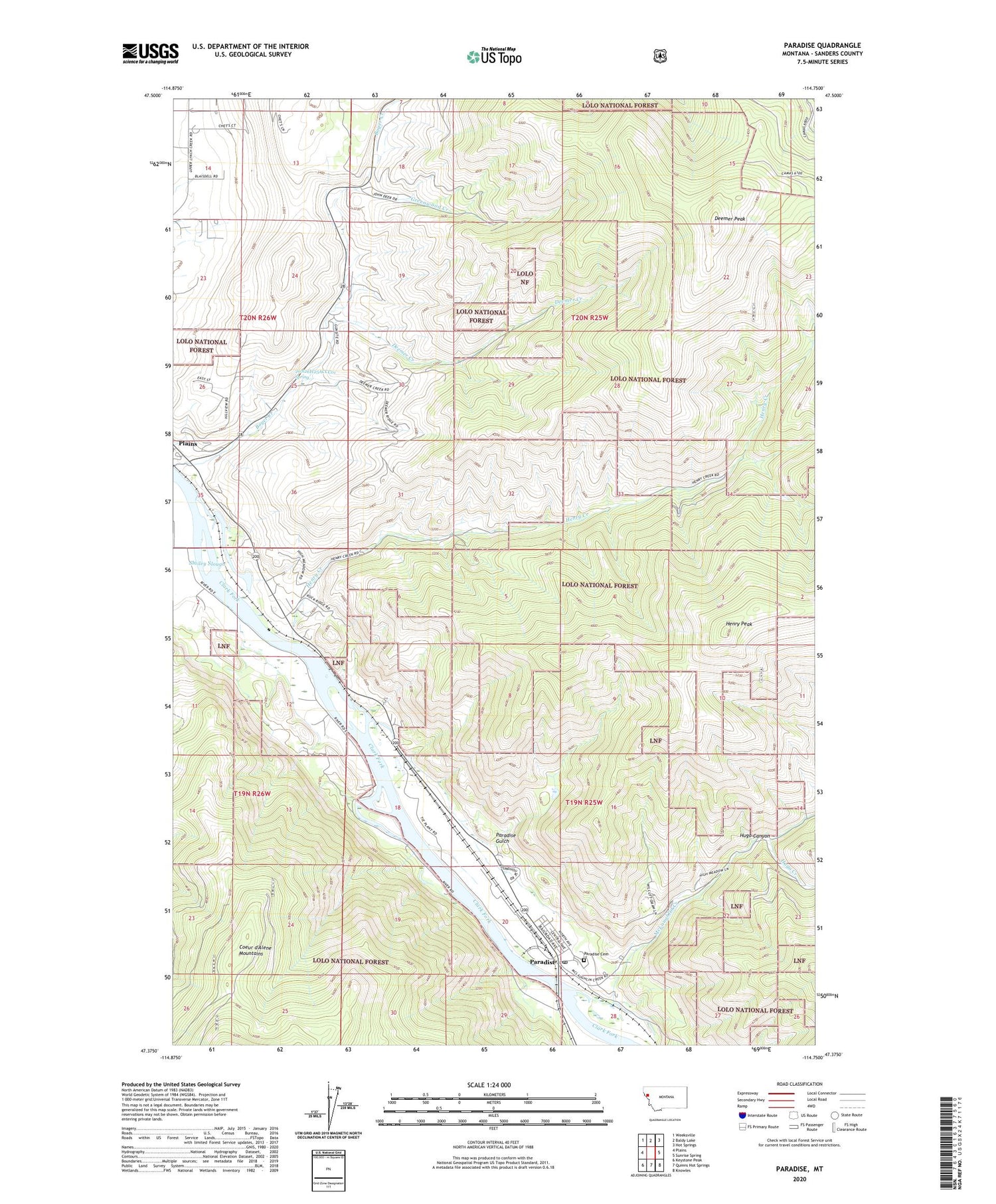
2020 topographic map quadrangle Paradise in the state of Montana. Scale: 1:24000. Based on the newly updated USGS 7.5' US Topo map series, this map is in the following counties: Sanders. The map contains contour data, water features, and other items you are used to seeing on USGS maps, but also has updated roads and other features. This is the next generation of topographic maps. Printed on high-quality waterproof paper with UV fade-resistant inks.
Quads adjacent to this one:
West: Plains
Northwest: Weeksville
North: Baldy Lake
Northeast: Hot Springs
East: Sunrise Spring
Southeast: Knowles
South: Quinns Hot Springs
Southwest: Keystone Peak
Contains the following named places: 19N26W01CAB_01 Well, 20N26W14ACCB01 Well, 20N26W24DDC_01 Well, 20N26W25ACCC01 Spring, Boyer Creek, Deemer Creek, Deemer Peak, Greenwood Creek, Henry Creek, Henry Peak, Hugo Canyon, Hugo Creek, McLaughlin Creek, McMillans Trading Post, Minnehan, Paradise, Paradise Cemetery, Paradise Census Designated Place, Paradise Elementary School, Paradise Gulch, Paradise Post Office, Smiley Slough


