MyTopo
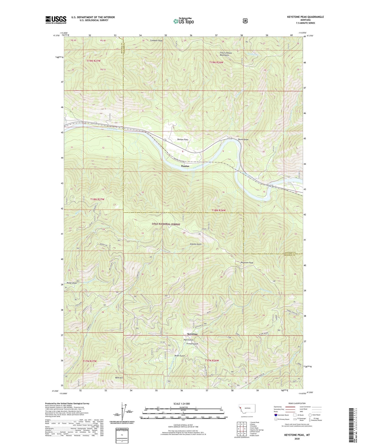
Keystone Peak Montana US Topo Map
Couldn't load pickup availability
Also explore the Keystone Peak Forest Service Topo of this same quad for updated USFS data
2024 topographic map quadrangle Keystone Peak in the state of Montana. Scale: 1:24000. Based on the newly updated USGS 7.5' US Topo map series, this map is in the following counties: Mineral, Sanders. The map contains contour data, water features, and other items you are used to seeing on USGS maps, but also has updated roads and other features. This is the next generation of topographic maps. Printed on high-quality waterproof paper with UV fade-resistant inks.
Quads adjacent to this one:
West: Saint Regis
Northwest: Sunset Peak
North: Plains
Northeast: Paradise
East: Quinns Hot Springs
Southeast: Idaho Gulch
South: Superior
Southwest: Wilson Gulch
This map covers the same area as the classic USGS quad with code o47114c8.
Contains the following named places: Bald Hill, Brian Gulch, Carter, Carter Post Office, Carter School, Chevrolet Number 1 and 2 Mine, Donlan, Donlan Flats, Dunns Draw, Firman Gulch, Keystone, Keystone Mine, Keystone Peak, Keystone Post Office, Keystone School, Little Anaconda Mine, Little Pittsburg Mine, Lower Prosperity Mine, Miller Draw, Nancy Lee Millsite, Nancy Lee Mine, Nancy Lee/Fawcett Mine, Nite Owl Number 2 Mine, Nite Owl Number 3 Mine, Nite Owl Number 8 Mine, O R and N Mine, Pack Gulch, Patrick Creek, S and H Mine, Santa Rita Mine, Sesame Creek, Seven Mile Creek Mine, Sevenmile Creek, Triumph Mine, Upper Keesey Mine, Upper Nancy Lee Mine, Upper Prosperity Mine