MyTopo
Park Lake Montana US Topo Map
Couldn't load pickup availability
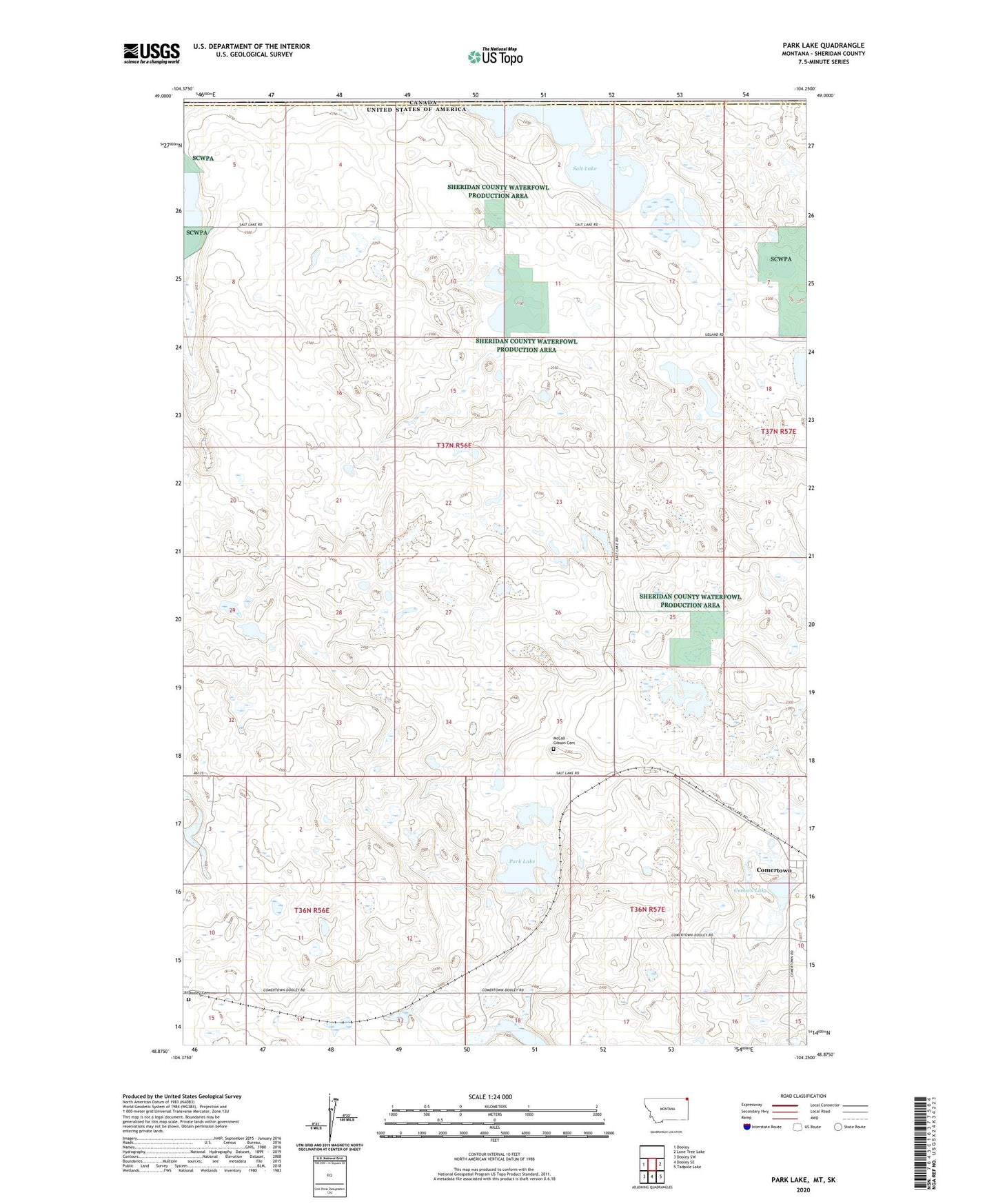
2020 topographic map quadrangle Park Lake in the state of Montana. Scale: 1:24000. Based on the newly updated USGS 7.5' US Topo map series, this map is in the following counties: Sheridan. The map contains contour data, water features, and other items you are used to seeing on USGS maps, but also has updated roads and other features. This is the next generation of topographic maps. Printed on high-quality waterproof paper with UV fade-resistant inks.
Quads adjacent to this one:
West: Dooley
East: Lone Tree Lake
Southeast: Tadpole Lake
South: Dooley SE
Southwest: Dooley SW
Contains the following named places: 36N57E09CACB01 Well, Comer Park, Comers Lake, Comertown, Comertown School, Dooley Cemetery, Frog Springs Post Office, Johnson Lake, McCall - Gibson Cemetery, Park Lake, Salt Lake, Zion Lutheran Church