MyTopo
Hemlock Lake Montana US Topo Map
Couldn't load pickup availability
Also explore the Hemlock Lake Forest Service Topo of this same quad for updated USFS data
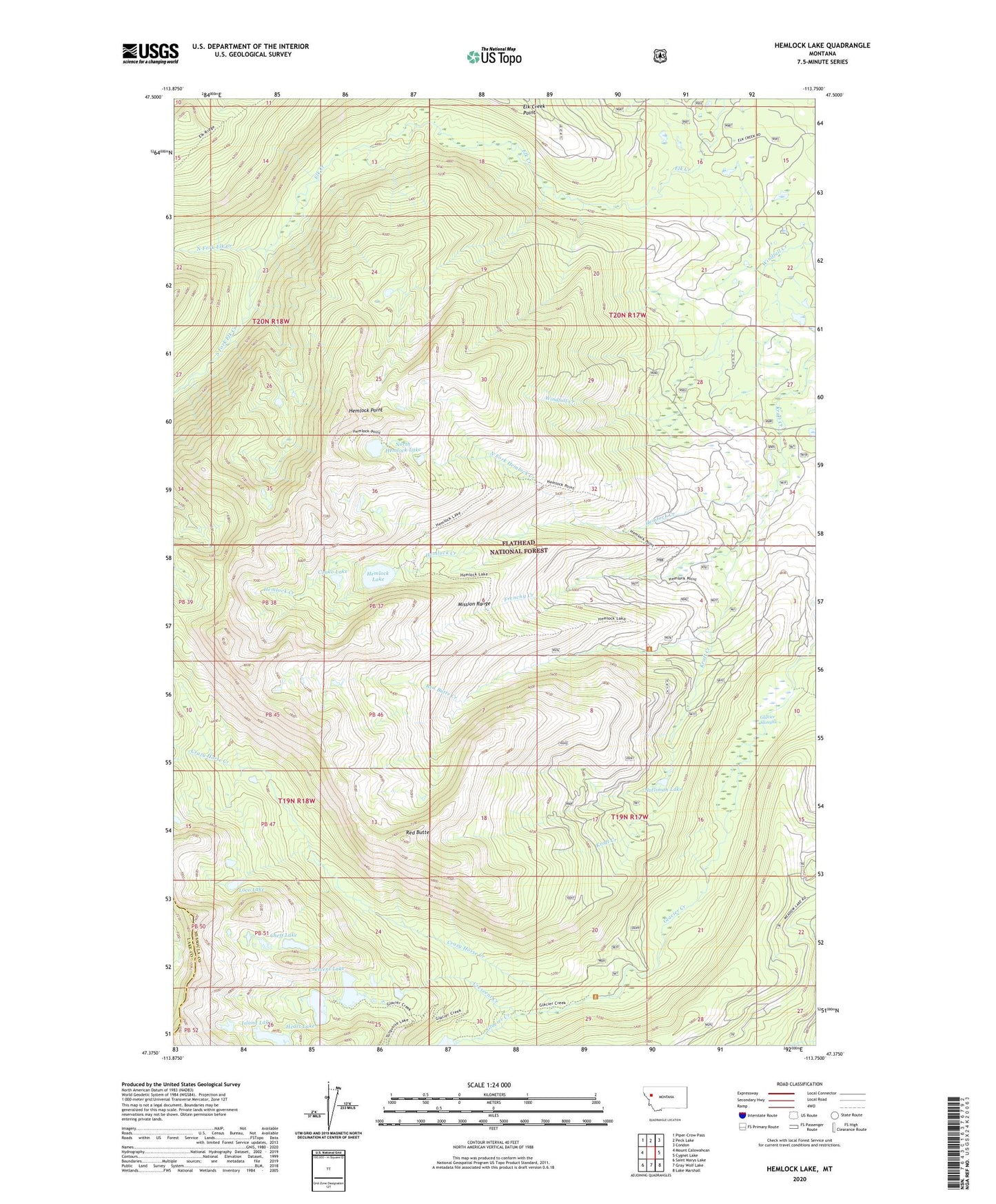
2024 topographic map quadrangle Hemlock Lake in the state of Montana. Scale: 1:24000. Based on the newly updated USGS 7.5' US Topo map series, this map is in the following counties: Missoula, Lake. The map contains contour data, water features, and other items you are used to seeing on USGS maps, but also has updated roads and other features. This is the next generation of topographic maps. Printed on high-quality waterproof paper with UV fade-resistant inks.
Quads adjacent to this one:
West: Mount Calowahcan
Northwest: Piper-Crow Pass
North: Peck Lake
Northeast: Condon
East: Cygnet Lake
Southeast: Lake Marshall
South: Gray Wolf Lake
Southwest: Saint Marys Lake
This map covers the same area as the classic USGS quad with code o47113d7.
Contains the following named places: Cheff Lake, Conko Lake, Crazy Horse Creek, Crescent Creek, Crescent Lake, Elk Creek Point, Frenchy Creek, Glacier Sloughs, Heart Lake, Hemlock Creek, Hemlock Lake, Hemlock Point, Island Lake, Loco Lake, Mission Mountains Wilderness, North Fork Elk Creek, North Fork Hemlock Creek, North Hemlock Lake, Notlimah Lake, Red Butte, Red Butte Creek, South Fork Elk Creek