MyTopo
Phillippi Reservoir Montana US Topo Map
Couldn't load pickup availability
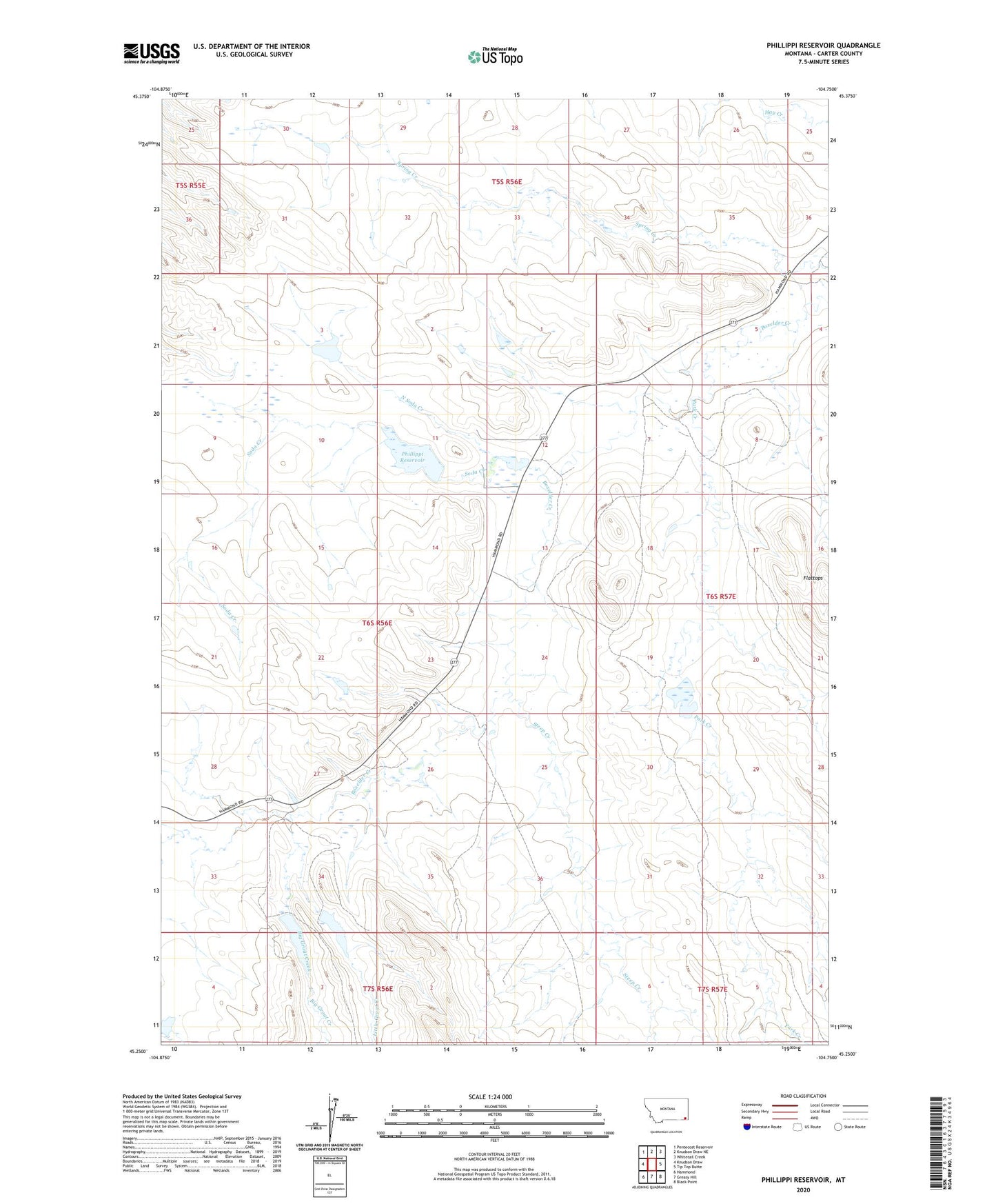
2024 topographic map quadrangle Phillippi Reservoir in the state of Montana. Scale: 1:24000. Based on the newly updated USGS 7.5' US Topo map series, this map is in the following counties: Carter. The map contains contour data, water features, and other items you are used to seeing on USGS maps, but also has updated roads and other features. This is the next generation of topographic maps. Printed on high-quality waterproof paper with UV fade-resistant inks.
Quads adjacent to this one:
West: Knudson Draw
Northwest: Pentecost Reservoir
North: Knudson Draw NE
Northeast: Whitetail Creek
East: Tip Top Butte
Southeast: Black Point
South: Greasy Hill
Southwest: Hammond
This map covers the same area as the classic USGS quad with code o45104c7.
Contains the following named places: Big Groat Creek, Boxelder School, Brownfield Dam, Bum Lamb Dam, Gardner Airport, Gardner Number 2 Dam, Groat Creek, La Ze Number 1 Dam, Little Groat Creek, Marys Lamb Dam, North Soda Creek, Park Creek, Phillippi Number 1 Dam, Phillippi Reservoir, Soda Creek, Soda Creek Dam, Spring Creek, Steep Creek, ZIP Code: 59332