MyTopo
Hammond Montana US Topo Map
Couldn't load pickup availability
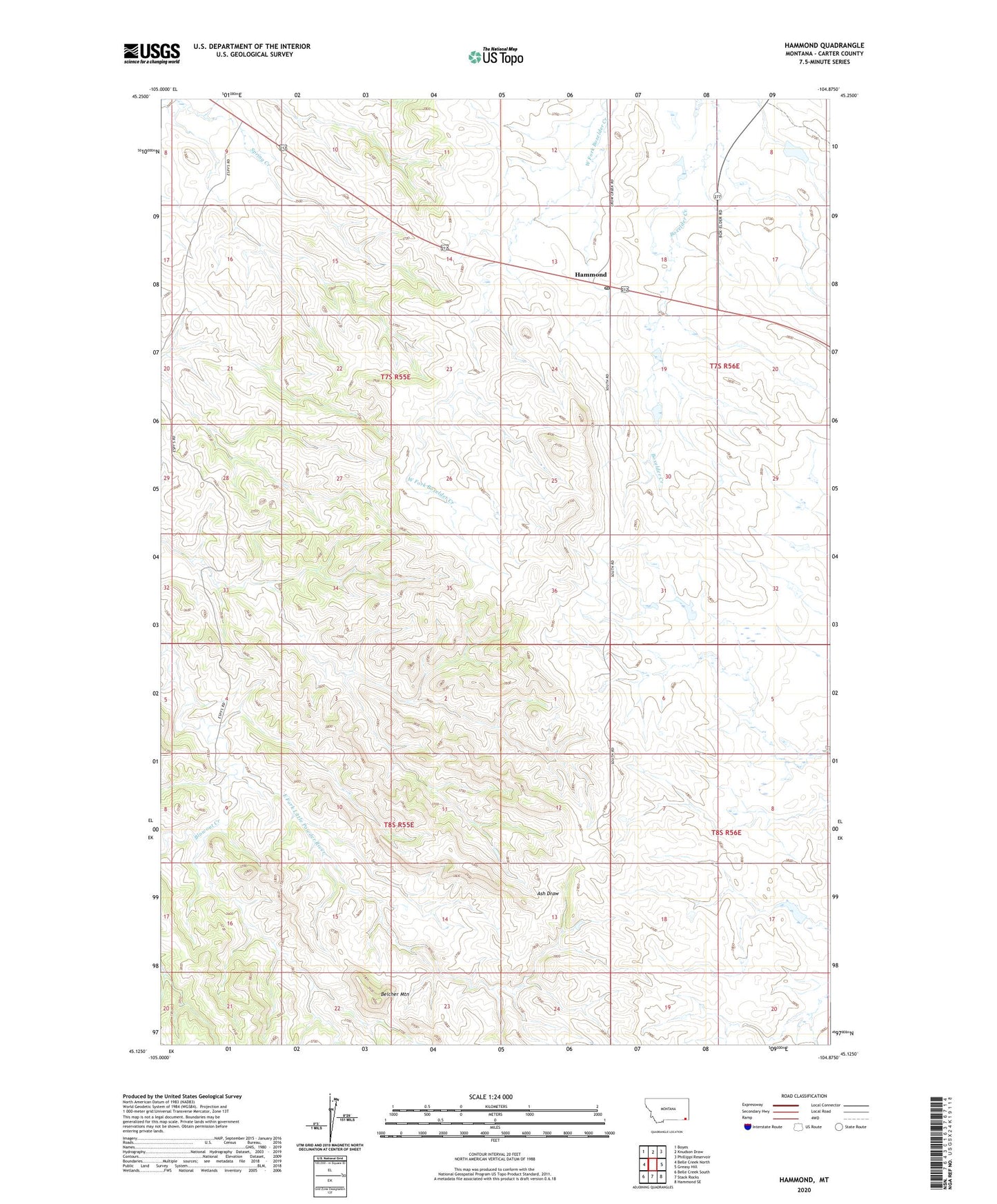
2024 topographic map quadrangle Hammond in the state of Montana. Scale: 1:24000. Based on the newly updated USGS 7.5' US Topo map series, this map is in the following counties: Carter. The map contains contour data, water features, and other items you are used to seeing on USGS maps, but also has updated roads and other features. This is the next generation of topographic maps. Printed on high-quality waterproof paper with UV fade-resistant inks.
Quads adjacent to this one:
West: Belle Creek North
Northwest: Boyes
North: Knudson Draw
Northeast: Phillippi Reservoir
East: Greasy Hill
Southeast: Hammond SE
South: Stack Rocks
Southwest: Belle Creek South
This map covers the same area as the classic USGS quad with code o45104b8.
Contains the following named places: 07S55E11BDCA01 Well, 07S55E14BB__01 Well, 07S55E33CAA_01 Well, 08S55E01AD__01 Well, 08S55E02DDDB01 Well, 08S55E04CDAC01 Well, 08S55E10CB__01 Well, Aldrich Dam, Belcher Mountain, Blowout Creek, Gerald Craft Number 3 Dam, Gerald Craft Number 5 Dam, Hammond, Hammond Post Office, Hammond School, Velvet Dam