MyTopo
Knudson Draw Montana US Topo Map
Couldn't load pickup availability
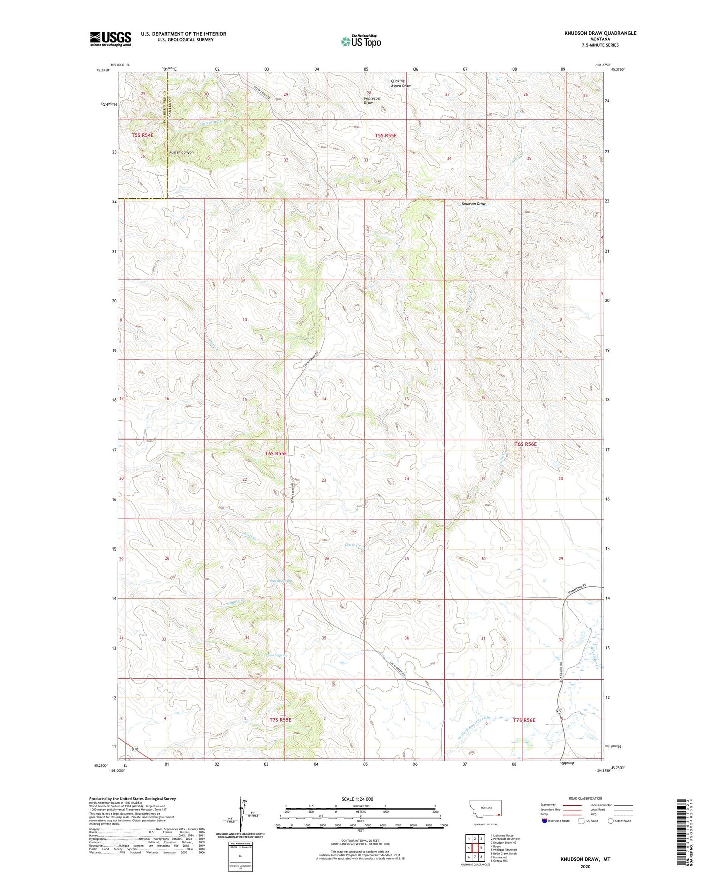
2024 topographic map quadrangle Knudson Draw in the state of Montana. Scale: 1:24000. Based on the newly updated USGS 7.5' US Topo map series, this map is in the following counties: Carter, Powder River. The map contains contour data, water features, and other items you are used to seeing on USGS maps, but also has updated roads and other features. This is the next generation of topographic maps. Printed on high-quality waterproof paper with UV fade-resistant inks.
Quads adjacent to this one:
West: Boyes
Northwest: Lightning Butte
North: Pentecost Reservoir
Northeast: Knudson Draw NE
East: Phillippi Reservoir
Southeast: Greasy Hill
South: Hammond
Southwest: Belle Creek North
This map covers the same area as the classic USGS quad with code o45104c8.
Contains the following named places: 06S55E04DACB01 Well, 06S55E09ABCC01 Well, 06S55E15BACA01 Well, 06S55E23AADD01 Well, 06S55E25BBBB01 Well, 06S55E25CDDB01 Well, 06S56E30DD__01 Well, 07S55E01ADD_01 Well, 07S55E02ABDC01 Well, 07S55E04DCBC01 Well, Church Spring, Hammond Mini-Mutes Radar Site, Knudson Draw, Piniele, Piniele Post Office, Piniele School, Selway Spring, West Fork Boxelder Creek, Whitetail Dam