MyTopo
Pine Creek Montana US Topo Map
Couldn't load pickup availability
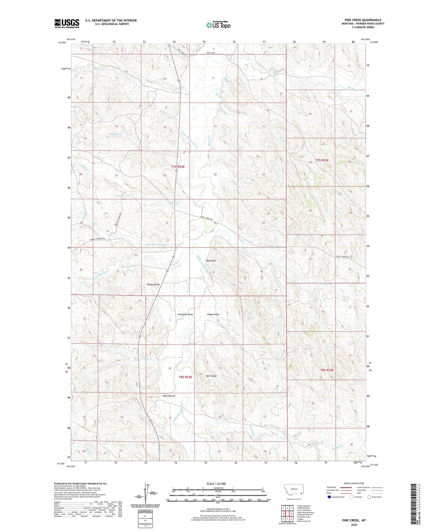
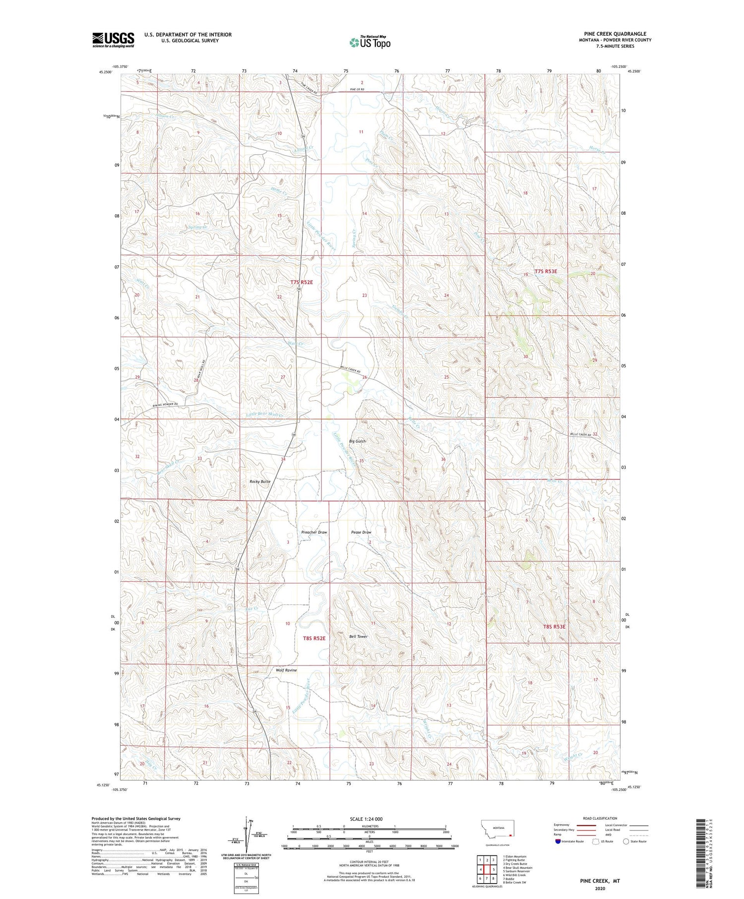
2020 topographic map quadrangle Pine Creek in the state of Montana. Scale: 1:24000. Based on the newly updated USGS 7.5' US Topo map series, this map is in the following counties: Powder River. The map contains contour data, water features, and other items you are used to seeing on USGS maps, but also has updated roads and other features. This is the next generation of topographic maps. Printed on high-quality waterproof paper with UV fade-resistant inks.
Quads adjacent to this one:
West: Bear Skull Mountain
Northwest: Eldon Mountain
North: Fighting Butte
Northeast: Dry Creek Butte
East: Sanburn Reservoir
Southeast: Belle Creek SW
South: Biddle
Southwest: Wild Bill Creek
Contains the following named places: 07S52E02ACDC01 Well, 07S52E10DBDC01 Well, 07S52E11BBBB01 Well, 07S52E21DC__01 Well, 07S52E26BACB01 Well, 07S52E27ABBB01 Well, 07S52E34BB__01 Well, 08S52E15CCAD01 Well, Allison Creek, Bear Skull Creek, Bell Tower, Belle Creek, Big Gulch, Bobcat Creek, Gumbo Creek, Home Creek, Horse Creek, Little Bear Skull Creek, North Fork Little Bear Skull Creek, Pease Draw, Pine Creek, Plum Creek, Preacher Draw, Rocky Butte, Rue Creek, South Fork Wright Creek, Spring Creek, Watt Creek, Wolf Ravine, Wright Creek