MyTopo
Corey Flat Montana US Topo Map
Couldn't load pickup availability
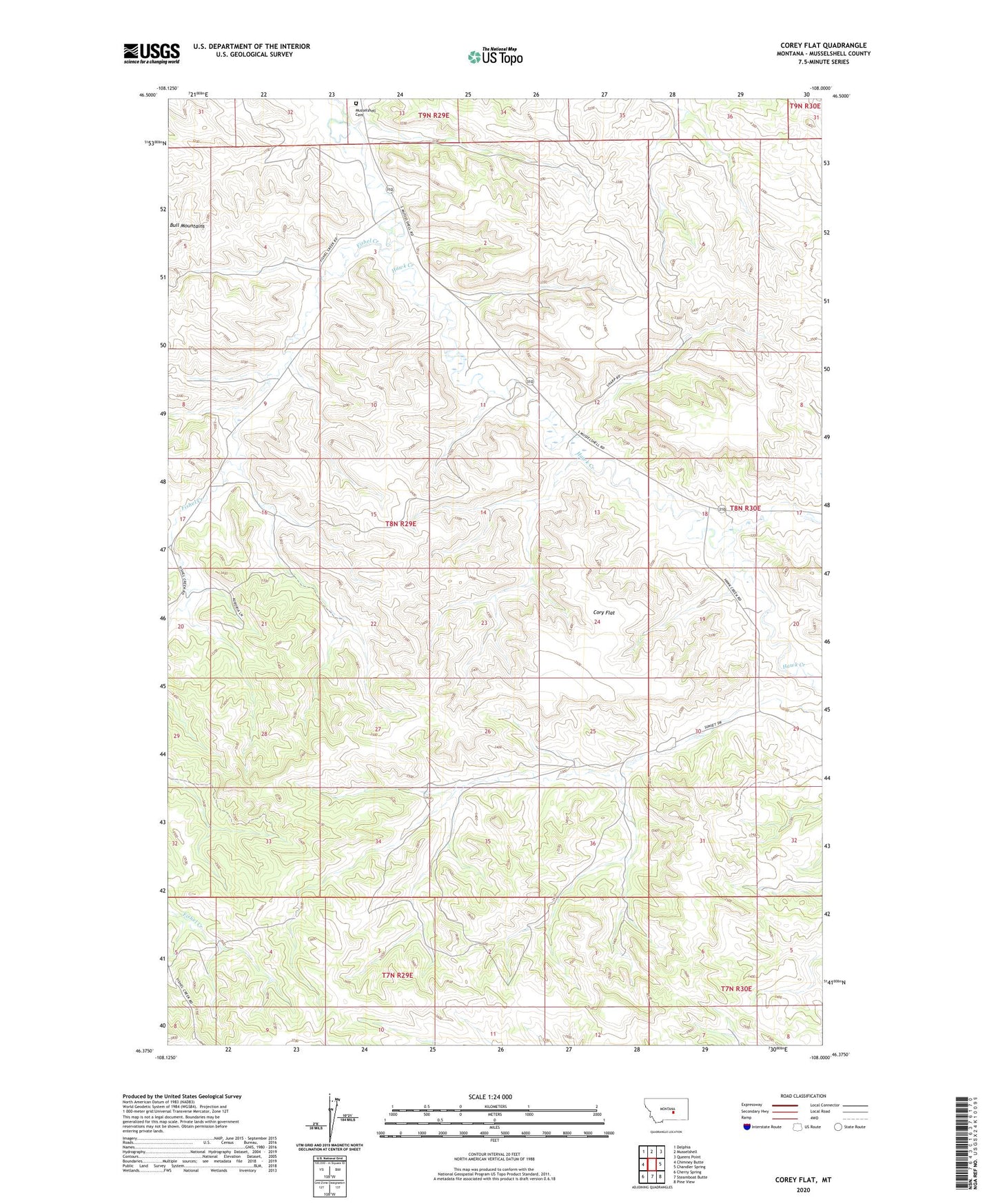
2024 topographic map quadrangle Corey Flat in the state of Montana. Scale: 1:24000. Based on the newly updated USGS 7.5' US Topo map series, this map is in the following counties: Musselshell. The map contains contour data, water features, and other items you are used to seeing on USGS maps, but also has updated roads and other features. This is the next generation of topographic maps. Printed on high-quality waterproof paper with UV fade-resistant inks.
Quads adjacent to this one:
West: Chimney Butte
Northwest: Delphia
North: Musselshell
Northeast: Queens Point
East: Chandler Spring
Southeast: Pine View
South: Steamboat Butte
Southwest: Cherry Spring
This map covers the same area as the classic USGS quad with code o46108d1.
Contains the following named places: 08N29E22CBAA01 Well, 08N29E23AADD01 Well, 08N29E33CAA_01 Well, 08N29E36DBDA01 Well, 08N30E06CDBD01 Well, 08N30E07BCA_01 Well, 08N30E32CCCC01 Well, 09N29E33CBBD01 Well, 59059, Cory Flat, Fishel Creek, Melstone Division, Musselshell Cemetery, Page Well, Tripod Well