MyTopo
Porcupine Butte Montana US Topo Map
Couldn't load pickup availability
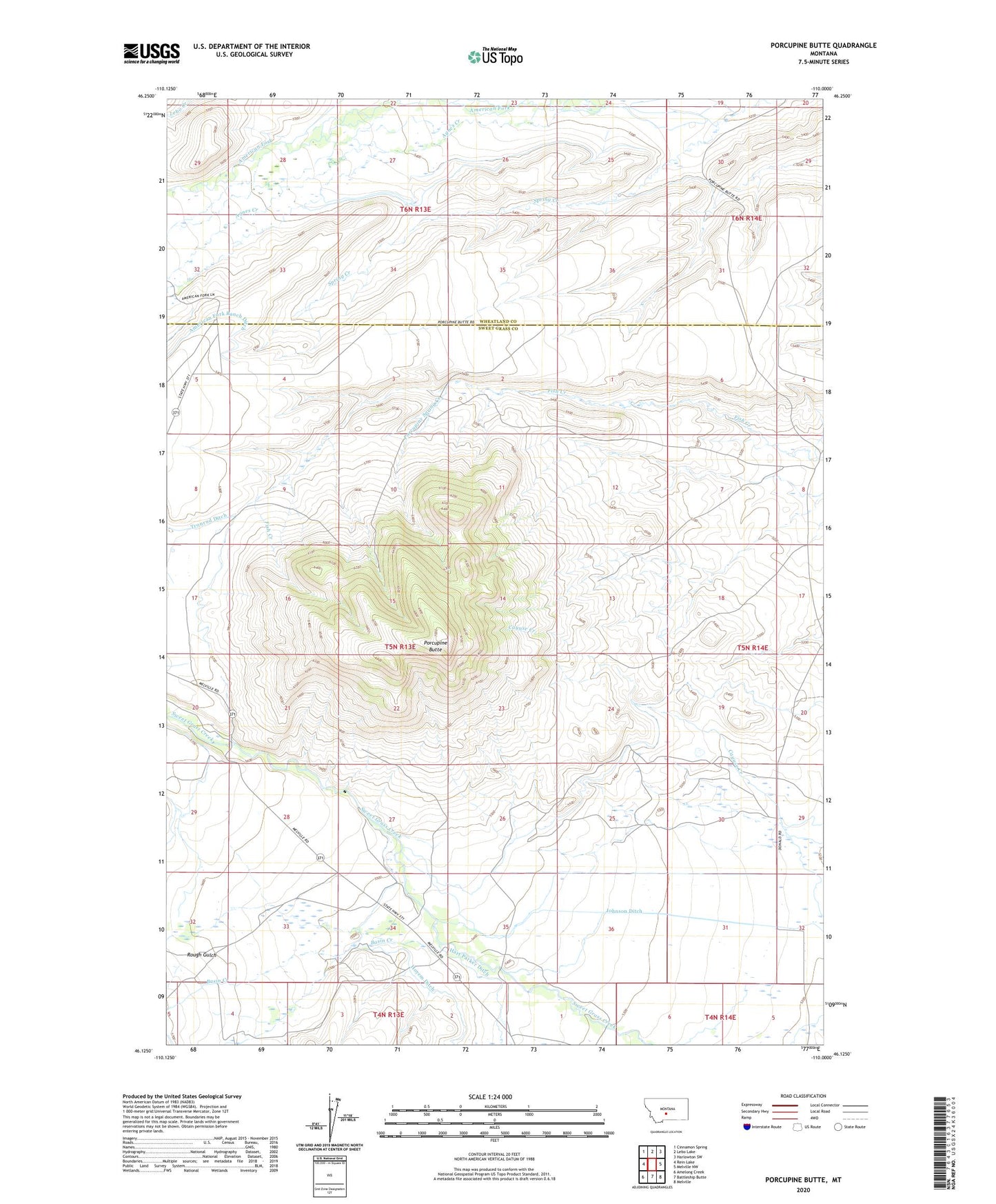
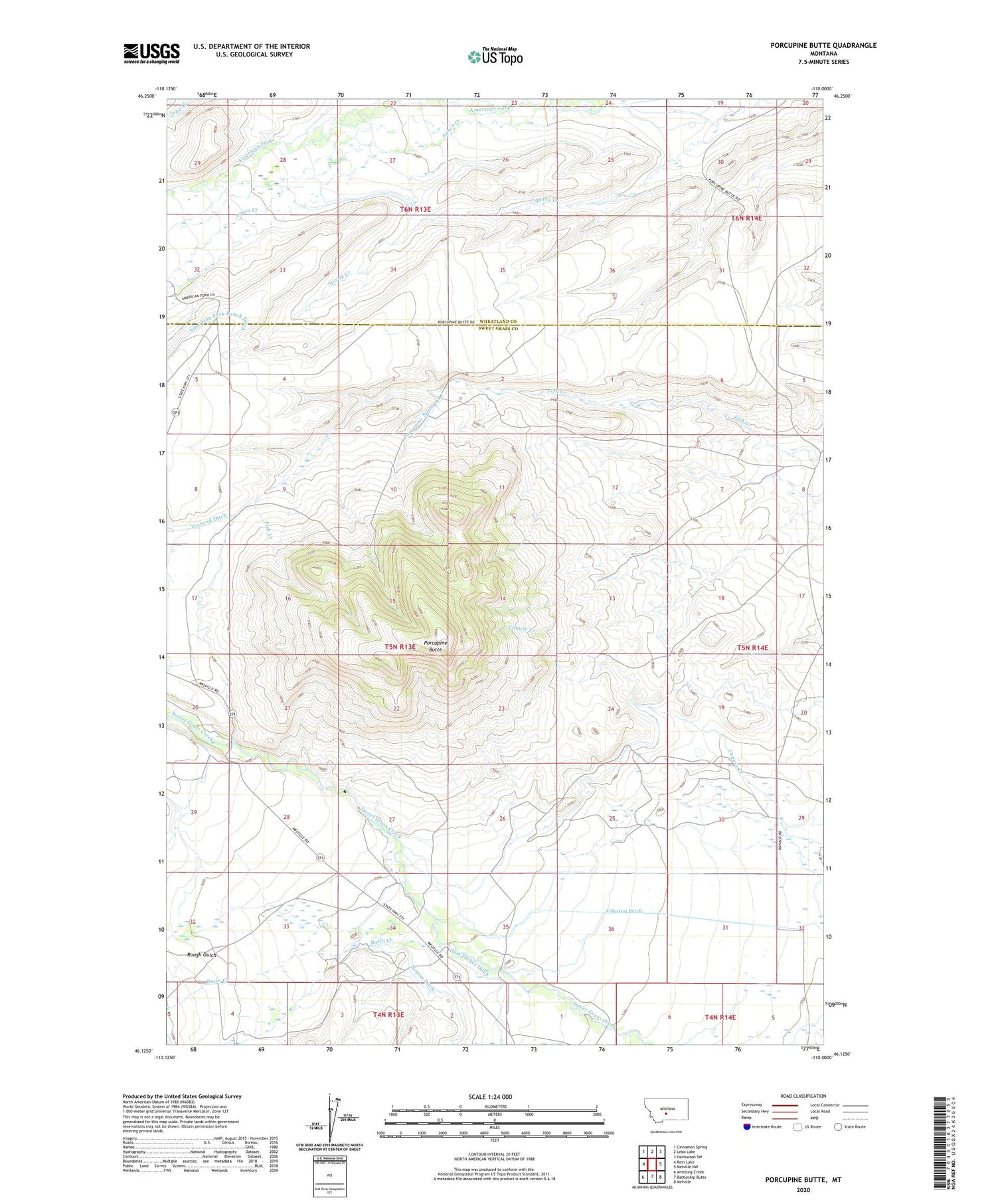
2020 topographic map quadrangle Porcupine Butte in the state of Montana. Scale: 1:24000. Based on the newly updated USGS 7.5' US Topo map series, this map is in the following counties: Sweet Grass, Wheatland. The map contains contour data, water features, and other items you are used to seeing on USGS maps, but also has updated roads and other features. This is the next generation of topographic maps. Printed on high-quality waterproof paper with UV fade-resistant inks.
Quads adjacent to this one:
West: Rein Lake
Northwest: Cinnamon Spring
North: Lebo Lake
Northeast: Harlowton SW
East: Melville NW
Southeast: Melville
South: Battleship Butte
Southwest: Amelong Creek
Contains the following named places: 05N13E28____01 Well, Agnes Creek, Basin Creek, Cottontail Ranch Airport, Donald Dam, Hoyem Ditch, Hurst, Hurst Post Office, Johnson Ditch, Porcupine Butte, Porcupine Spring Creek, Rough Gulch, Tronrud Ditch