MyTopo
Price Creek NE Montana US Topo Map
Couldn't load pickup availability
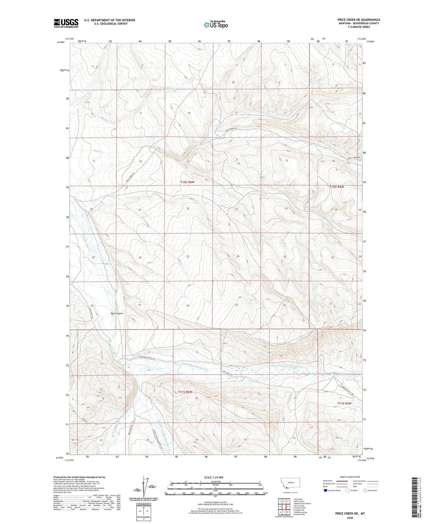
2024 topographic map quadrangle Price Creek NE in the state of Montana. Scale: 1:24000. Based on the newly updated USGS 7.5' US Topo map series, this map is in the following counties: Beaverhead. The map contains contour data, water features, and other items you are used to seeing on USGS maps, but also has updated roads and other features. This is the next generation of topographic maps. Printed on high-quality waterproof paper with UV fade-resistant inks.
Quads adjacent to this one:
West: Price Creek
Northwest: Elk Gulch
North: Red Canyon
Northeast: Belmont Park Ranch
East: Swamp Creek
Southeast: Antone Peak
South: Whiskey Spring
Southwest: Vinegar Hill
This map covers the same area as the classic USGS quad with code o44112h3.
Contains the following named places: Alkali Creek, Andersen Ranch, East Fork Blacktail Deer Creek, Febes Post Office, Middle Fork Blacktail Deer Creek, Red Canyon, West Fork Blacktail Deer Creek