MyTopo
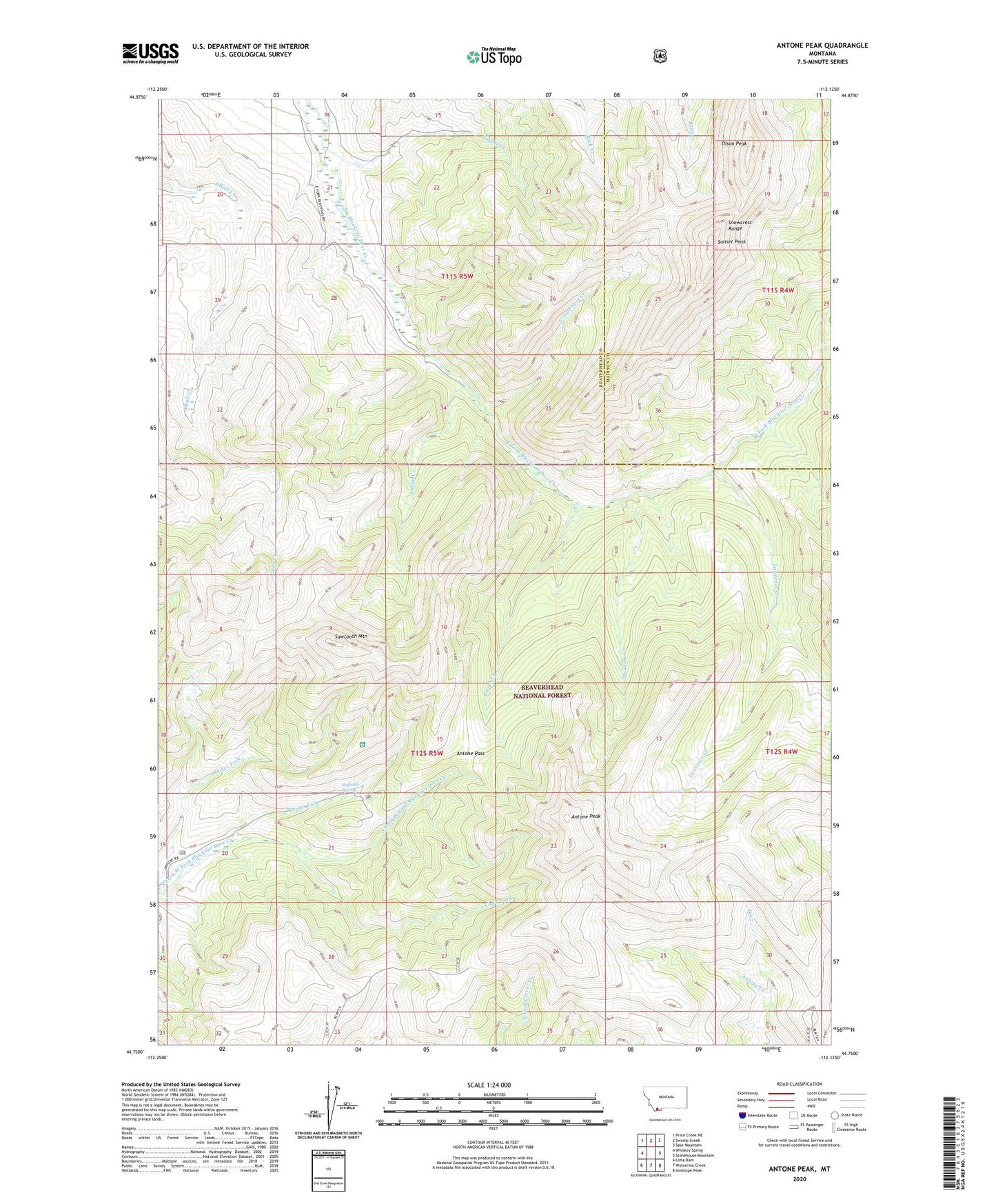
Antone Peak Montana US Topo Map
Couldn't load pickup availability
Also explore the Antone Peak Forest Service Topo of this same quad for updated USFS data
2024 topographic map quadrangle Antone Peak in the state of Montana. Scale: 1:24000. Based on the newly updated USGS 7.5' US Topo map series, this map is in the following counties: Beaverhead, Madison. The map contains contour data, water features, and other items you are used to seeing on USGS maps, but also has updated roads and other features. This is the next generation of topographic maps. Printed on high-quality waterproof paper with UV fade-resistant inks.
Quads adjacent to this one:
West: Whiskey Spring
Northwest: Price Creek NE
North: Swamp Creek
Northeast: Spur Mountain
East: Stonehouse Mountain
Southeast: Antelope Peak
South: Wolverine Creek
Southwest: Lima Dam
This map covers the same area as the classic USGS quad with code o44112g2.
Contains the following named places: Antone Creek, Antone Guard Station, Antone Pass, Antone Peak, Bonita Fork, Clark Fork, Cornell Camp, Cornell Trail, Crows Nest Creek, Indian Creek, Lawrence Creek, Lodgepole Trail, Meadow Creek, Olson Peak, Rough Creek, Sawtooth Mountain, Sawtooth Trail, Seybold Spring, Snowcrest Range, Sunset Peak, Taylor Creek, Two Meadows Creek