MyTopo
Elk Gulch Montana US Topo Map
Couldn't load pickup availability
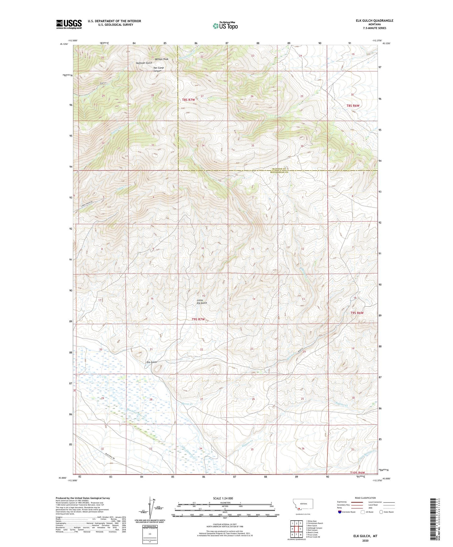
2024 topographic map quadrangle Elk Gulch in the state of Montana. Scale: 1:24000. Based on the newly updated USGS 7.5' US Topo map series, this map is in the following counties: Beaverhead, Madison. The map contains contour data, water features, and other items you are used to seeing on USGS maps, but also has updated roads and other features. This is the next generation of topographic maps. Printed on high-quality waterproof paper with UV fade-resistant inks.
Quads adjacent to this one:
West: Ashbough Canyon
Northwest: Dillon East
North: Christensen Ranch
Northeast: Mine Gulch
East: Red Canyon
Southeast: Price Creek NE
South: Price Creek
Southwest: Beech Creek
This map covers the same area as the classic USGS quad with code o45112a4.
Contains the following named places: Benson Peak, Brown Ranch, Crazy Springs Creek, Elk Gulch, Graphite Birds Nest Mine, Little Elk Gulch, Moose Creek, Wagner Creek