MyTopo
Section House Draw Montana US Topo Map
Couldn't load pickup availability
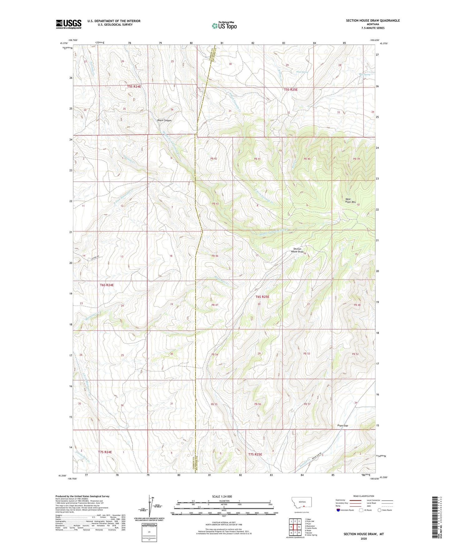
2024 topographic map quadrangle Section House Draw in the state of Montana. Scale: 1:24000. Based on the newly updated USGS 7.5' US Topo map series, this map is in the following counties: Big Horn, Carbon. The map contains contour data, water features, and other items you are used to seeing on USGS maps, but also has updated roads and other features. This is the next generation of topographic maps. Printed on high-quality waterproof paper with UV fade-resistant inks.
Quads adjacent to this one:
West: Bluewater
Northwest: Edgar
North: Pryor NW
Northeast: Pryor
East: Castle Rocks
Southeast: Indian Spring
South: Bowler
Southwest: Wade
This map covers the same area as the classic USGS quad with code o45108c6.
Contains the following named places: Bird Spring, Black Canyon, Sand Spring