MyTopo
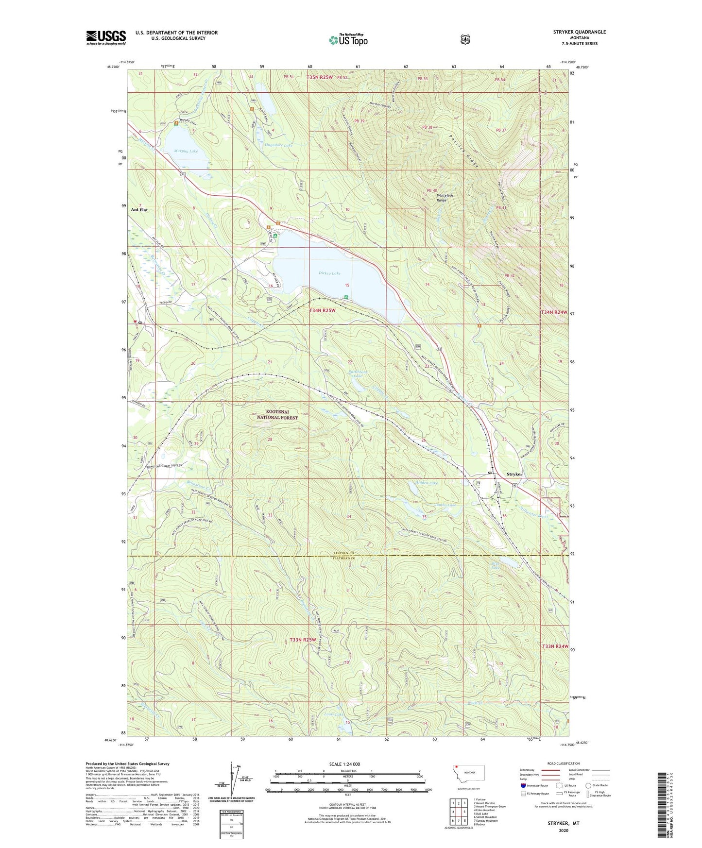
Stryker Montana US Topo Map
Couldn't load pickup availability
Also explore the Stryker Forest Service Topo of this same quad for updated USFS data
2024 topographic map quadrangle Stryker in the state of Montana. Scale: 1:24000. Based on the newly updated USGS 7.5' US Topo map series, this map is in the following counties: Lincoln, Flathead. The map contains contour data, water features, and other items you are used to seeing on USGS maps, but also has updated roads and other features. This is the next generation of topographic maps. Printed on high-quality waterproof paper with UV fade-resistant inks.
Quads adjacent to this one:
West: Edna Mountain
Northwest: Fortine
North: Mount Marston
Northeast: Mount Thompson-Seton
East: Bull Lake
Southeast: Radnor
South: Sunday Mountain
Southwest: Skillet Mountain
This map covers the same area as the classic USGS quad with code o48114f7.
Contains the following named places: 34N24W31BC__01 Well, 34N25W16ABCB01 Well, 59933, Blue Lake, Brimstone, Cripple Creek, Dancing Bear Health Clinic, Dickey, Dickey Creek, Dickey Lake, Hagadore Lake, Hidden Lake, Jumbo Lake, Laughing Water Creek, Leona Post Office, Louis Lake, Martin Lake, Murphy Lake, Murphy Lake Ranger Station, North Campground, Rattlebone Lake, Sink Creek, South Campground, Stryker, Stryker Census Designated Place, Stryker Post Office, Summit Creek, Trego, Trego - Fortine - Stryker Volunteer Fire Department Station 2, Trego Post Office