MyTopo
Raynesford Montana US Topo Map
Couldn't load pickup availability
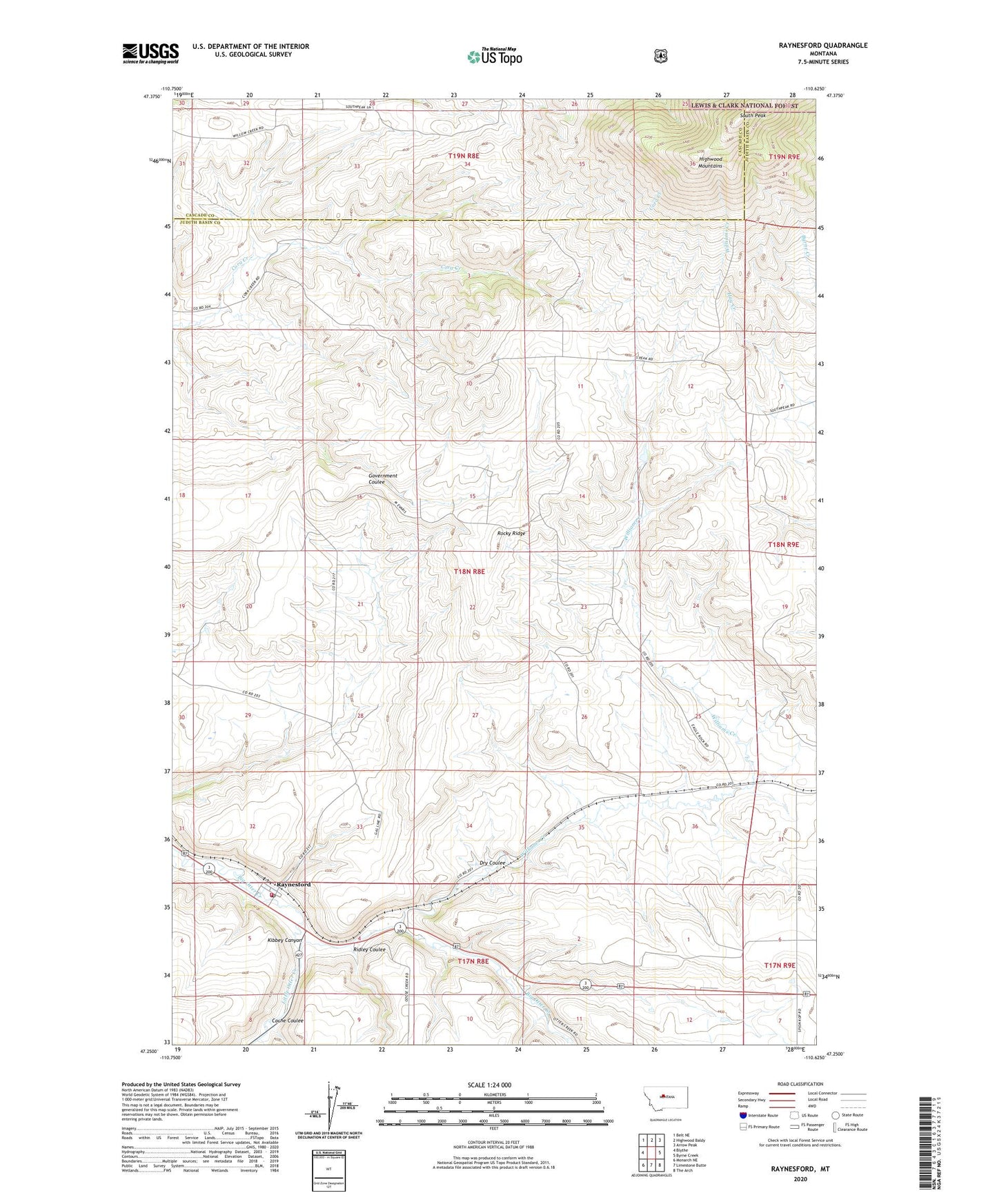
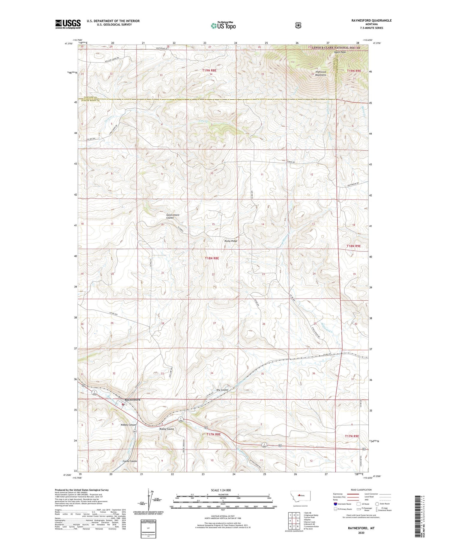
2020 topographic map quadrangle Raynesford in the state of Montana. Scale: 1:24000. Based on the newly updated USGS 7.5' US Topo map series, this map is in the following counties: Judith Basin, Cascade. The map contains contour data, water features, and other items you are used to seeing on USGS maps, but also has updated roads and other features. This is the next generation of topographic maps. Printed on high-quality waterproof paper with UV fade-resistant inks.
Quads adjacent to this one:
West: Blythe
Northwest: Belt NE
North: Highwood Baldy
Northeast: Arrow Peak
East: Byrne Creek
Southeast: The Arch
South: Limestone Butte
Southwest: Monarch NE
Contains the following named places: 17N08E03A___01 Well, 18N08E10C___01 Well, 18N08E12BBCC01 Well, 18N08E13A___01 Well, 18N08E20____01 Well, 18N08E24A___01 Well, 18N08E28____01 Well, 18N08E29____01 Well, Cache Coulee, Dry Coulee, Judith Basin Rural Fire District Raynesford, Kibbey Canyon, Little Otter Creek, Mann, Mann Post Office, Otter Post Office, Raynesford, Raynesford Census Designated Place, Raynesford Elementary School, Raynesford Post Office, Ridley Coulee, Rocky Ridge, South Peak, Williams Creek