MyTopo
Blythe Montana US Topo Map
Couldn't load pickup availability
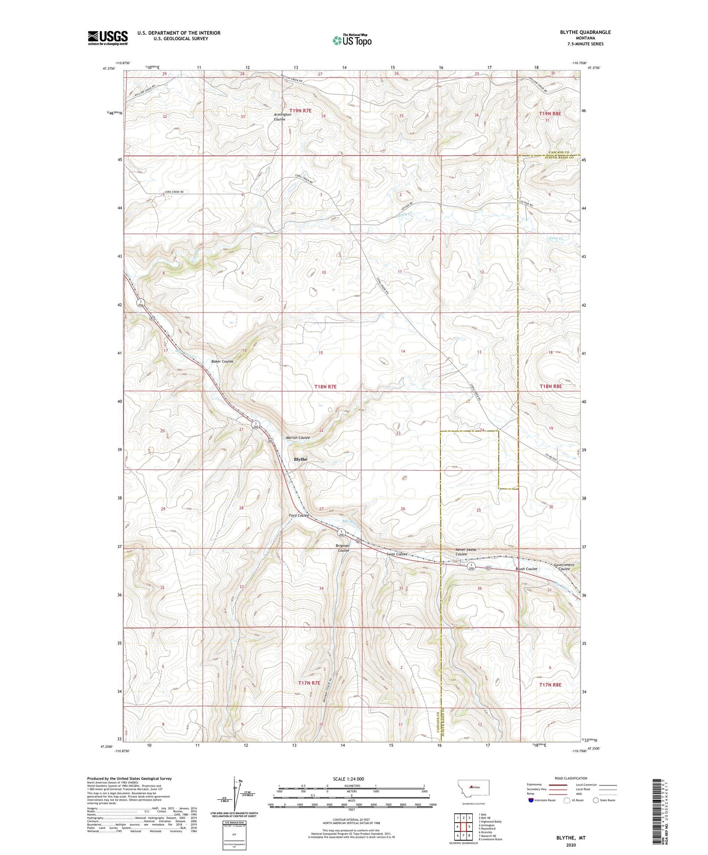
2024 topographic map quadrangle Blythe in the state of Montana. Scale: 1:24000. Based on the newly updated USGS 7.5' US Topo map series, this map is in the following counties: Cascade, Judith Basin. The map contains contour data, water features, and other items you are used to seeing on USGS maps, but also has updated roads and other features. This is the next generation of topographic maps. Printed on high-quality waterproof paper with UV fade-resistant inks.
Quads adjacent to this one:
West: Armington
Northwest: Belt
North: Belt NE
Northeast: Highwood Baldy
East: Raynesford
Southeast: Limestone Butte
South: Monarch NE
Southwest: Riceville
This map covers the same area as the classic USGS quad with code o47110c7.
Contains the following named places: 18N07E05____01 Well, 18N07E05A___01 Well, 18N07E11____01 Well, 18N07E11____02 Well, 59412, Baker Coulee, Blyth School, Blythe, Brigman Coulee, Brigman Coulee School, Brush Coulee, Burlingame School, Cora, Cora Creek, Cora Post Office, Dawson Ranch Number 1 Dam, Ford Coulee, Government Coulee, Marion Coulee, Never Sweat Coulee, Swan Coulee