MyTopo
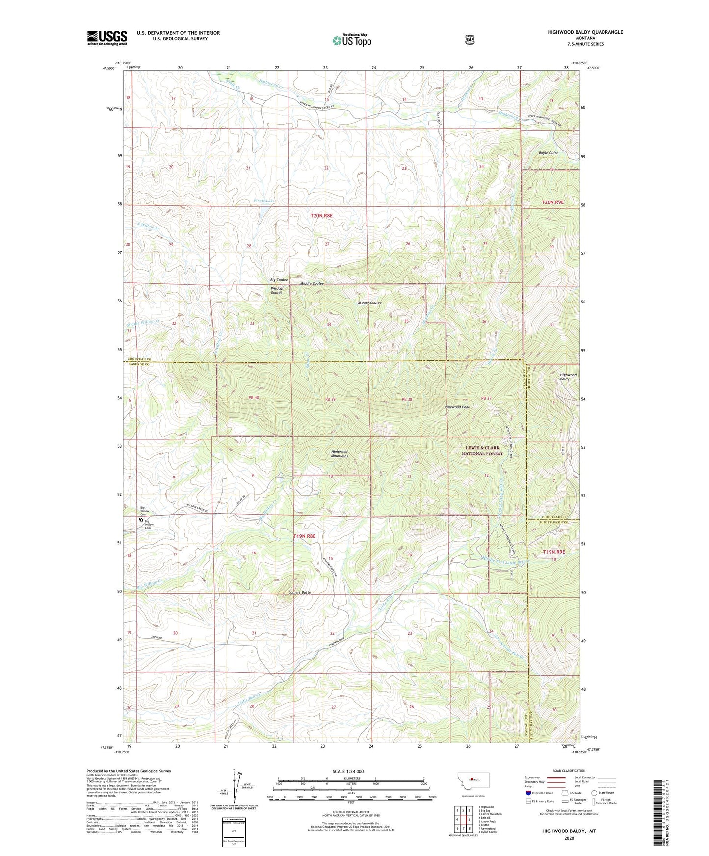
Highwood Baldy Montana US Topo Map
Couldn't load pickup availability
Also explore the Highwood Baldy Forest Service Topo of this same quad for updated USFS data
2024 topographic map quadrangle Highwood Baldy in the state of Montana. Scale: 1:24000. Based on the newly updated USGS 7.5' US Topo map series, this map is in the following counties: Cascade, Chouteau, Judith Basin. The map contains contour data, water features, and other items you are used to seeing on USGS maps, but also has updated roads and other features. This is the next generation of topographic maps. Printed on high-quality waterproof paper with UV fade-resistant inks.
Quads adjacent to this one:
West: Belt NE
Northwest: Highwood
North: Big Sag
Northeast: Carter Mountain
East: Arrow Peak
Southeast: Byrne Creek
South: Raynesford
Southwest: Blythe
This map covers the same area as the classic USGS quad with code o47110d6.
Contains the following named places: Big Coulee, Big Willow Cemetery, Big Willow School, Boyle Gulch, Comers Butte, Dexter Creek, Grouse Coulee, Harris Creek, Highwood Baldy, Highwood Creek Community Hall, Highwood Mountains, Middle Coulee, Middle Fork Little Belt Creek, Minnehaha Post Office, Mountain View School, Nelson School, North Fork Little Belt Creek, Pinewood Peak, Pirate Dam, Pirate Lake, South Fork Little Belt Creek, South Gap Creek, Watkins Creek, Wildcat Coulee