MyTopo
Limestone Butte Montana US Topo Map
Couldn't load pickup availability
Also explore the Limestone Butte Forest Service Topo of this same quad for updated USFS data
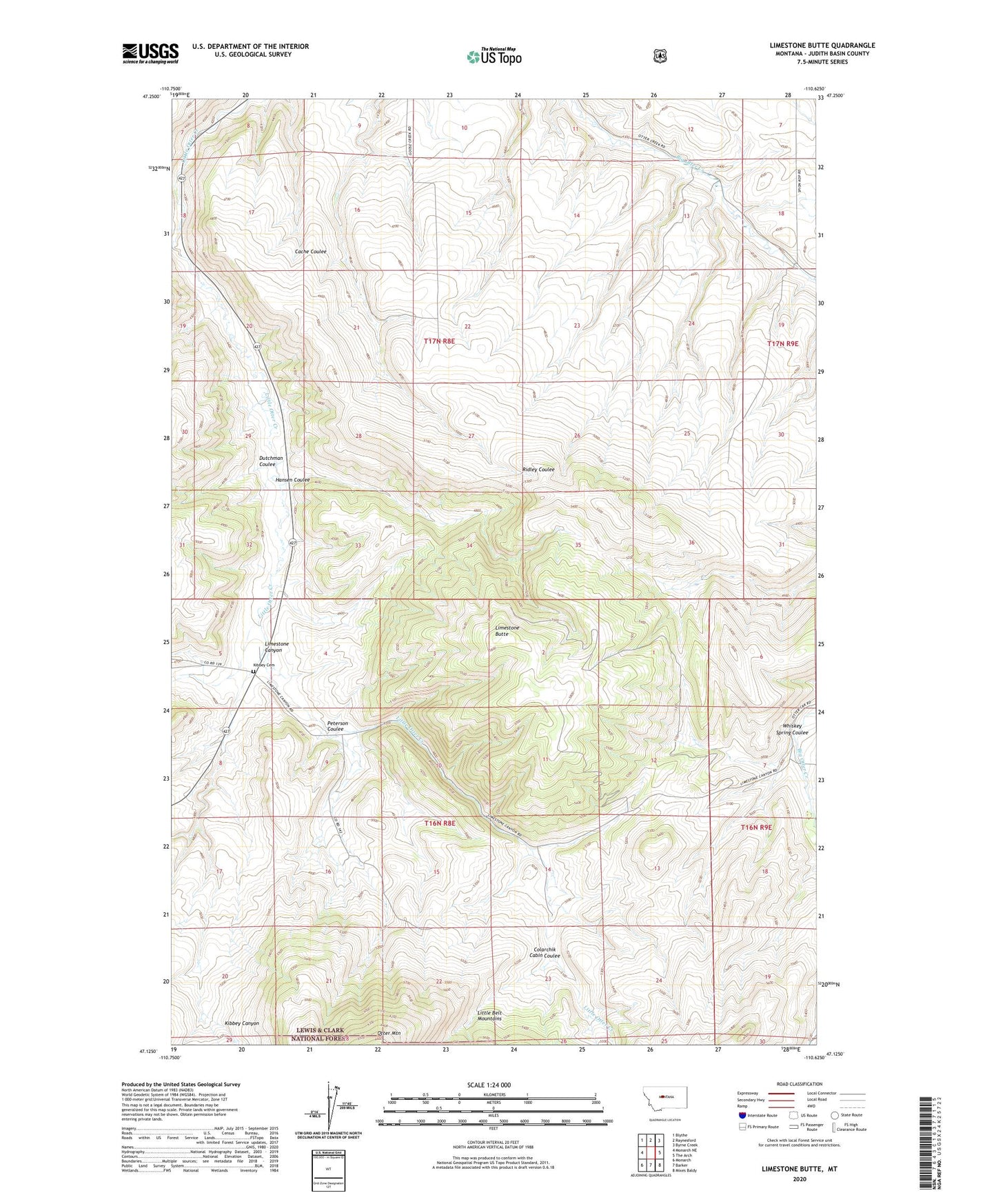
2024 topographic map quadrangle Limestone Butte in the state of Montana. Scale: 1:24000. Based on the newly updated USGS 7.5' US Topo map series, this map is in the following counties: Judith Basin. The map contains contour data, water features, and other items you are used to seeing on USGS maps, but also has updated roads and other features. This is the next generation of topographic maps. Printed on high-quality waterproof paper with UV fade-resistant inks.
Quads adjacent to this one:
West: Monarch NE
Northwest: Blythe
North: Raynesford
Northeast: Byrne Creek
East: The Arch
Southeast: Mixes Baldy
South: Barker
Southwest: Monarch
This map covers the same area as the classic USGS quad with code o47110b6.
Contains the following named places: 17N08E10CCCC01 Well, 17N08E15BBCB01 Well, 59469, Colarchik Cabin Coulee, Dutchman Coulee, Hansen Coulee, Kibbey, Kibbey Cemetery, Kibbey Post Office, Kibbey School, Kibby, Limestone Butte, Limestone Canyon, Peterson Coulee, Whiskey Spring Coulee