MyTopo
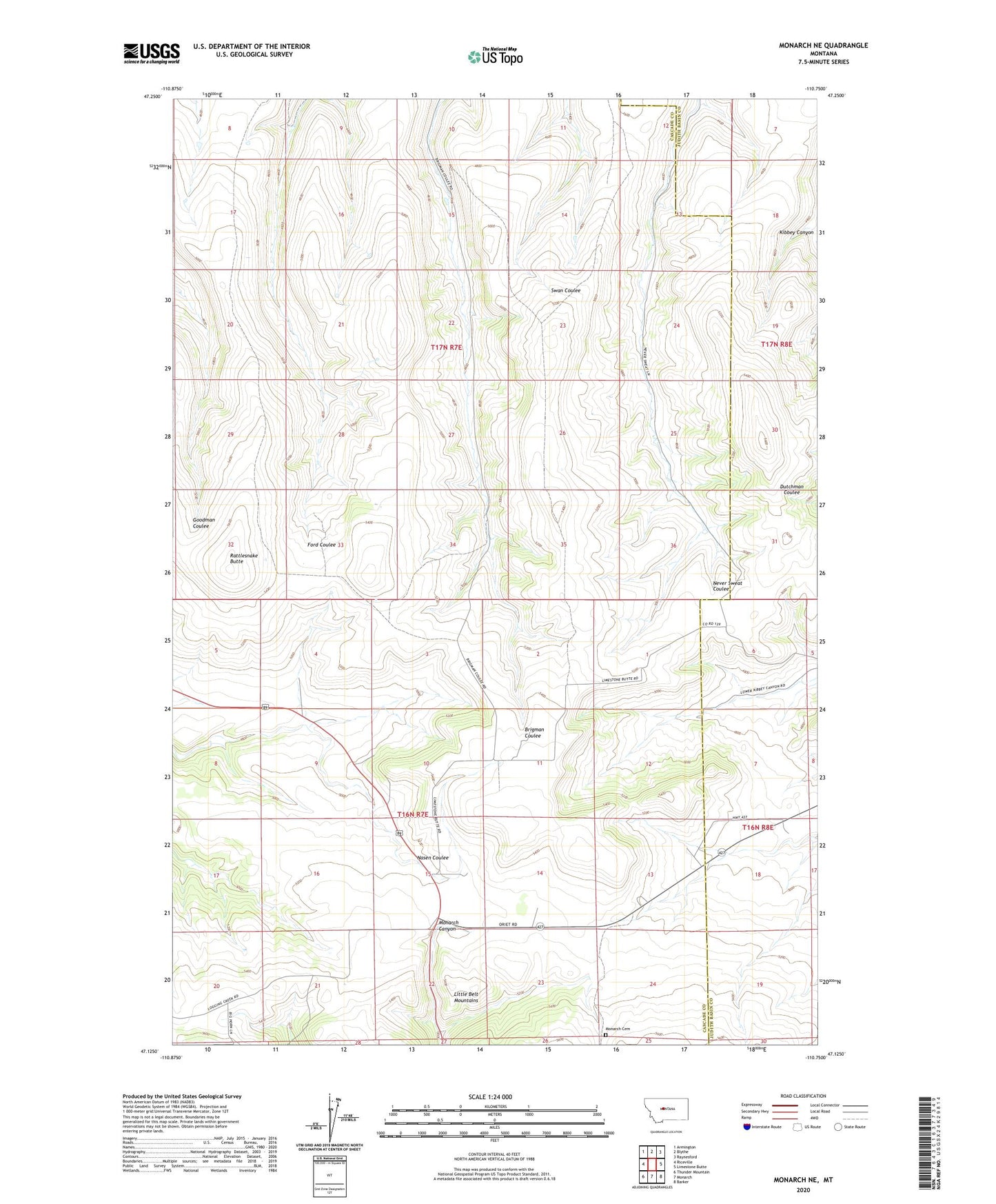
Monarch NE Montana US Topo Map
Couldn't load pickup availability
Also explore the Monarch NE Forest Service Topo of this same quad for updated USFS data
2024 topographic map quadrangle Monarch NE in the state of Montana. Scale: 1:24000. Based on the newly updated USGS 7.5' US Topo map series, this map is in the following counties: Cascade, Judith Basin. The map contains contour data, water features, and other items you are used to seeing on USGS maps, but also has updated roads and other features. This is the next generation of topographic maps. Printed on high-quality waterproof paper with UV fade-resistant inks.
Quads adjacent to this one:
West: Riceville
Northwest: Armington
North: Blythe
Northeast: Raynesford
East: Limestone Butte
Southeast: Barker
South: Monarch
Southwest: Thunder Mountain
This map covers the same area as the classic USGS quad with code o47110b7.
Contains the following named places: Goodman Coulee, King School, Love School, Michigan School, Michigan Settlement, Monarch Cemetery, Nason School, Pleasant Valley School, Rattlesnake Butte, Swan School