MyTopo
Red Buttes Montana US Topo Map
Couldn't load pickup availability
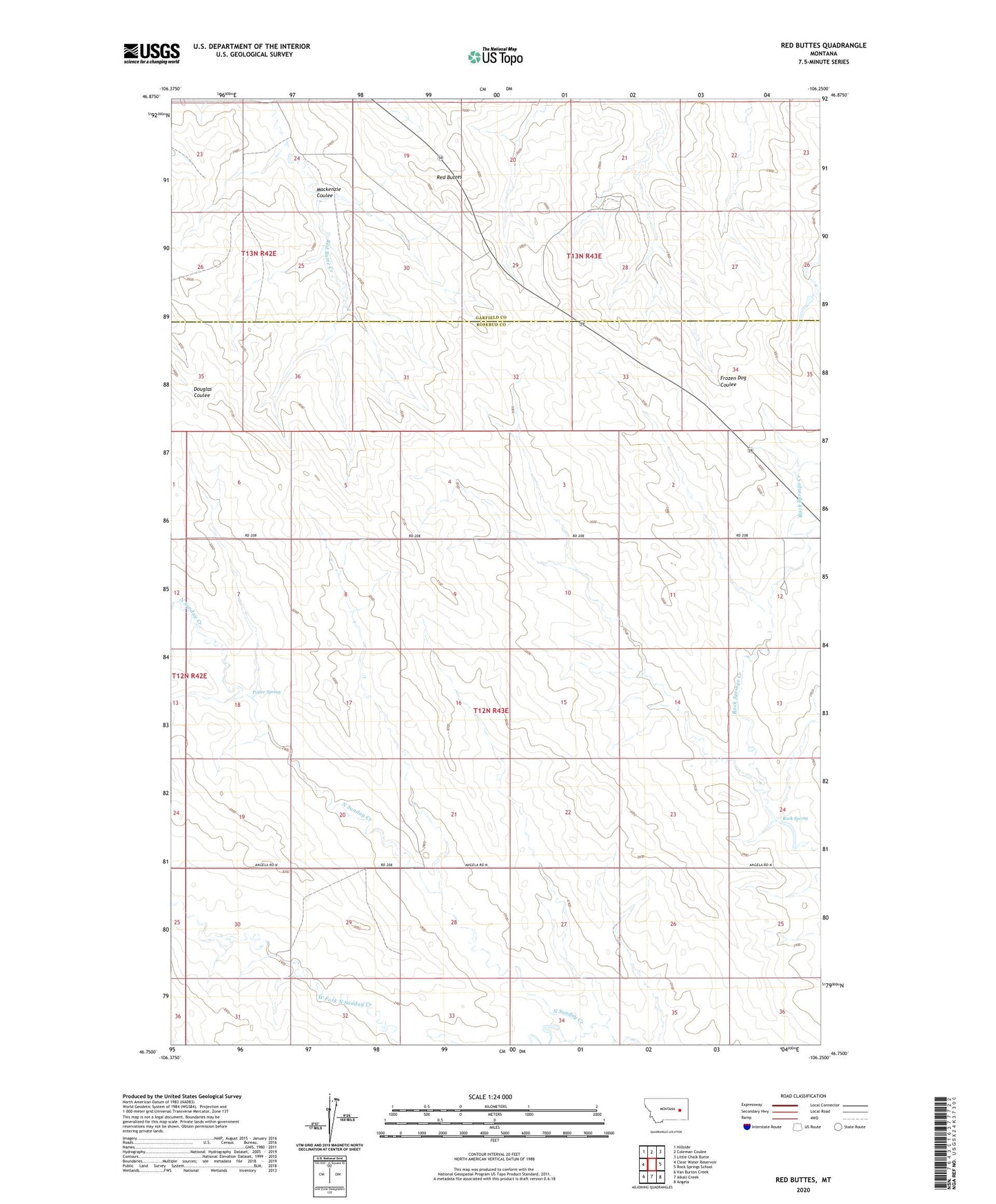
2024 topographic map quadrangle Red Buttes in the state of Montana. Scale: 1:24000. Based on the newly updated USGS 7.5' US Topo map series, this map is in the following counties: Rosebud, Garfield. The map contains contour data, water features, and other items you are used to seeing on USGS maps, but also has updated roads and other features. This is the next generation of topographic maps. Printed on high-quality waterproof paper with UV fade-resistant inks.
Quads adjacent to this one:
West: Clear Water Reservoir
Northwest: Hillside
North: Coleman Coulee
Northeast: Little Chalk Butte
East: Rock Springs School
Southeast: Angela
South: Alkali Creek
Southwest: Van Burton Creek
This map covers the same area as the classic USGS quad with code o46106g3.
Contains the following named places: 13N43E29ADAA01 Well, Mackenzie Coulee, Potter Spring, Red Buttes, Rock Spring, Satchwell, Satchwell Post Office, West Fork North Sunday Creek