MyTopo
Little Chalk Butte Montana US Topo Map
Couldn't load pickup availability
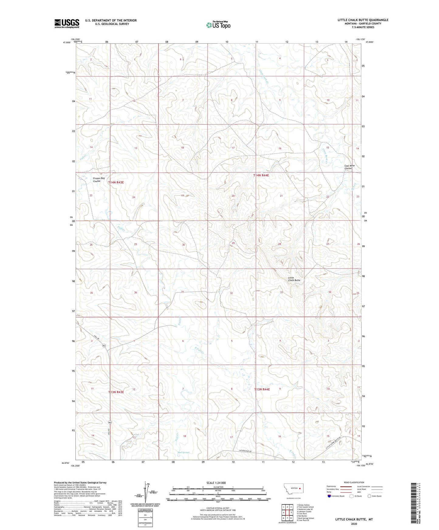
2024 topographic map quadrangle Little Chalk Butte in the state of Montana. Scale: 1:24000. Based on the newly updated USGS 7.5' US Topo map series, this map is in the following counties: Garfield. The map contains contour data, water features, and other items you are used to seeing on USGS maps, but also has updated roads and other features. This is the next generation of topographic maps. Printed on high-quality waterproof paper with UV fade-resistant inks.
Quads adjacent to this one:
West: Coleman Coulee
Northwest: Sleepy Hollow
North: Tree Coulee School
Northeast: Hedstrom Lake SE
East: Crow Rock
Southeast: Crow Rock SE
South: Rock Springs School
Southwest: Red Buttes
This map covers the same area as the classic USGS quad with code o46106h2.
Contains the following named places: 02N44E01BAAA01 Well, 13N44E06BABB01 Well, 13N44E09CCBC01 Well, 14N43E35DDAC01 Well, 14N44E05DACC01 Well, 14N44E16BBBD01 Well, 14N44E18DCAB01 Well, 14N44E22CDBB01 Well, Ash Creek, Coal Mine Coulee, East Uall Creek, East Uall School, Frozen Dog Coulee, Little Chalk Butte, Mud Springs, Uoll Heights Post Office, Vic Jay Number 1 Dam