MyTopo
Red Top Butte Montana US Topo Map
Couldn't load pickup availability
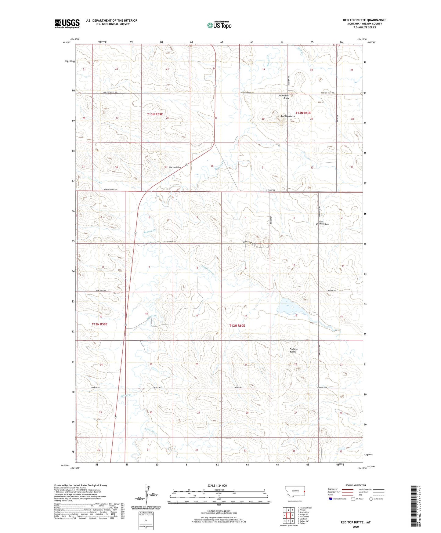
2024 topographic map quadrangle Red Top Butte in the state of Montana. Scale: 1:24000. Based on the newly updated USGS 7.5' US Topo map series, this map is in the following counties: Wibaux. The map contains contour data, water features, and other items you are used to seeing on USGS maps, but also has updated roads and other features. This is the next generation of topographic maps. Printed on high-quality waterproof paper with UV fade-resistant inks.
Quads adjacent to this one:
West: Hodges SE
Northwest: Freeman Creek
North: Wibaux
Northeast: Beach West
East: Duck Creek
Southeast: Carlyle
South: Carlyle NW
Southwest: Cap Rock
This map covers the same area as the classic USGS quad with code o46104g2.
Contains the following named places: 12N60E06CCC_01 Well, 12N60E11ABB_01 Well, 12N60E22CCC_01 Well, 12N60E28AADB01 Well, 13N59E23CDDD01 Well, 13N59E24BDD_01 Well, 13N59E35AD__01 Well, 13N60E30AAAA01 Well, Horse Point, Jackrabbit Butte, Lamesteer Creek, Lamesteer National Wildlife Refuge, Lamesteer Reservoir, Lamesteer Reservoir Dam, Liberty School, Lone Tree Creek, Pierce School, Podolski Butte, Red Top Butte, Saint Philip Church, Saint Philips Cemetery, Saint Phillip, Saint Phillip School, Sominski School, South Center School